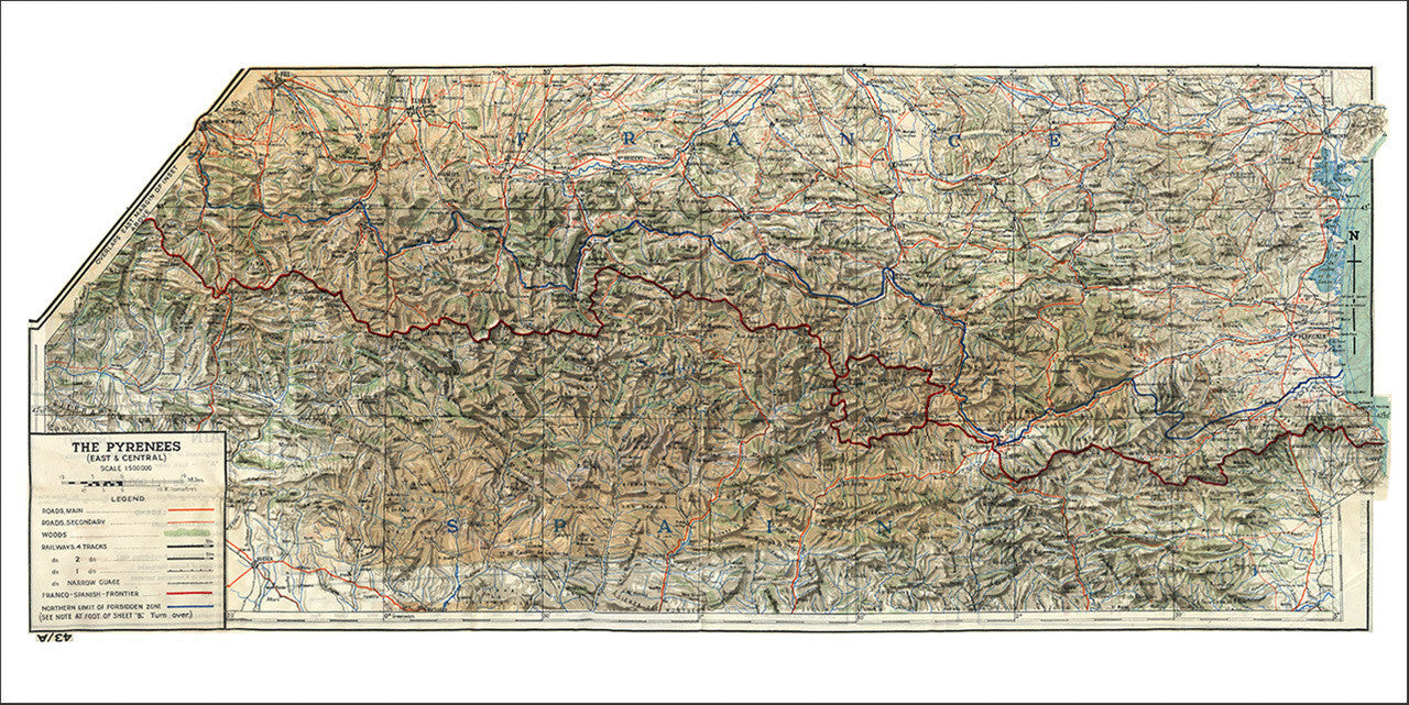
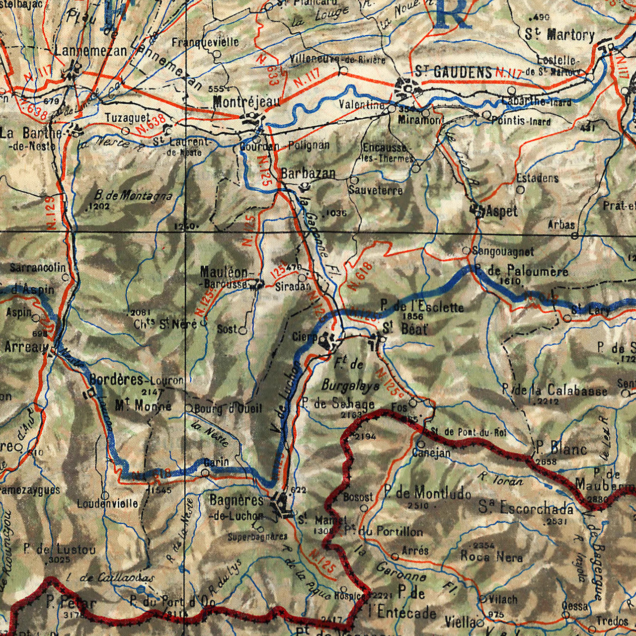
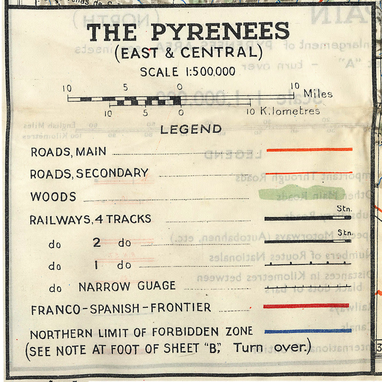

World War II Era cloth map of the eastern Pyrenees region, delineating the French–Spanish border (Franco–Spanish frontier) and Andorra. The map was reportedly issued by the GB War Office, (later British Ministry of Defence), to special operations and reconnaissance units active in the region. It contains strategic information — terrain relief and elevations, main and secondary roads, railroad tracks, wooded areas, rural and urban settlements, limits of the “Forbidden Zone” (Zone interdite), and international boundaries.
• Cloth map of the Pyrenees region (French–Spanish border), 1943, WWII
• Premium Giclée Canvas Print (Fine Art Paper Print available upon request)
• Suitable for framing, stretching, or using as a desk/tabletop map
• Size of map: 35” x 15” (approx.)
• Size of print: 36” x 18”