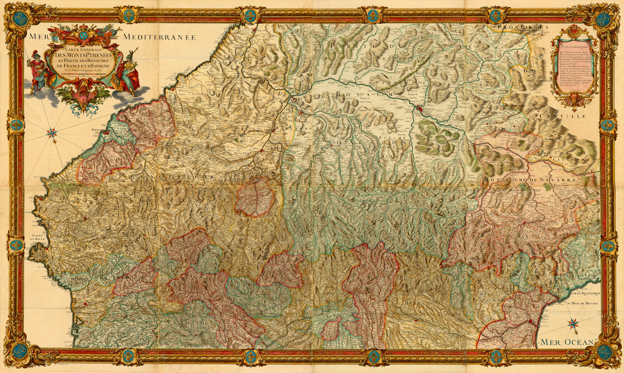
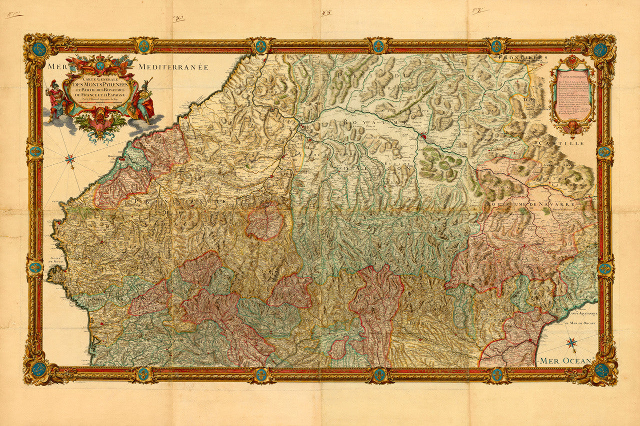
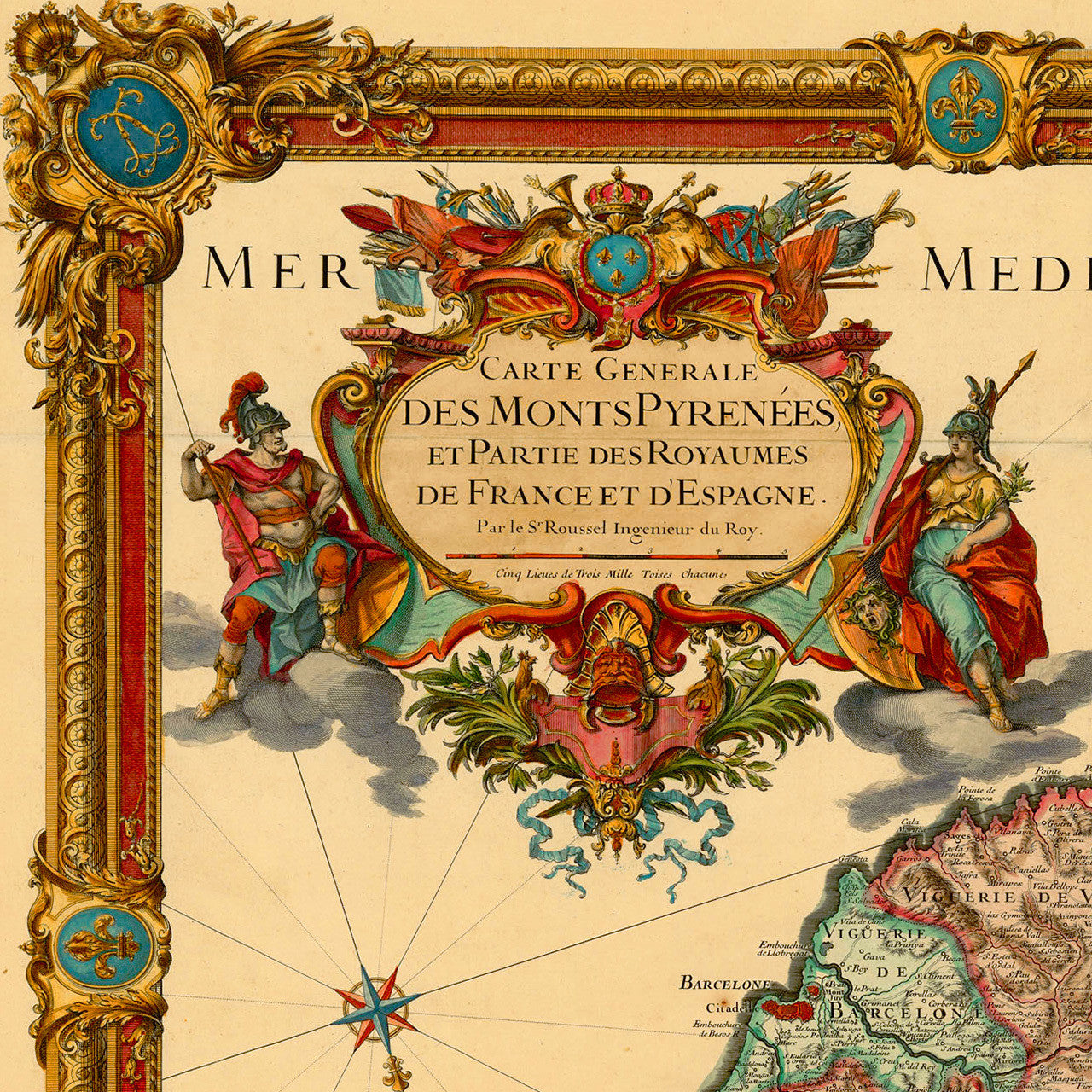
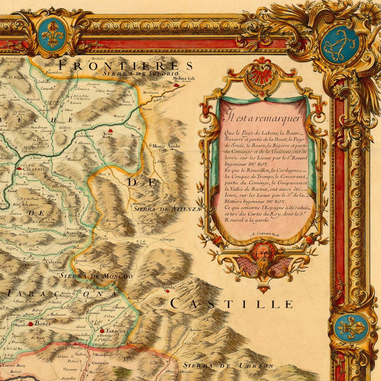

An eighteenth-century detailed French map of the Pyrenees, adorned with elaborate cartouches and a decorative border. The map is oriented with South-southwest (SSW) up, and depicts in great detail the mountain range which has served as a natural border between France and Spain for centuries. Andorra is also represented on the map. With its large-scale catrographic detail, elaborate engravings, and sophisticated coloring, the 1730 Monts Pyrénées map epitomizes the pinnacle of 18th-century French cartography. By the early 1700s France had managed to take over from the Dutch and Flemish mapmakers, who had been undisputed experts in the art of mapmaking throughout the previous century. Scientific approach and improved accuracy, state-sponsored explorations and mapping in the 17th–18th centuries, and superb design, had all helped establish France as a leader in the field. The authorship credits for the Pyrenees map are recorded as follows: Sieur (Sir) Roussel (Engineer, Surveyor, Cartographer, Chief Engineer to the King; Knight of the Order of Saint Louis); Sr. François de La Blottière (Cartographer, Maréchal de camp, Engineer to the King); Antoine Coquart & Jean-Baptiste Delahaye (Engravers). The secondary cartouche, entitled, ‘Il est à remarquer’, contains a breakdown of the surveying work done by each member of the team. The map title in the primary cartouche reads: Carte Generale des Monts Pyrenées, et Partie des Royaumes de France et d'Espagne / Par le Sr. Roussel Ingenieur du Roy
• 18th-century French map of the Pyrenees, 1730, Roussel, La Blottière, Coquart, Delahaye
• Fine Art Premium Giclée (Gouttelette) Print (100% cotton 340 gsm fine art paper)
• Made in USA