
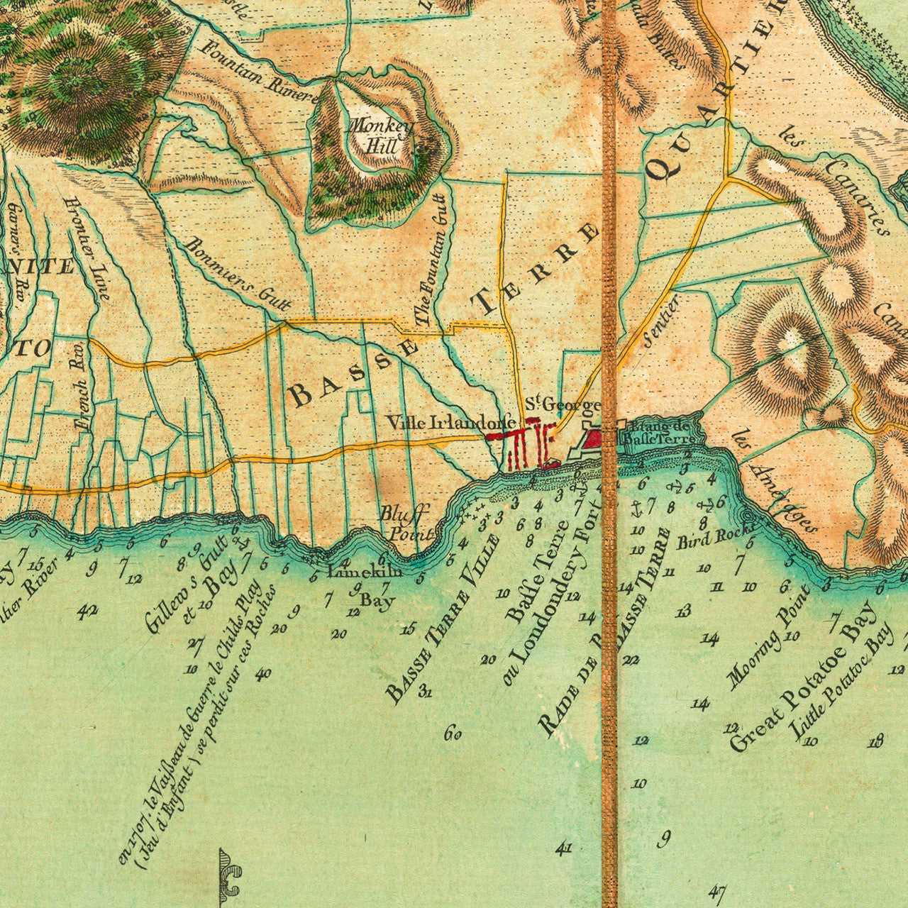
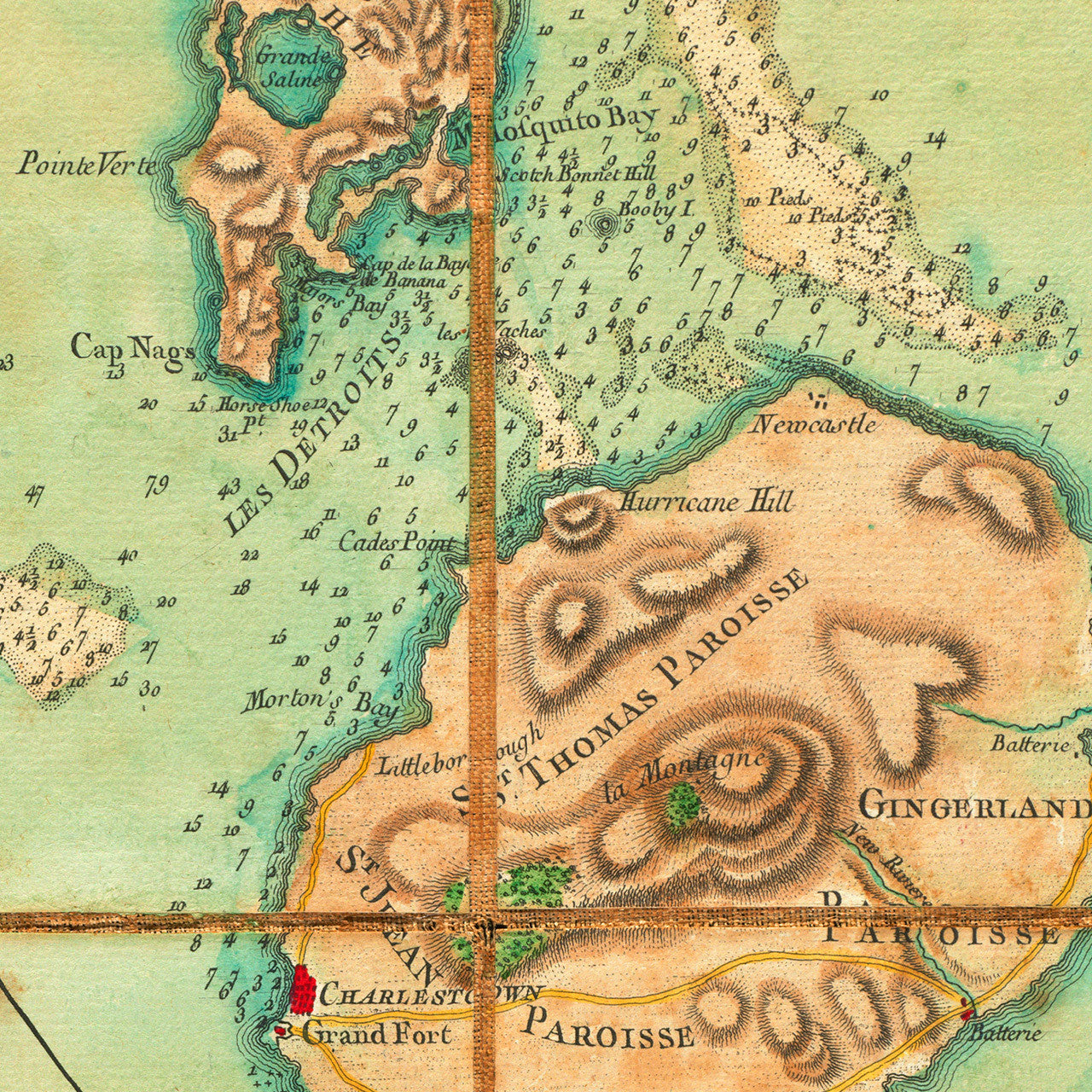
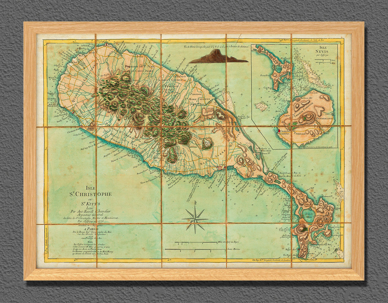

An eighteenth-century map of Saint Kitts and Nevis by Georges-Louis Le Rouge. It is based on Anthony Ravell’s map of the island from 1775 and contains administrative divisions, fortifications, anchorages and depth soundings. It also features an inset map and a profile of the island of Nevis.
During the American War of Independence, as part of their campaigns in the Caribbean theater between 1779 and 1783, the French Navy captured St. Kitts (St. Christopher/St. Christopher’s), as well as Dominica, Grenada, Saint Vincent, Montserrat, Tobago, and the Turks and Caicos. All of those islands were later restored to Britain with the Treaty of Versailles of 1783. Le Rouge’s map of St. Kitts was one of many prepared during the period of the American Revolution to be used by the French Navy.
Original map title: St. Christophers, or St. Kitts, Surveyed by Anthony Ravell Esq. (Efqr.), Surveyor General of the Islands of St. Christophers, Nevis & Montserrat. Engraved by Thomas Jefferys Geographer to the King.
Map title in French: Isle St. Christophe ou St. Kitts Levé par Ant: Ravell Chevalier Arpenteur Général des Isles de St. Christophe, Nevis et Monserrat. Par Jafferys en 1775. Traduit de l’Anglais. A Paris. Par le Rouge Ingr. Geographe du Roi rue des Grands Augustus 1779 avec Privilege du Roi. (Shown frames are not included.)
• 1779 map of the islands of St. Kitts (St. Christopher) and Nevis, Revolutionary War Era
• Fine Art Premium Giclée (Gouttelette) Print (100% cotton 340 gsm fine art paper)
• Made in USA