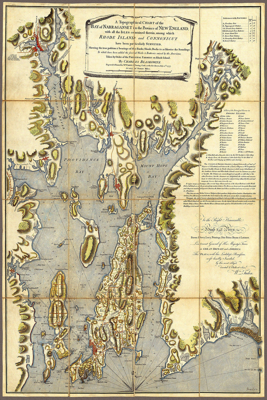
New England, 1777, Narragansett Bay, Rhode Island, Gaspée Affair, Revolutionary Era Map
Brand: Battlemaps.us

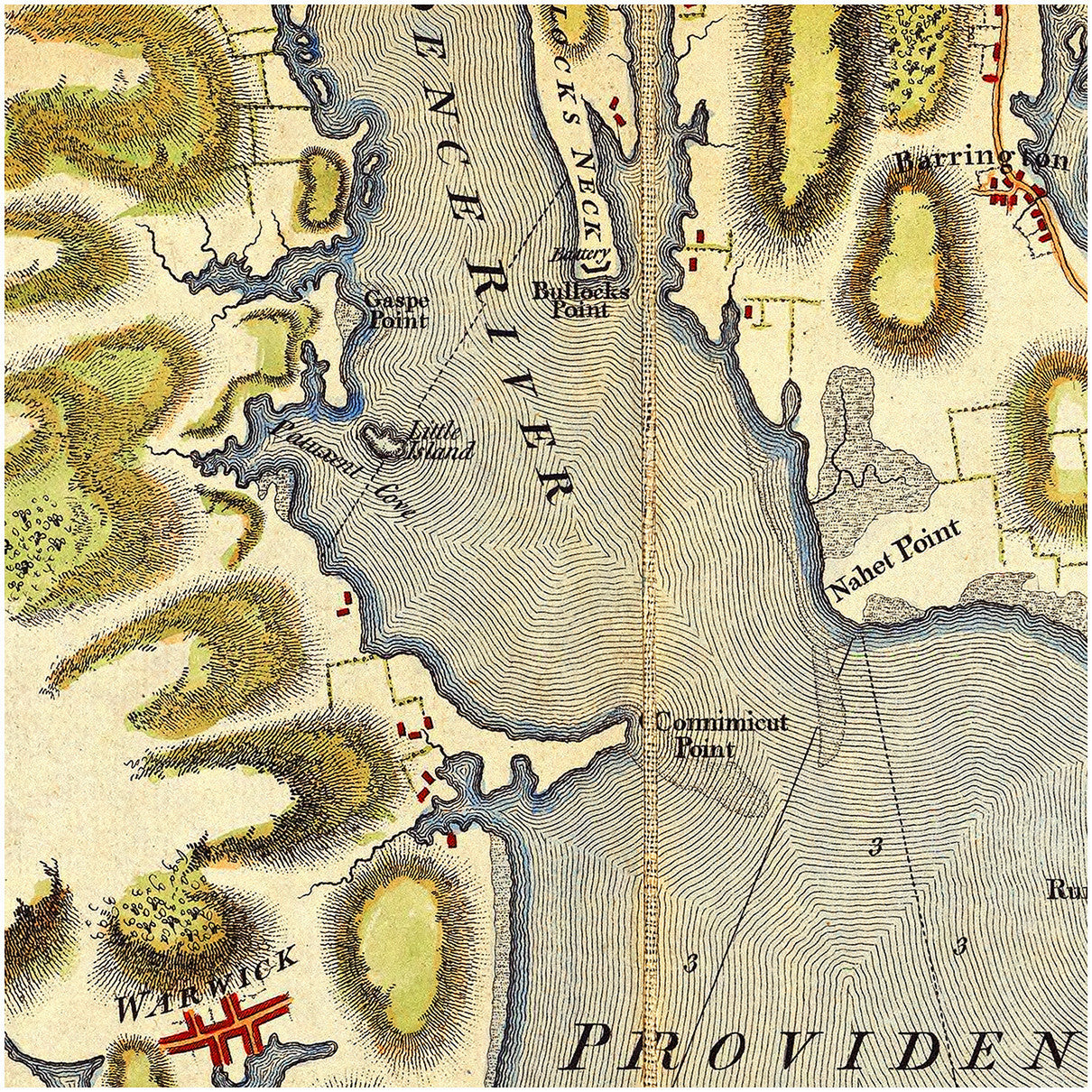
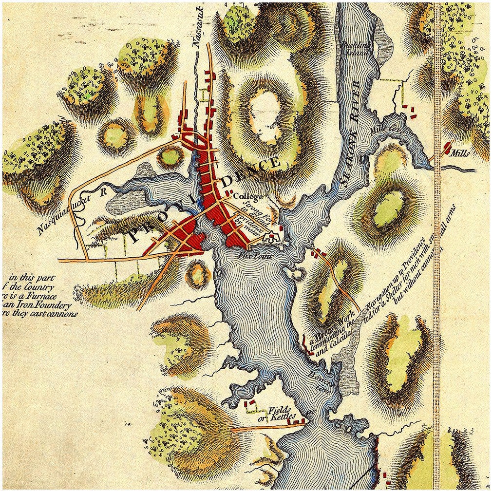
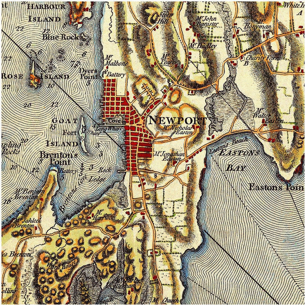
A highly detailed, large-size nautical chart and coastal survey of Narragansett Bay, from the 1770s; surveyed and drawn by Charles Blaskowitz, engraved and printed by William Faden. An excellent map to use when studying the Gaspee Affair — the attack on the British schooner HMS Gaspée in 1772 and one of the precursors of the American Revolution. Full map title: A Topographical Chart of the Bay of Narraganset in the Province of New England, with all the Isles contained therein, among which Rhode Island and Connonicut have been particularly Surveyed, Shewing the true pofition & bearings of the Banks, Shoals, Rocks &c. as likewise the Soundings: To which have been added the several Works & Batteries raised by the Americans, Taken by Order of the Principal Farmers on Rhode Island, By Charles Blaskowitz… 1777.
• Revolutionary War Era map of Narragansett Bay, Rhode Island, 1777, C. Blaskowitz
• Fine Art Premium Giclée (Gouttelette) Print (100% cotton 340 gsm fine art paper)
• Made in USA