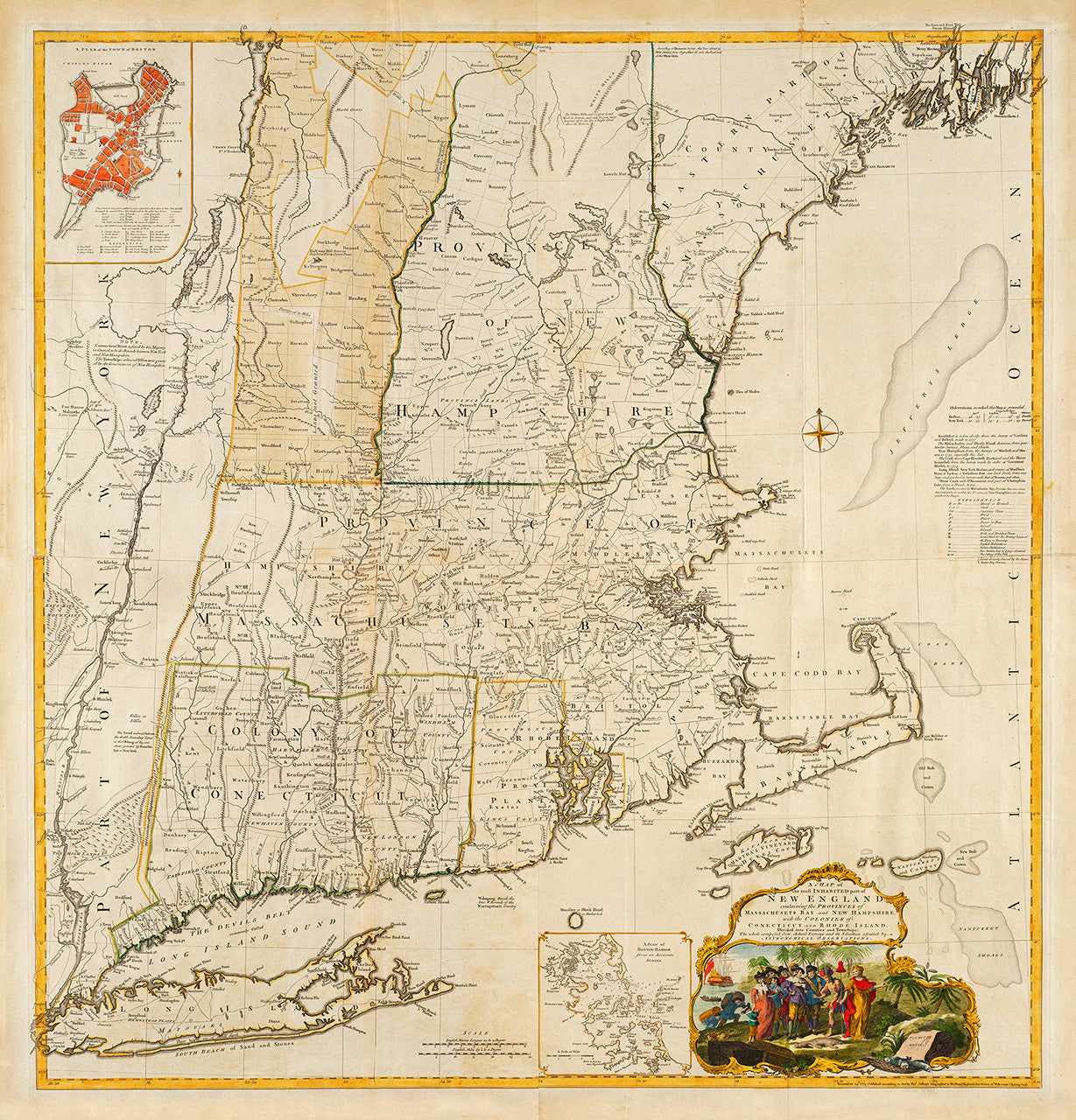
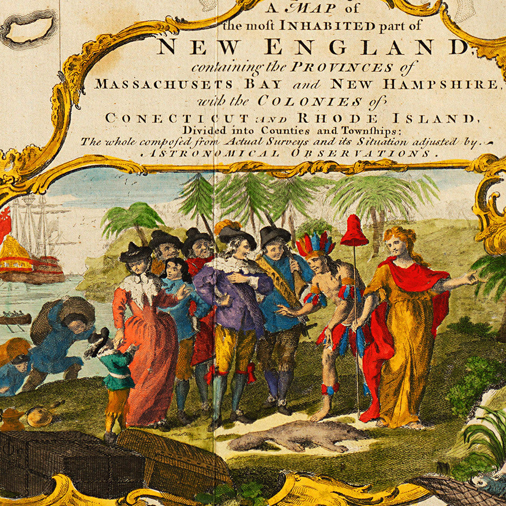
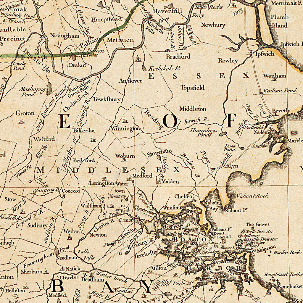
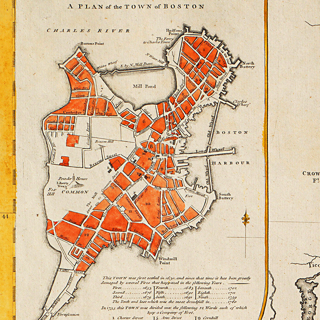
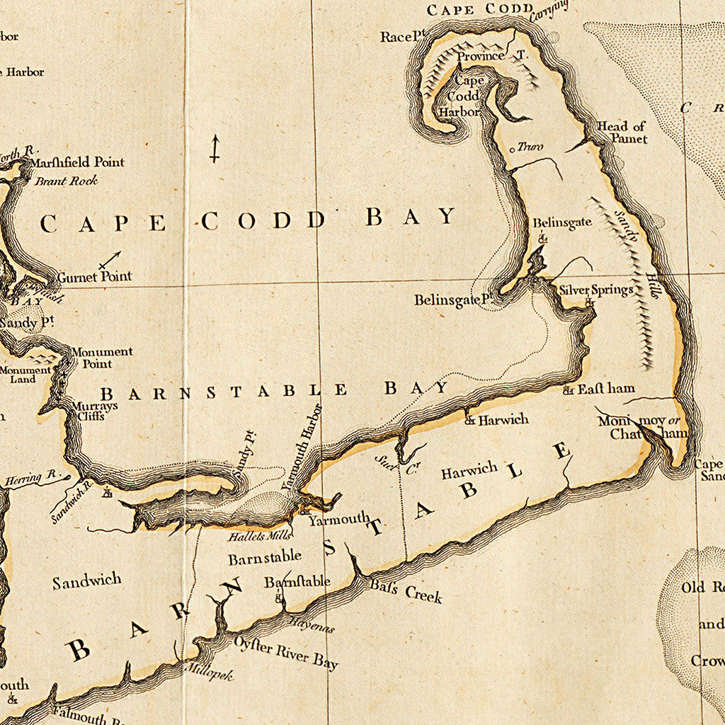

A detailed, Mercator-projection, 18th-century map of New England by John Green (real name Braddock Mead), first published by Thomas Jefferys in London in 1755. Jefferys reissued the map prior to the American Revolution, as it had remained the most accurate survey of New England. The map contains insets with ‘A Plan of the Town of Boston’, and ‘A Plan of Boston Harbor’ with soundings and navigation marks, and a beautifully illustrated title cartouche depicting the arrival of the Pilgrims on the Mayflower, with a large rock in the foreground inscribed, “Plymouth MDCXX” (Plymouth, 1620).
Full title reads: A Map of the most Inhabited part of New England; containing the Provinces of Massachusets Bay and New Hampshire, with the colonies of Conecticut (Konektikut) and Rhode Island, divided into counties and townships: The whole composed from Actual Surveys and its Situation adjusted by Astronomical Observations.
• 18th-century map of New England with vignettes & illustrations of Pilgrims and the Mayflower
• Title: A Map of the Most Inhabited Part of New England…, 1755 (1774), John Green
• Fine Art Premium Giclée (Gouttelette) Print (100% cotton 340 gsm fine art paper)
• Made in USA