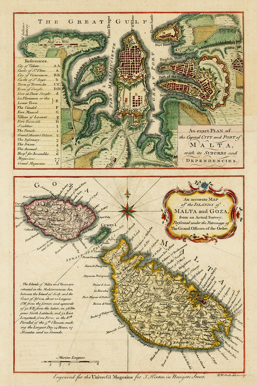

An eighteenth-century double map of Malta, consisting of a plan of Valletta with a key to locations of note, and a map of Malta, Gozo (Goza) and Comino (Cumin). The map was made in 1761 by Richard William Seale from a survey approved by the Knights of the Order of St. John. Title map 1: An exact Plan of the Capital City and Port of Malta, with its Suburbs and Dependencies; title map 2: An accurate Map of the Islands of Malta and Goza, from an Acutal Survey, Performed under the Patronage of The Grand Officers of the Order.
• Old map of Malta with a plan of Valletta, 1761, Knights of Malta survey, R. W. Seale
• Fine Art Premium Giclée (Gouttelette) Print (100% cotton 340 gsm fine art paper)
• Made in USA