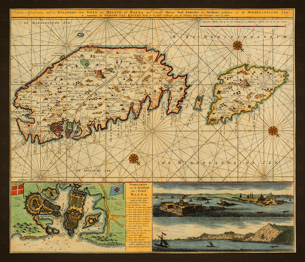
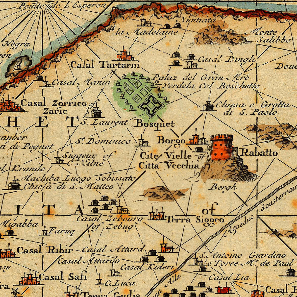
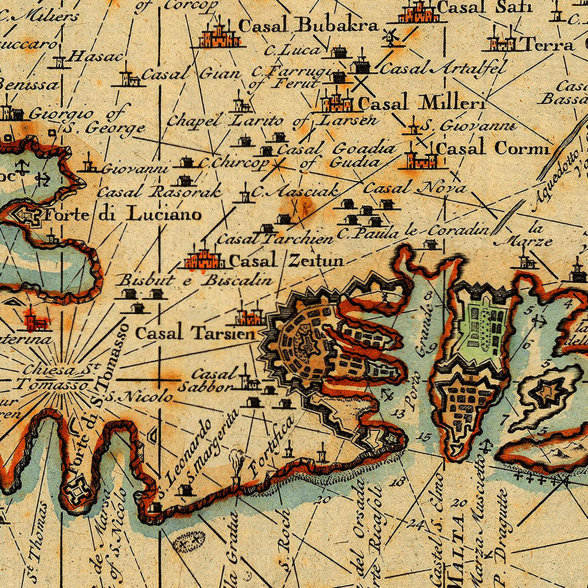
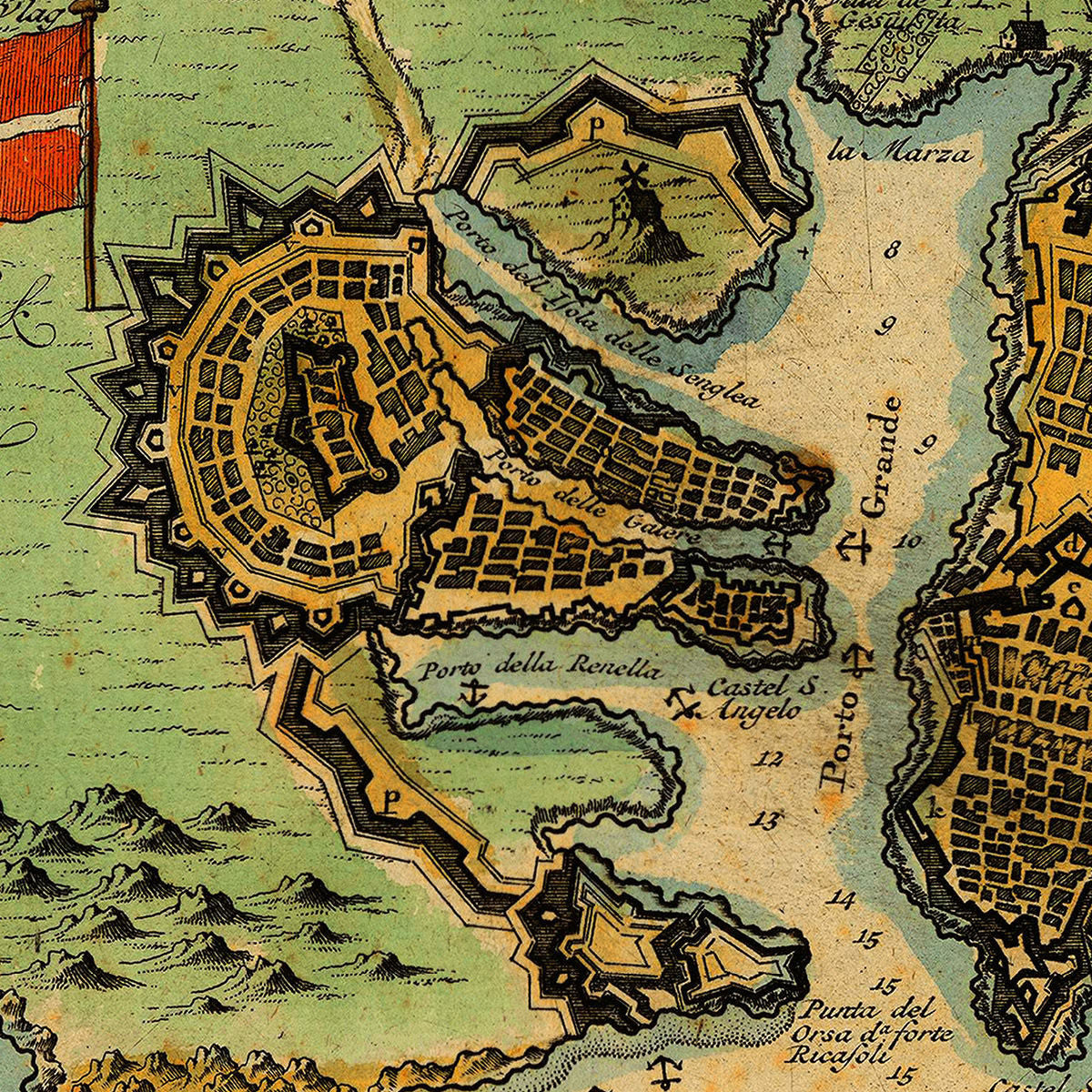
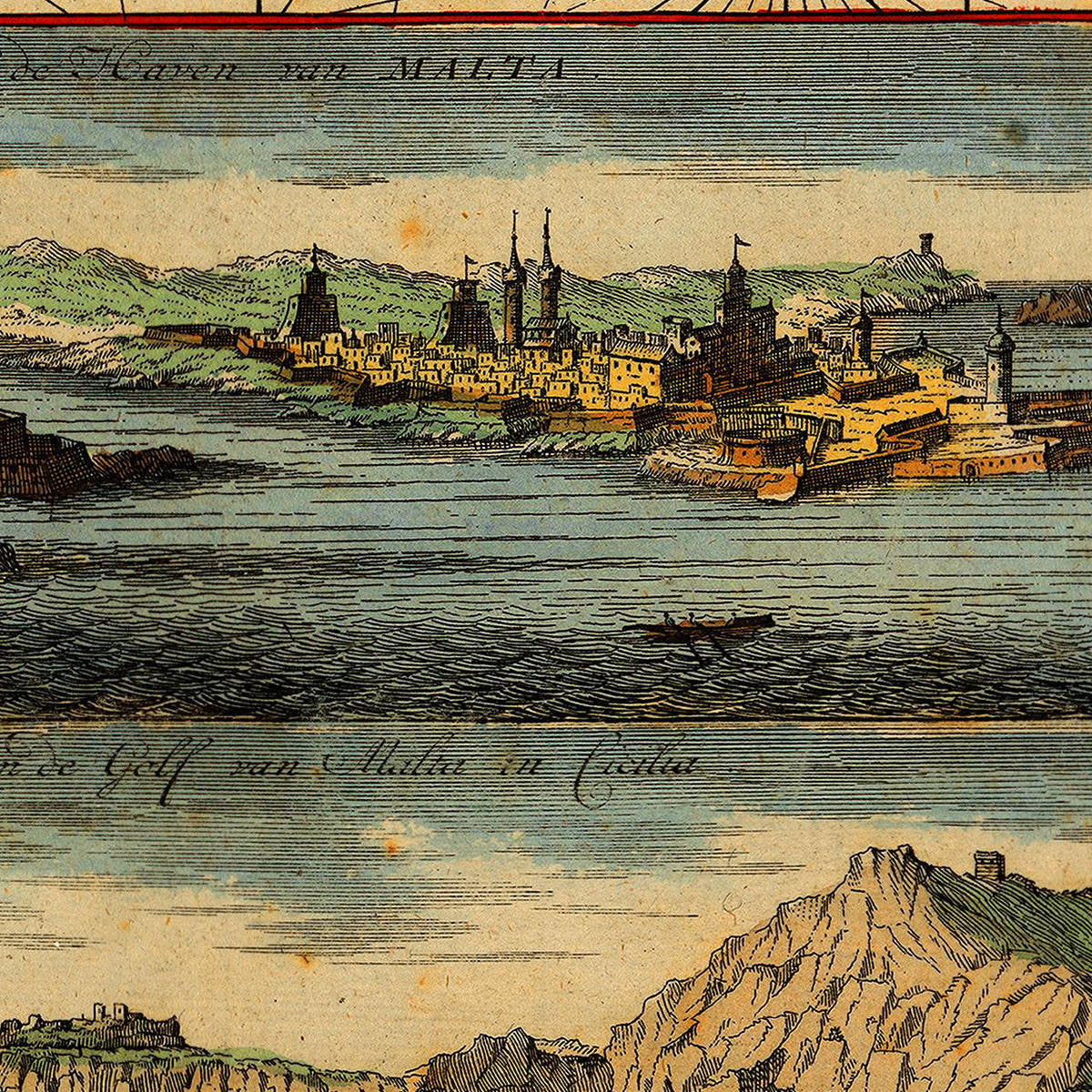

A very detailed, eighteenth-century map of the islands of Malta, Gozo and Comino, oriented with SW at the top. The map is essentially a sea chart of the islands, including a deployment map of Valletta, and a view of Valletta and Marsa (Il-Marsa), and Grand Harbour. Aside from the extensive annotations (mainly in Italian) throughout the entire map, it contains a key with 20 more important locations ascribed also in Italian — the language of preference of the Knights of Saint John. With the amount of information it contains of fortifications, infrastructures, nautical markings, etc., this is undoubtedly one of the most illuminating documents in existence, oft Malta from the epoch of the Order of Saint John (1530–1798). The main map title reads: Nieuwe Afteekening van de Eylanden van Gozo en Melita of Malta… This remarkable chart was surveyed and drawn by Gerard van Keulen and published by his son Johannes II van Keulen (and grandson of Johannes van Keulen) in 1734.
• Old map/chart of Malta with fortifications, soundings, views and plan of Valletta, 1734, Van Keulen
• Fine Art Premium Giclée (Gouttelette) Print (100% cotton 340 gsm fine art paper)
• Made in USA