Chesapeake Bay, 1781, Yorktown, Gloucester, Cornwallis Capture, Revolutionary War Map
Brand: Battlemaps.us

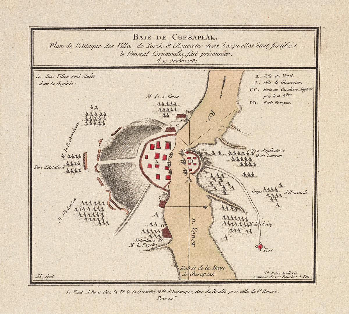
French battle map showing the plan of attack and siege on Yorktown and Gloucester in Virginia by French and American troops, commanded respectively by Comte de Rochambeau and General Washington. The siege lasted three weeks and resulted in the surrender of the British under the command of Lord Cornwallis on October 19, 1781. His capitulation effectively ended the American Revolutionary War.
Title FR: “Baie de Chesapeak. Plan de l’Attaque des Villes de Yorck et Gloucester dans l’esqu elles êtoit fortifie le Général Cornowalia, fait prisonnier, le 19 Octobre 1781”
Title EN: “Chesapeak (Chesapeake) Bay: Plan of Attack of the fortified Cities of Gloucester and Yorck (York), where General Cornowalia (Cornwallis) was captured, October 19, 1781”.
• Revolutionary War plan of attack on Yorktown, Virginia, 1781, French map
• Fine Art Premium Giclée (Gouttelette) Print (100% cotton 340 gsm fine art paper)
• Made in USA