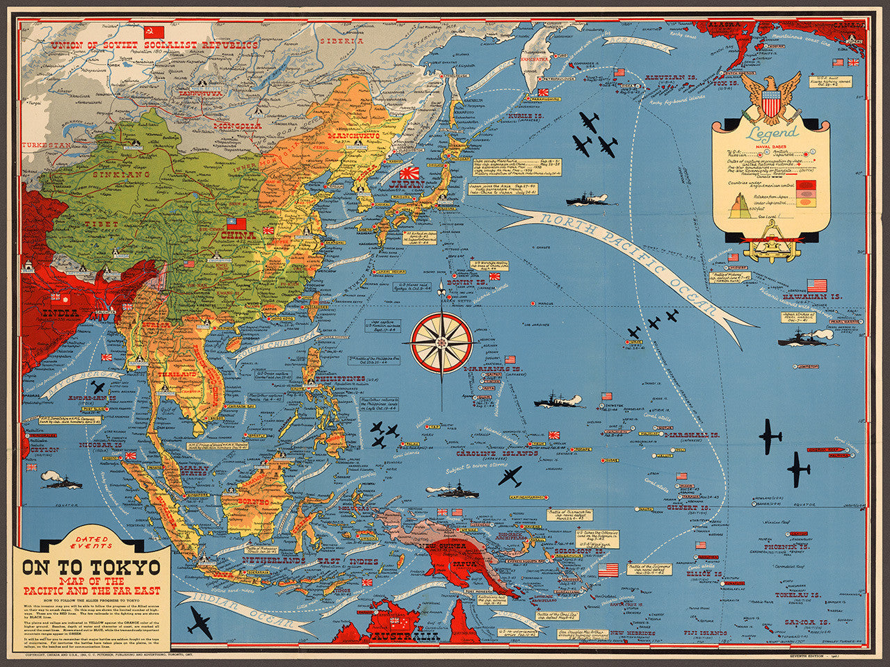
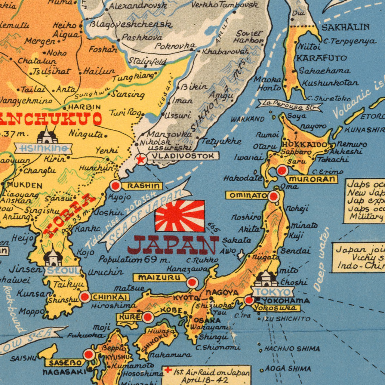
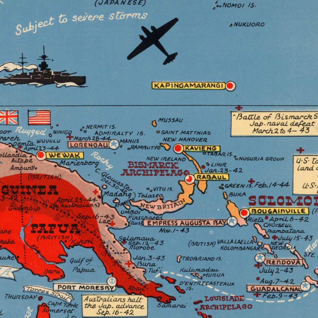
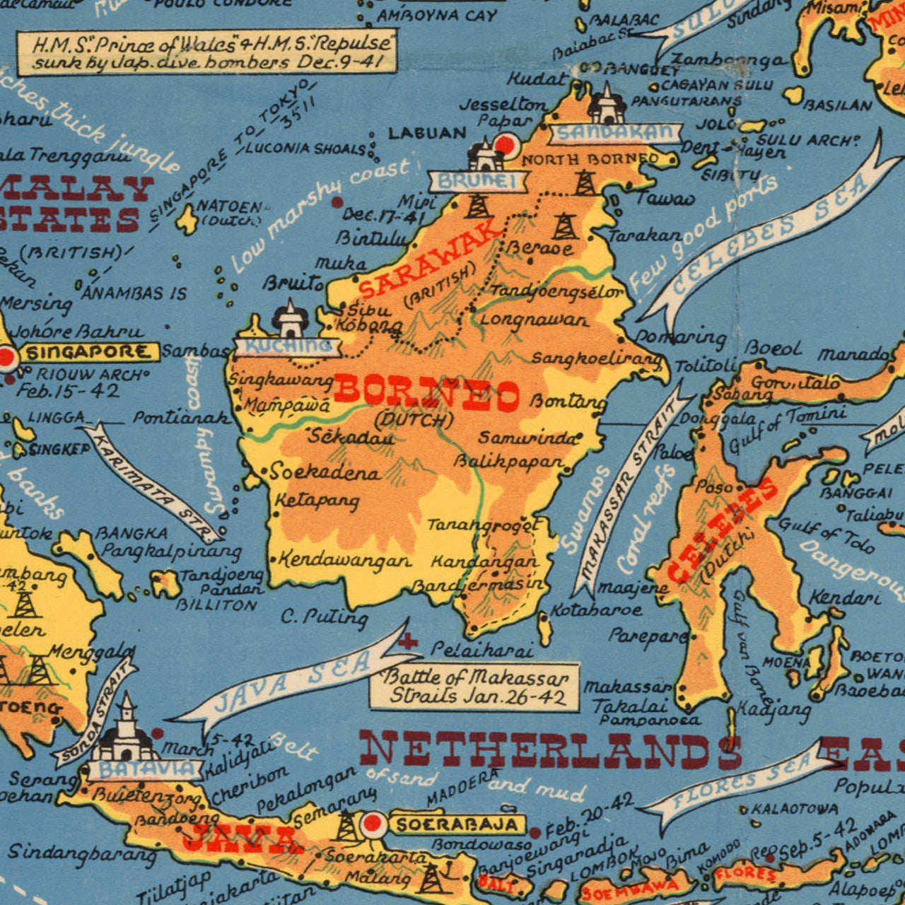
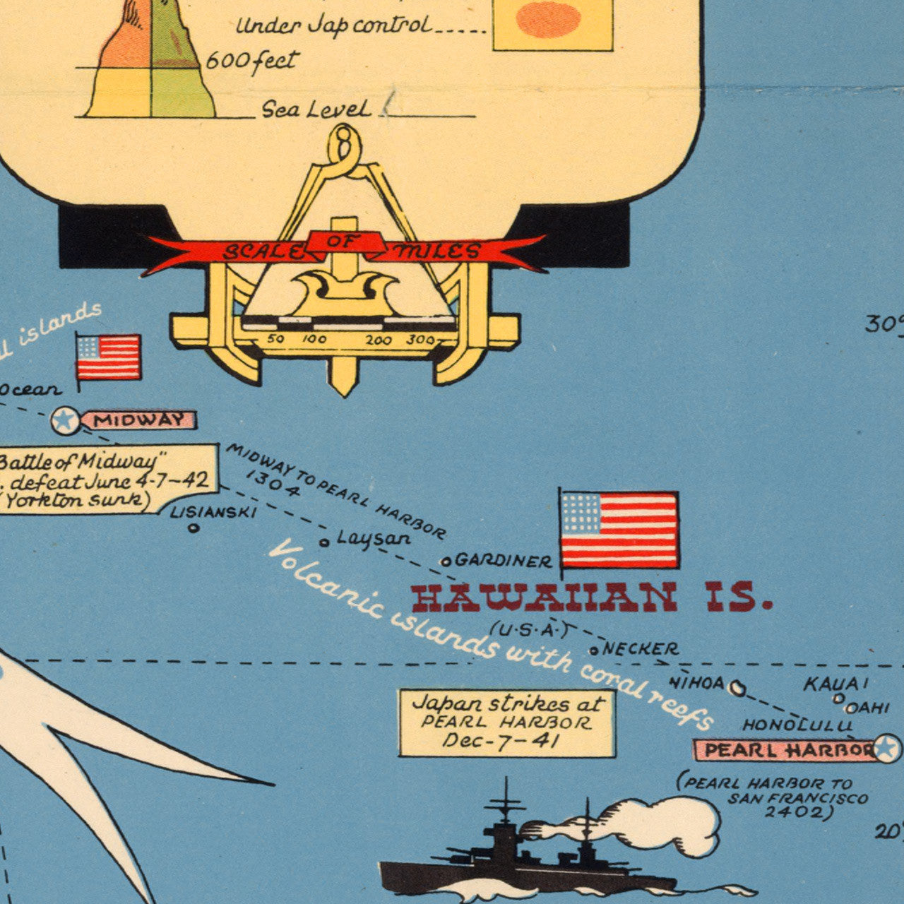

Large-scale World War Two map of Southeast Asia and the Pacific Ocean. This interesting pictorial map contains a wealth of information on battle dates and important events with illustrations. The legend includes U.S., British, Russian, and Japanese naval bases; dates of capture or occupation; victories; international boundaries, advancements, roads, railroads, canals, and elevations. Areas under Anglo-American control is shown in red, while Japanese controlled territories are shown in yellow. Main Title: Dated Events. On To Tokyo. Map of the Pacific and the Far East; Long title (cont’d): How to Follow the Allies Progress to Tokyo. With this invasion map you will be able to follow the progress of the Allied armies on their way to smash Japan…
• WWII Map of the Pacific Arena and Southeast Asia in 1944, with illustration and captions
• Fine Art Premium Giclée (Gouttelette) Print (100% cotton 340 gsm fine art paper)
• Made in USA