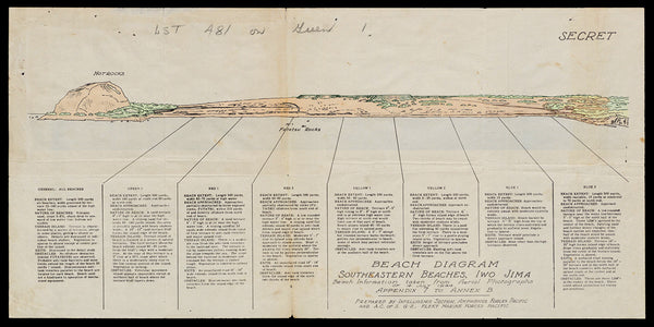
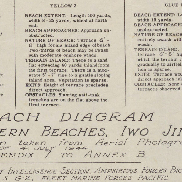
World War Two beach diagram of the SE beaches of the island of Iwo Jima, Japan, prepared in 1944 for the amphibious assault by the U.S. Navy in February, 1945. Title: “Beach Diagram, Southeastern beaches, Iwo Jima; Beach information taken from Aerial Photographs of 4 July 1944; Appendix 7 to Annex B; Prepared by Intelligence Section, Amphibious Forces Pacific and A. C. of S. G-2, Fleet Marine Forces Pacific”. The current copy of the diagram was given to the commander of the USS LST-481, as evident by the handwriting on the page. LST-481 was carrying the elements of the 28th Marine Regiment with the mission of landing on GREEN 1. Marines from the 28th Regiment, 5th Division, would raise the American flag atop Mount Suribachi, Iwo Jima, on February 23, 1945, creating one of the most iconic images in US history.
“The raising of that flag on Suribachi means a Marine Corps for the next five hundred years.” ~ James Forrestal, Secretary of the Navy, 23 February, 1945
• WWII beach diagram of Iwo Jima, prepared for the amphibious landing on D-Day (February 19, 1945)
• Premium Giclée Print (Ultra Premium Presentation Enhanced Matte Paper)
• Made in USA


