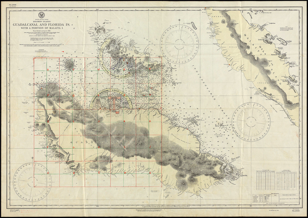
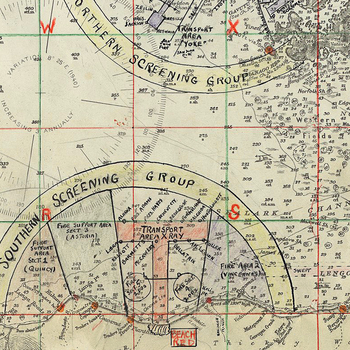
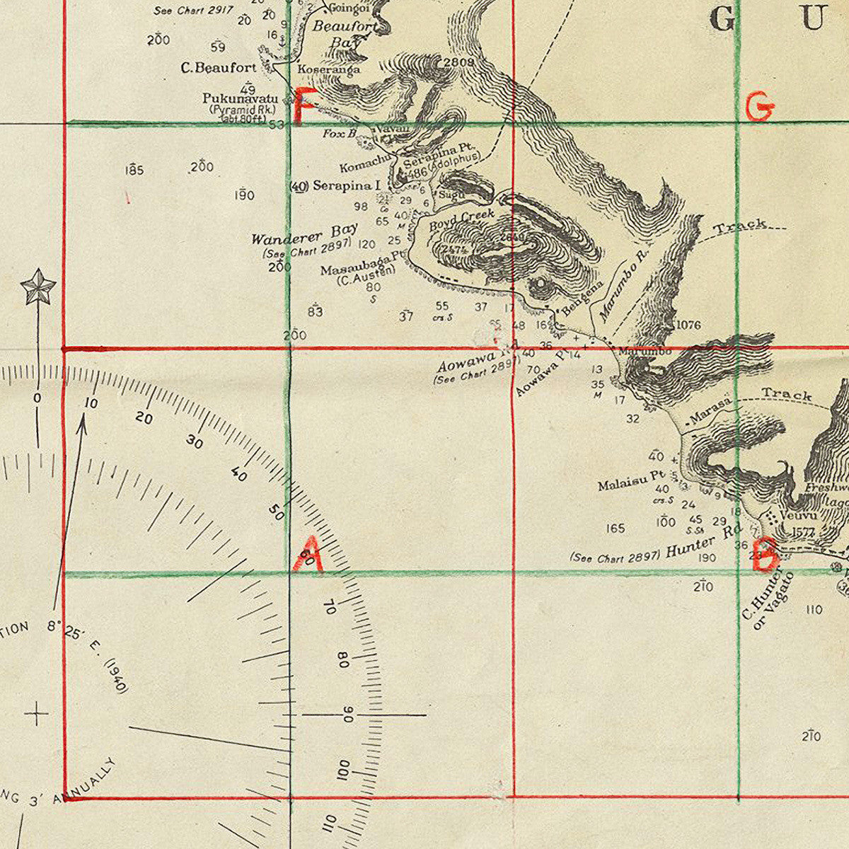
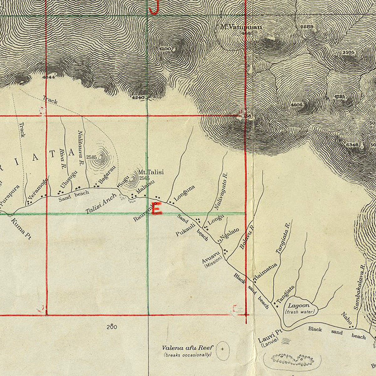

The battle map of the islands of Guadalcanal and Florida is a must-have for any student of US Naval and Marine operations in the Pacific Theater during World War Two. The map depicts tactical Naval graphics for the Southern and Northern screening operations and Red Beach landings with hand-drafted US operational specifics in red, green, blue, and black pencil. The printed map was issued in 1941. The hand-drawn graphics were drafted on to the map throughout the operations. Full title reads: South Pacific Ocean, Solomon Islands, Guadalcanal and Florida Is., with a portion of Malaita I.
• Map of the Guadalcanal Island Battlefield, Solomon Islands, Pacific Theater, WWII (large size)
• Hand drafted US operational specifics in red, blue, black and green pencil
• Premium Giclée Print (Ultra Premium Presentation Enhanced Matte Paper)
• Made in USA