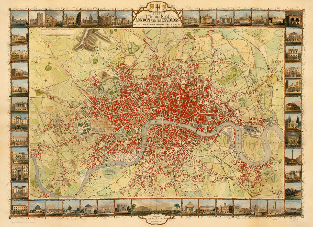
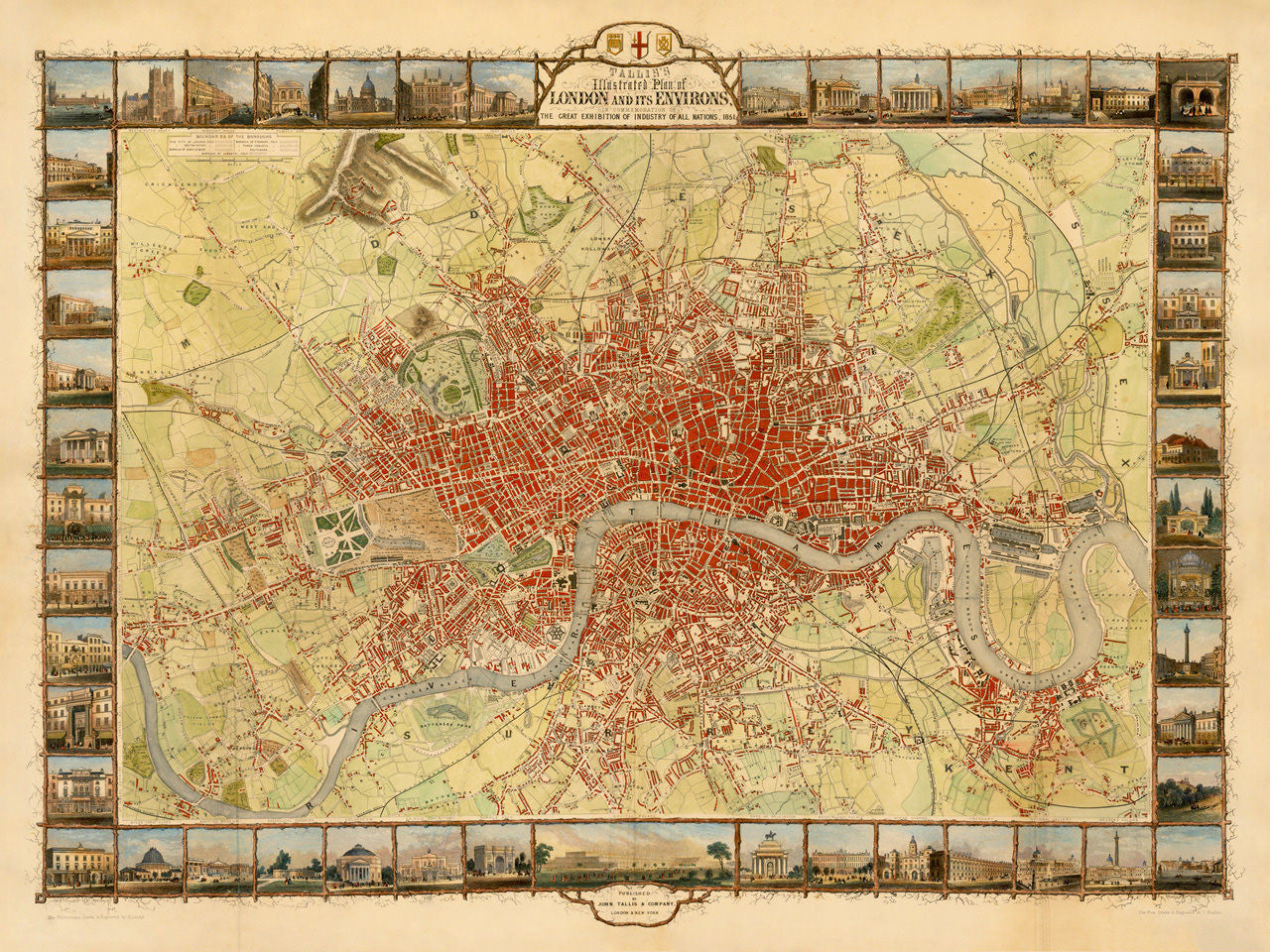

“The Most Beautiful and Perfect Plan of London Ever Produced” ~ John Tallis, 1851
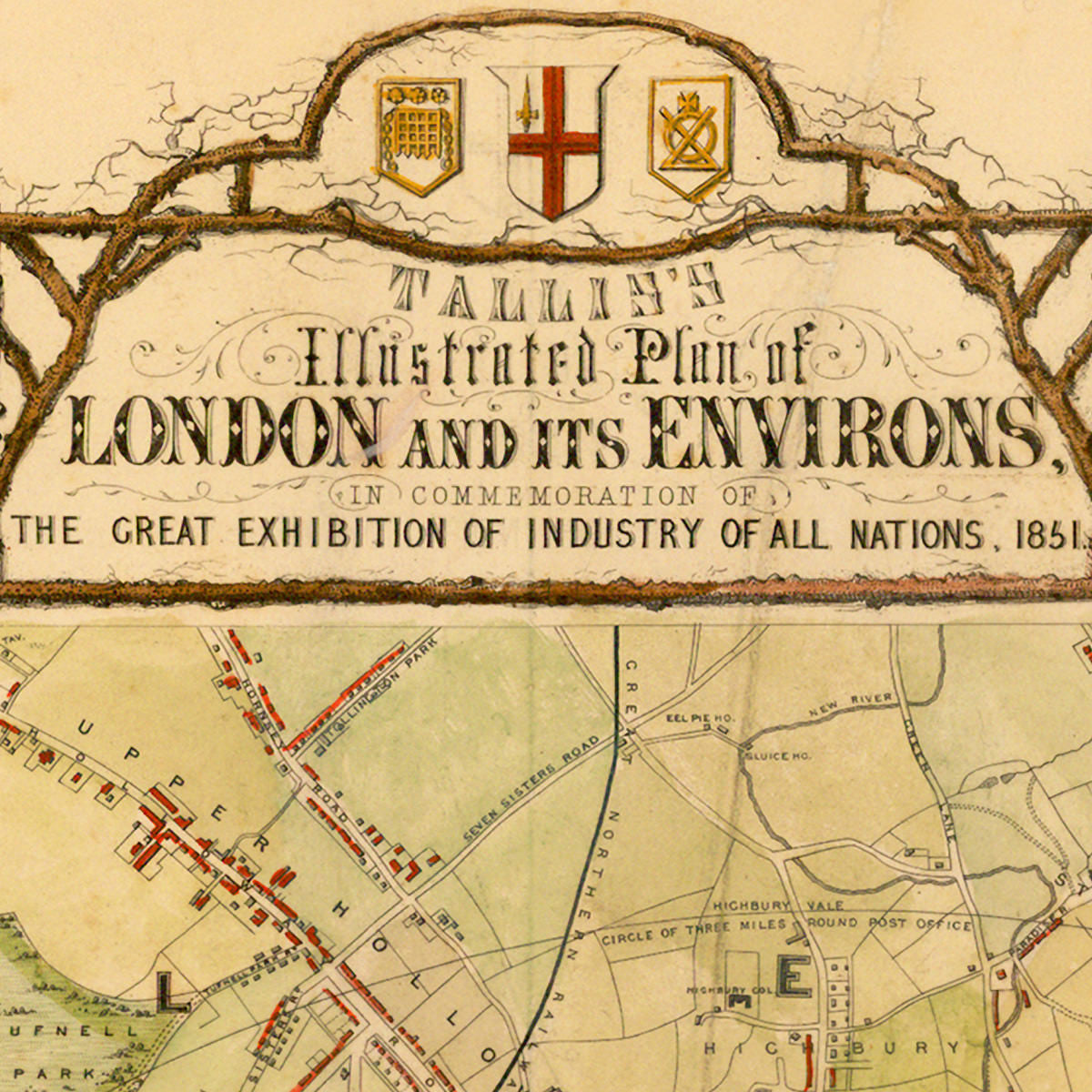
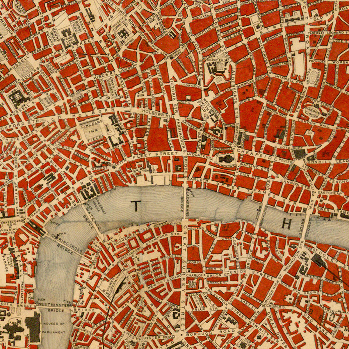
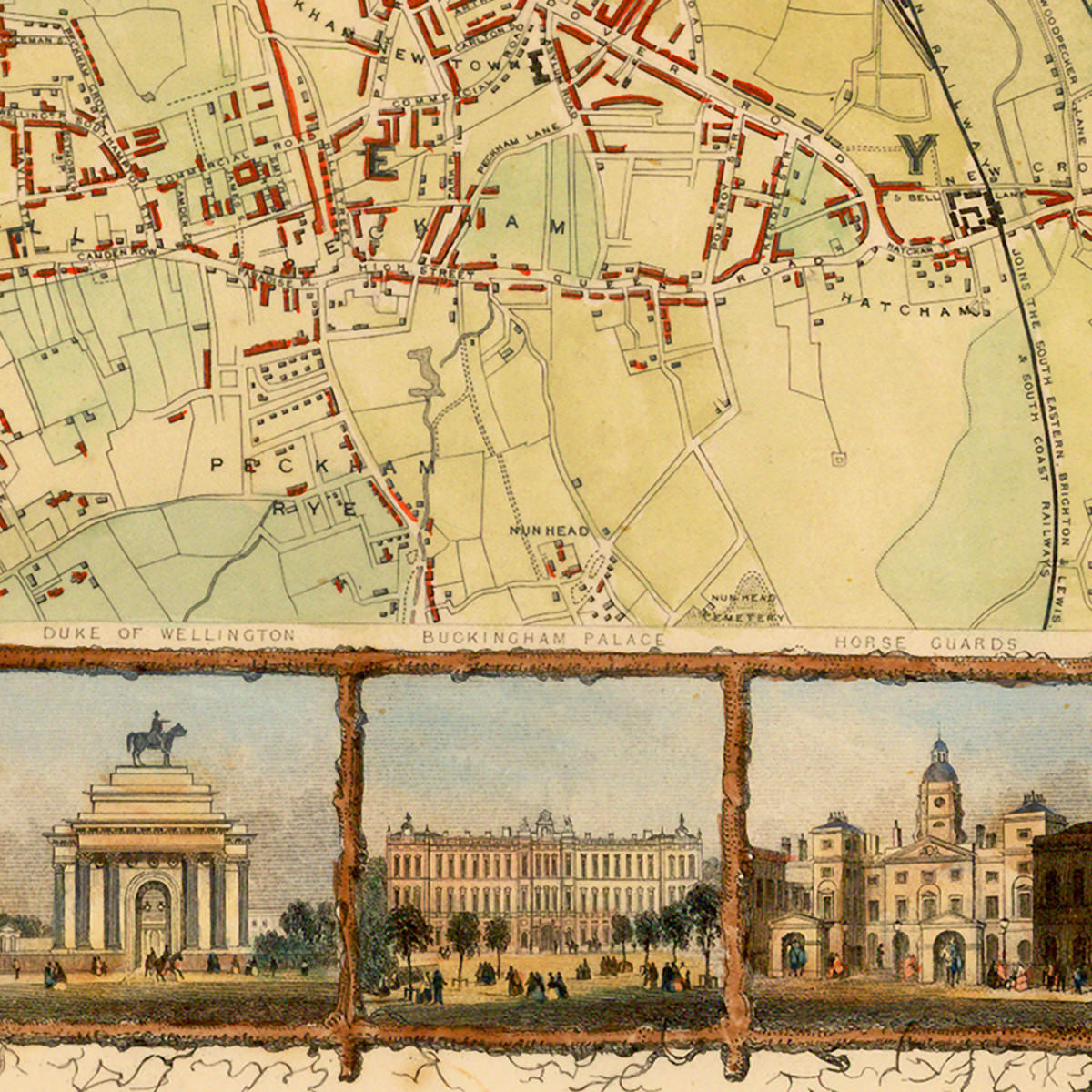
This striking, large-format, decorative map is John Tallis’ famous plan of London, drawn and engraved by John Rapkin, and published to commemorate the first World’s Fair — The Great Exhibition of 1851, held at the specially constructed Crystal Palace in Hyde Park, London. The map is adorned with 49 vignetted views of London landmarks, from the Houses of Parliament and Westminster Abbey, to Crystal Palace, Buckingham Palace and St Paul’s Cathedral, to name just a few. Full map title reads: Tallis’s Illustrated Plan of London and its Environs in Commemoration of the Great Exhibition of Industry of All Nations 1851.
John Tallis was one of the last great decorative map makers. His remarkable regional maps and city plans were the result of the obsessive and collaborative craftsmanship in his publishing company, whose main engraver and illustrator was John Rapkin. Upon issuing the London plan, Tallis himself remarked to have published the “most beautiful and perfect plan of London ever produced”. And although that may seem hardly modest to some, the plan has since been widely considered as the most attractive map of London produced in the nineteenth century.
• Illustrated city plan of London with landmarks, 1851, John Talis & John Rapkin
• Title: Tallis’s Illustrated Plan of London and its Environs…
• Fine Art Premium Giclée (Gouttelette) Print (100% cotton 340 gsm fine art paper)
• Made in USA