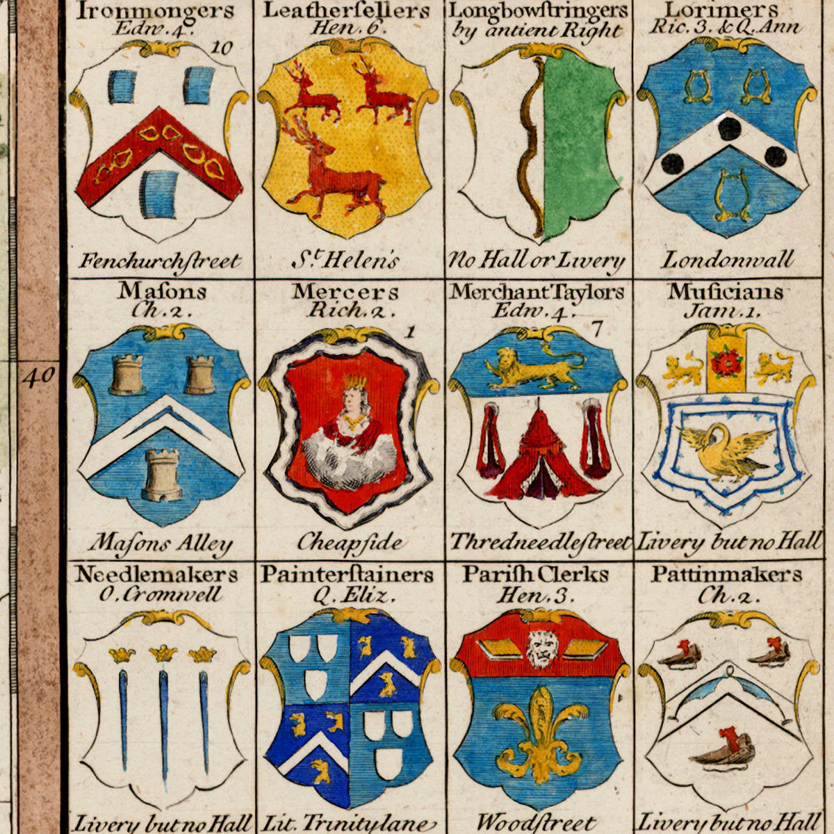
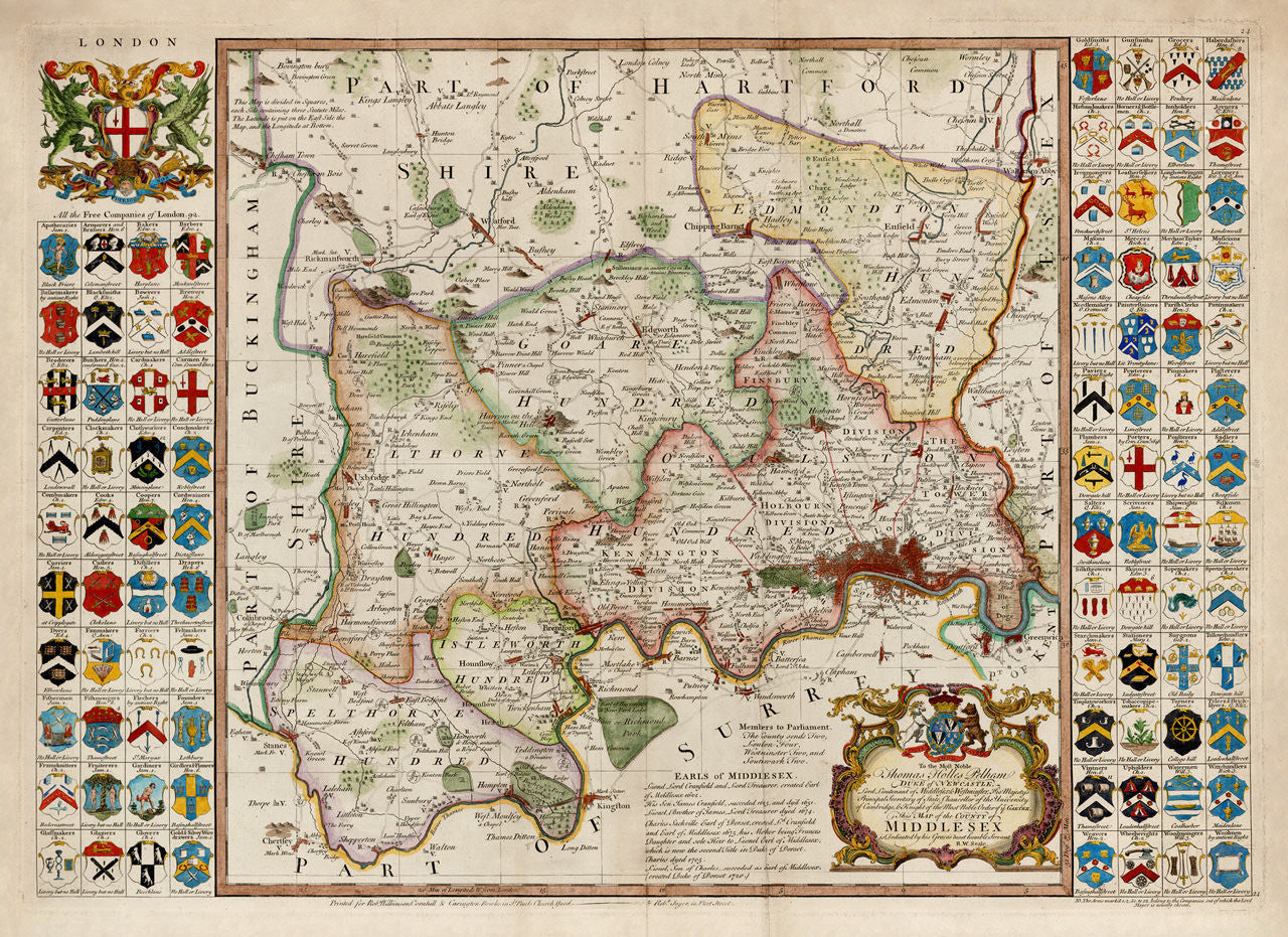
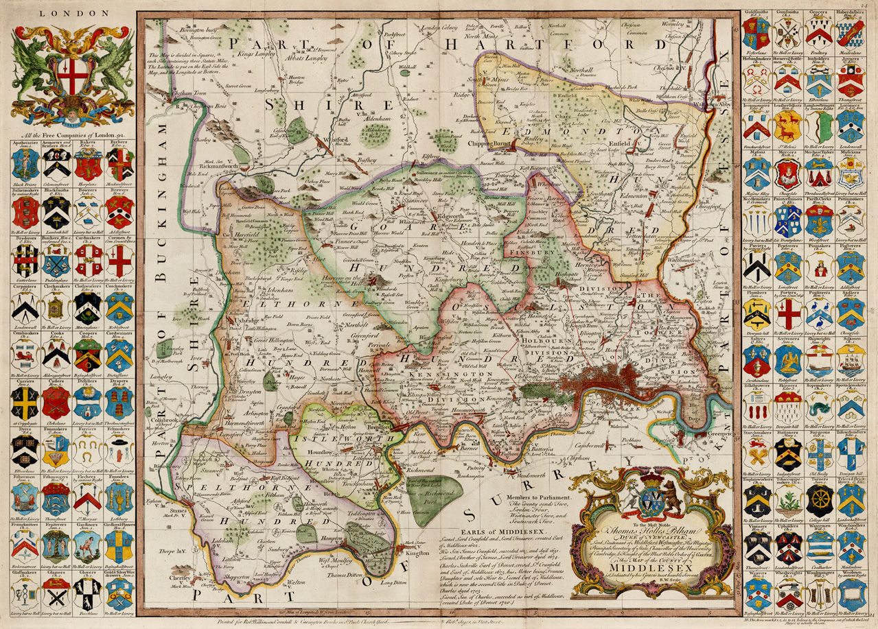
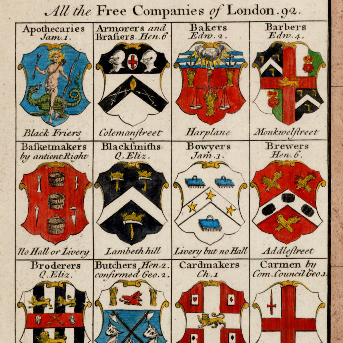
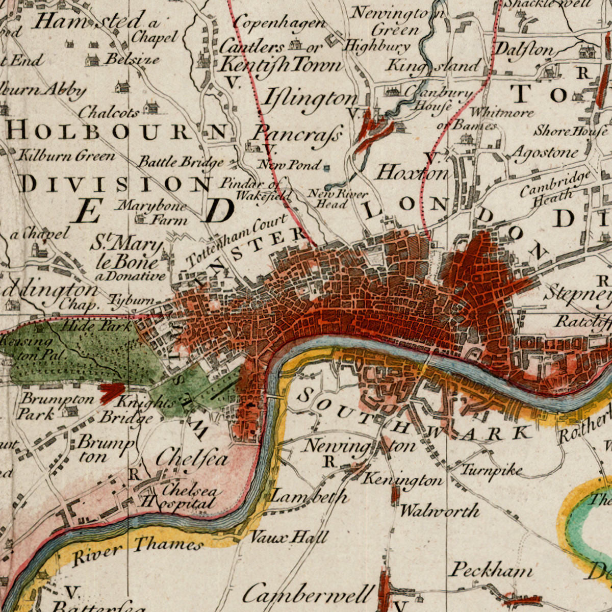

The Middlesex County Map is Richard William Seale’s most famous creation. Published in the middle of the 18th century, this large-scale map depicts in great detail the County of Middlesex and its surrounding areas, today all part of Greater London. The City of London is marked in red, and all its suburbs and outlying villages are shown along with roads, rivers, parks, hills, commons and notable buildings. The map is flanked by 92 coats of arms belonging to All the Free Companies of London — the livery companies, comprising London’s ancient and modern guilds. The map also features two large ornate cartouches — one with a spectacular rendition of the Arms of the City of London, displaying its motto, “Domine Dirige Nos”; the second one is a title cartouche, crowned by the coat of arms of the Duke of Newcastle, and containing a dedication to the duke: “To the Most Noble Thomas Holles Pelham Duke of Newcastle, Lord Lieutenant of Middlesex & Westminster, His Majesty’s Principal Secretary of State, Chancellor of the University of Cambridge, & Knight of the Most Noble Order of ye Garter. This Map of the County of Middlesex is Dedicated by his Grace’s most humble Servant R. W. Seale.”
• Beautiful, ornate map of London and Middlesex, today part of Greater London, ca. 1750, R. W. Seale
• Title: To the Most Noble Thomas Holles Pelham Duke of Newcastle… Map of the County of Middlesex…
• Fine Art Premium Giclée (Gouttelette) Print (100% cotton 340 gsm fine art paper)
• Made in USA