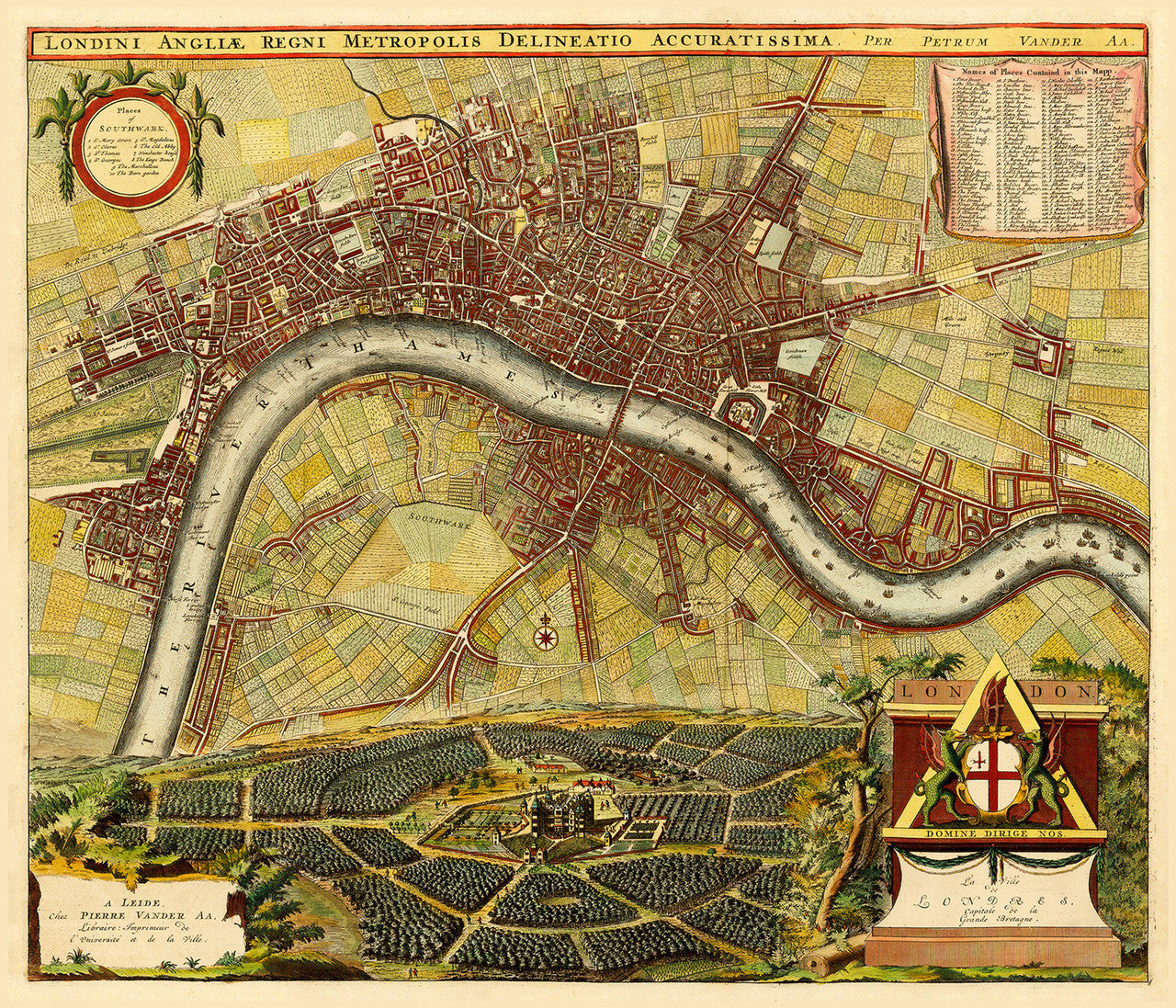


A strikingly beautiful and highly derivative map, depicting London in late 1600s – early 1700s. Londini Angliæ Regni Metropolis is based on Hollar’s 1675 map of London, which was copied and altered by De La Feuille in 1689, De Ram in 1689/90, and De Wit in 1690/93 to commemorate the Glorious Revolution of 1688. Finally, by 1728 Pieter van der Aa had created his own version of the acclaimed London map for his highly sought-after Galerie Agreable du Monde, keeping and improving on Hollar’s and de la Feuille’s color schemes, (see our ‘Rome Paris London’ set), and replacing the original portraits of William and Mary, garlands and cherubs, with a view of Westwood House surrounded by idyllic orchards. The result was nothing short of spectacular.
• Richly detailed old plan of London, ca. 1700, depicting the city in the late 17th – early 18th century
• Title: Londini Angliae Regni Metropolis Delineatio Accuratissima, Van der Aa
• Fine Art Premium Giclée (Gouttelette) Print (100% cotton 340 gsm fine art paper)
• Made in USA