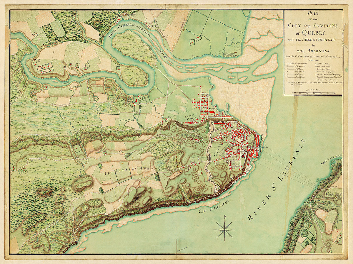
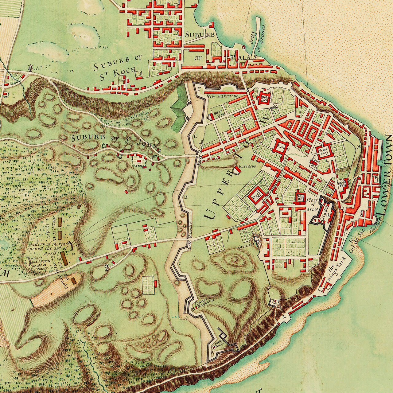
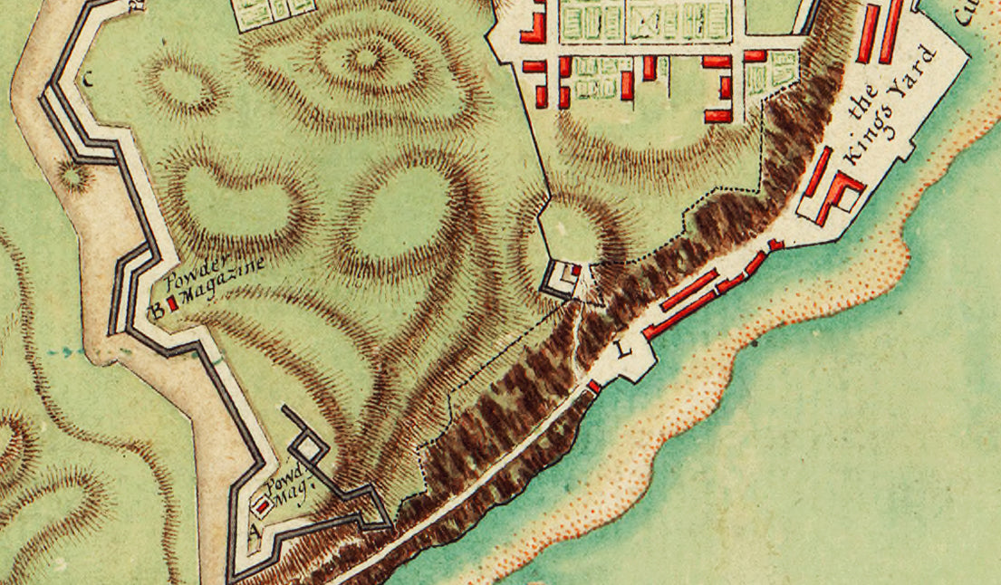

The failed attack and resulting siege of Quebec by the American army led by Major General Richard Montgomery and Colonel Benedict Arnold is depicted in this beautifully colored and detailed map. After several unsuccessful attempts by Montgomery to convince the British garrison to surrender, the Americans conducted a two-pronged assault during a snow storm on December 31, 1775. A force under Montgomery attacked the lower town gate (marked by L) where he received his mortal wound. Arnold’s force moved against the city from the north (marked by M) and he too was wounded in the assault. The important locations to the siege and assault on the city are annotated.
This excellent battle plan was published by William Faden in September 1776, just four months after the raising of the siege. It depicts the city and its surroundings in great detail, emphasizing its spectacular setting on cliffs overlooking the St. Lawrence. The street layout; major landmarks such as the citadel, cathedral and Jesuit seminary; the fortifications; and even the inhabitants' gardens are all clearly visible. The letters “L” and “M” indicate the points of attack by Montgomery and Arnold on December 31st. Arnold’s position on the Plains of Abraham during the long winter siege is shown, as are two American batteries erected in April 1776 across the St. Lawrence. The topography and road network of the surrounding countryside are also shown in some detail, making clear the farcical nature of Arnold’s attempt to maintain a siege with the few hundred men at his disposal.
Map Title: Plan of the City and Environs of Quebec, with its Siege and Blockade by the Americans, From the 8th Of December 1775 to the 13th Of May 1776. London: William Faden, 12 Septemr. 1776.
Inscription on Cartouche: To the Right Hon.ble the Lords Commission.rs for Trade and Plantations. This Plate is most Humbly Presented by Your Lordships Most Obedient and Devoted humble Servant T. Jefferys