
“In Flanders Fields the Poppies Grow…”
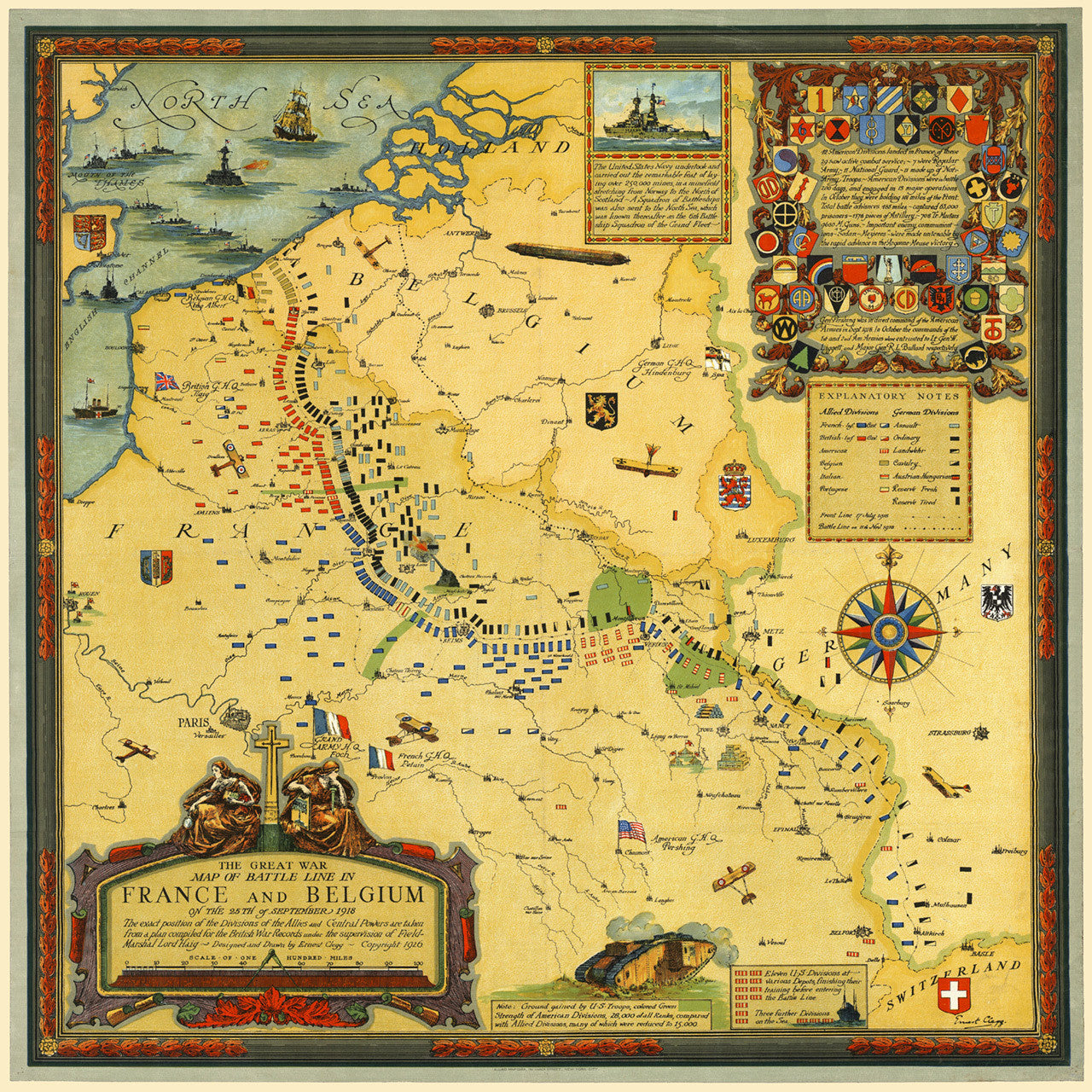
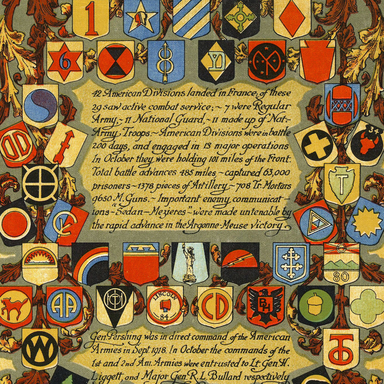
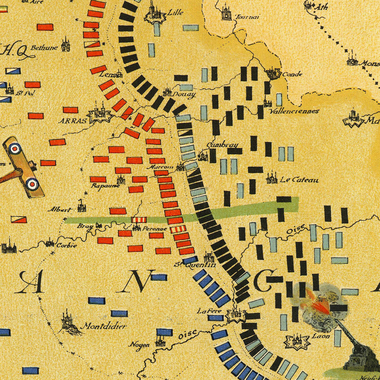
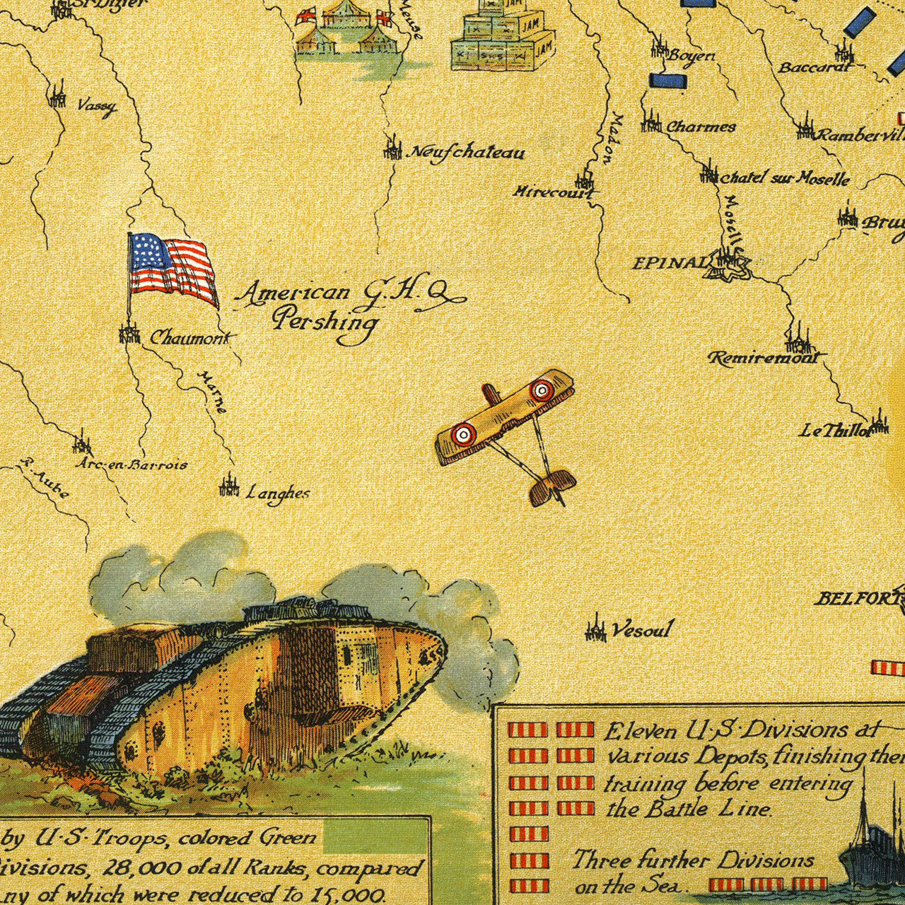
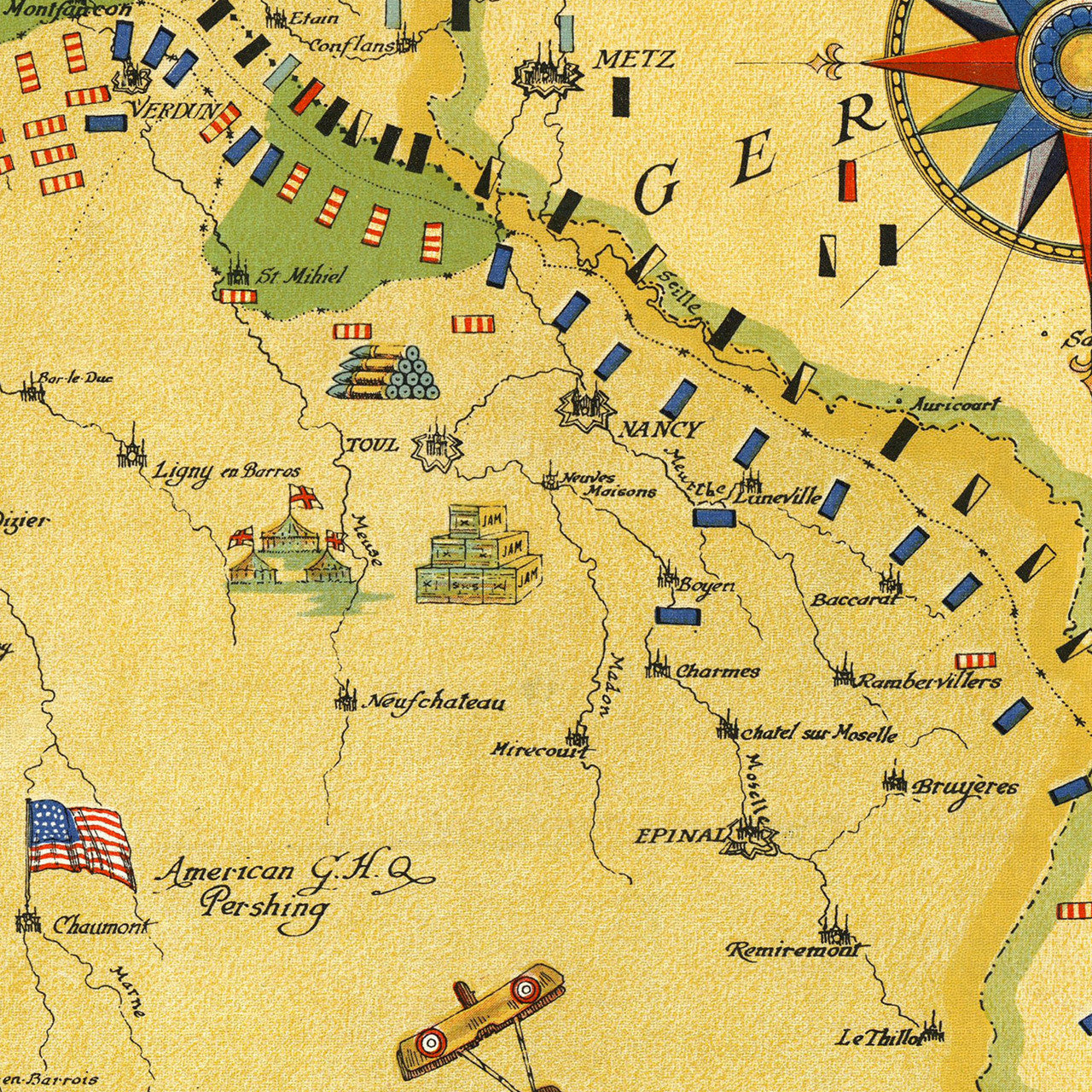
A decorative map of France and Belgium, showing American involvement and Allied operations in the Hundred Days Offensive of 1918, during World War I. The map depicts positions and troop movements throughout the Western Front. The areas covered are France, Belgium, Luxemburg, parts of Switzerland, Germany and Holland (the Netherlands), the English Channel and the North Sea. This beautiful pictorial map features insets with illustrations, divisions insignia and explanatory notes. It was designed and illustrated by Ernest Clegg in 1926. Clegg was himself a veteran of the First World War, as a Major in the Bedfordshire Regiment of the British Army. In 1921 he was asked to illustrate a book of poetry by a fellow soldier and a member of the Expeditionary Force — Canadian Lt. Col. John McCrae. McCrae, who just like Clegg had fought in the Second Boer War for the British Empire, had answered again the call of duty at the beginning of the Great War. In 1915, during the Second Battle of Ypres, McCrae had written what was to become one of the most memorable wartime poems of all time — “In Flanders Fields”:
In Flanders fields the poppies grow
Between the crosses, row on row,
That mark our place; and in the sky
The larks, still bravely singing, fly
Scarce heard amid the guns below.
We are the Dead. Short days ago
We lived, felt dawn, saw sunset glow,
Loved and were loved, and now we lie
In Flanders fields.
Take up our quarrel with the foe:
To you from failing hands we throw
The torch; be yours to hold it high.
If ye break faith with us who die
We shall not sleep, though poppies grow
In Flanders fields.
Lieutenant Colonel McCrae would die in 1918, during the war, while the poppy would eventually become a symbol of the fallen, and the official emblem of Remembrance Day.
Map title: The Great War Map of Battle Line in France and Belgium on the 25th of September 1918. The exact position of the Divisions of the Allies and the Central Powers are taken from a plan compiled for the British War Records under the supervision of Field-Marshall Lord Haig.
• WWI map of France and Belgium with troop positions and movements, 1926, Ernest Clegg
• Fine Art Premium Giclée (Gouttelette) Print (100% cotton 340 gsm textured fine art paper)
• Made in USA