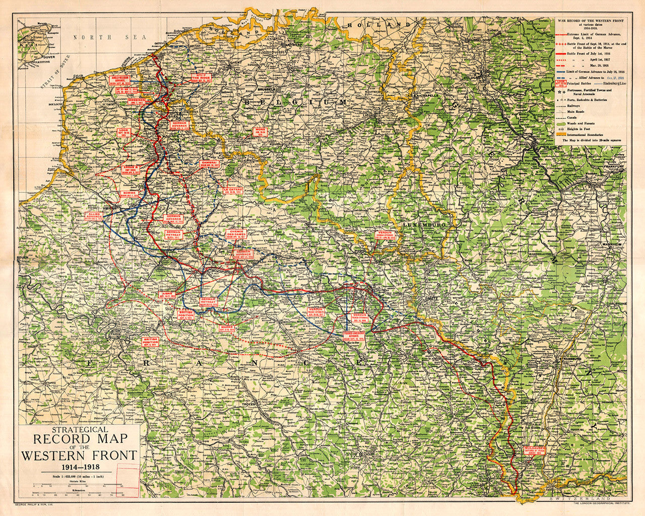
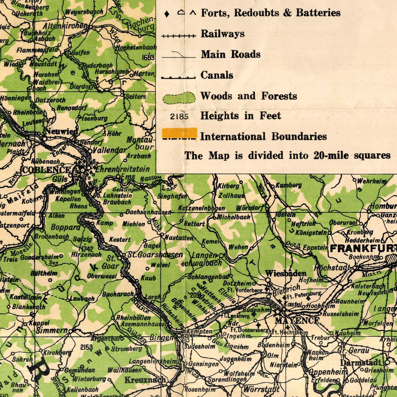
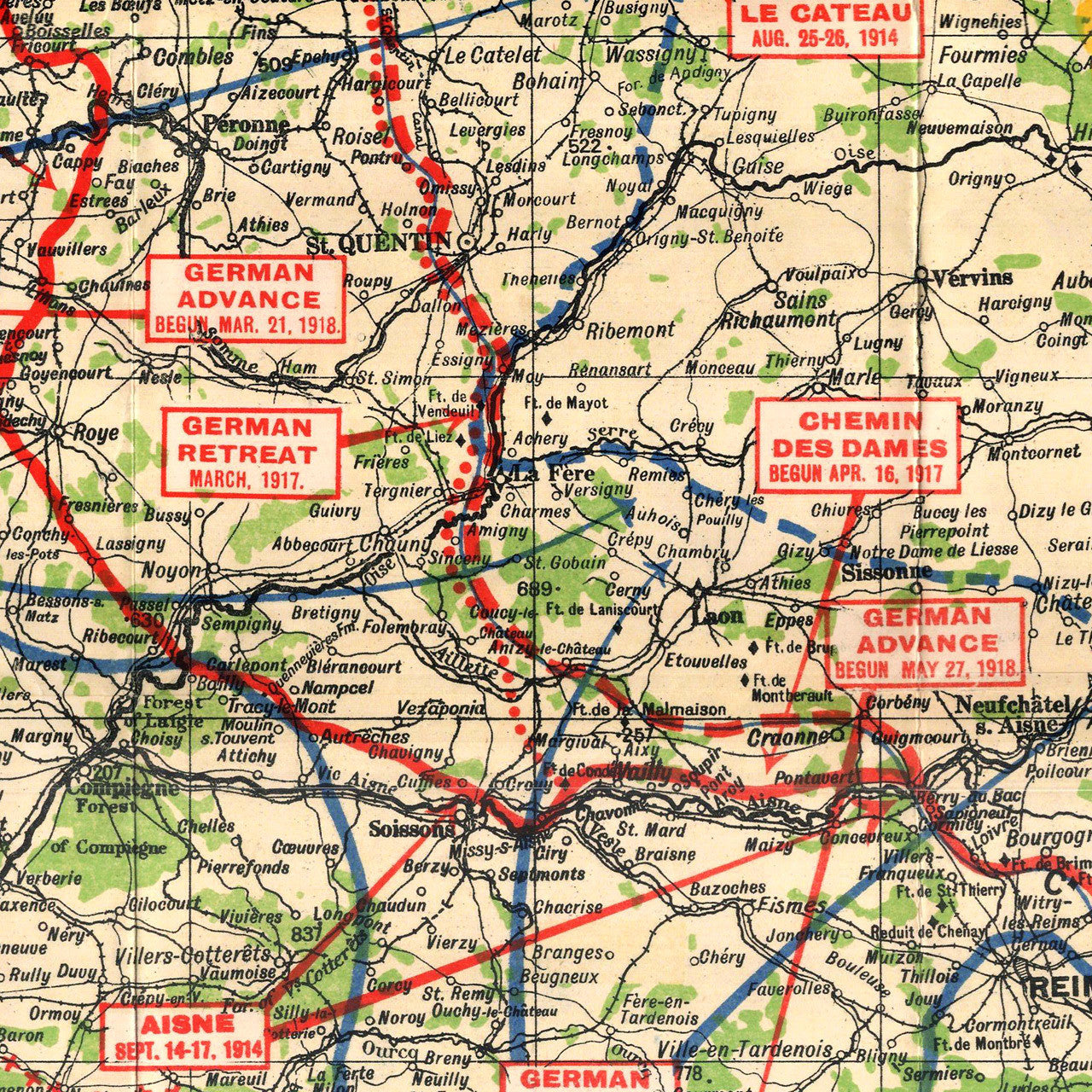
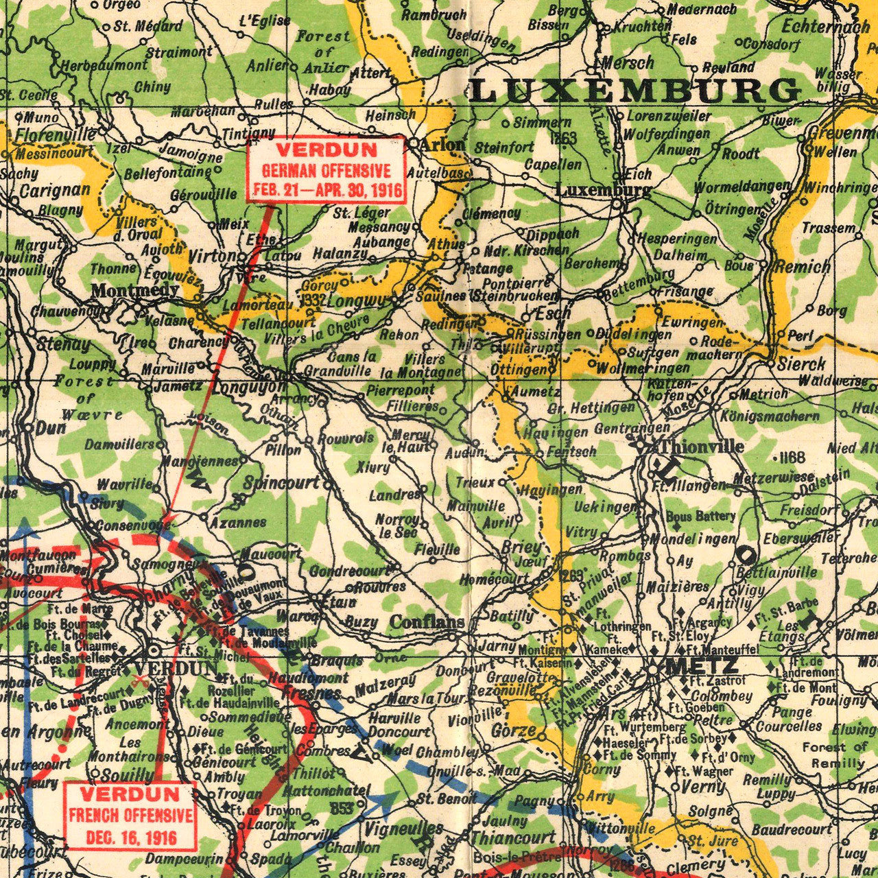
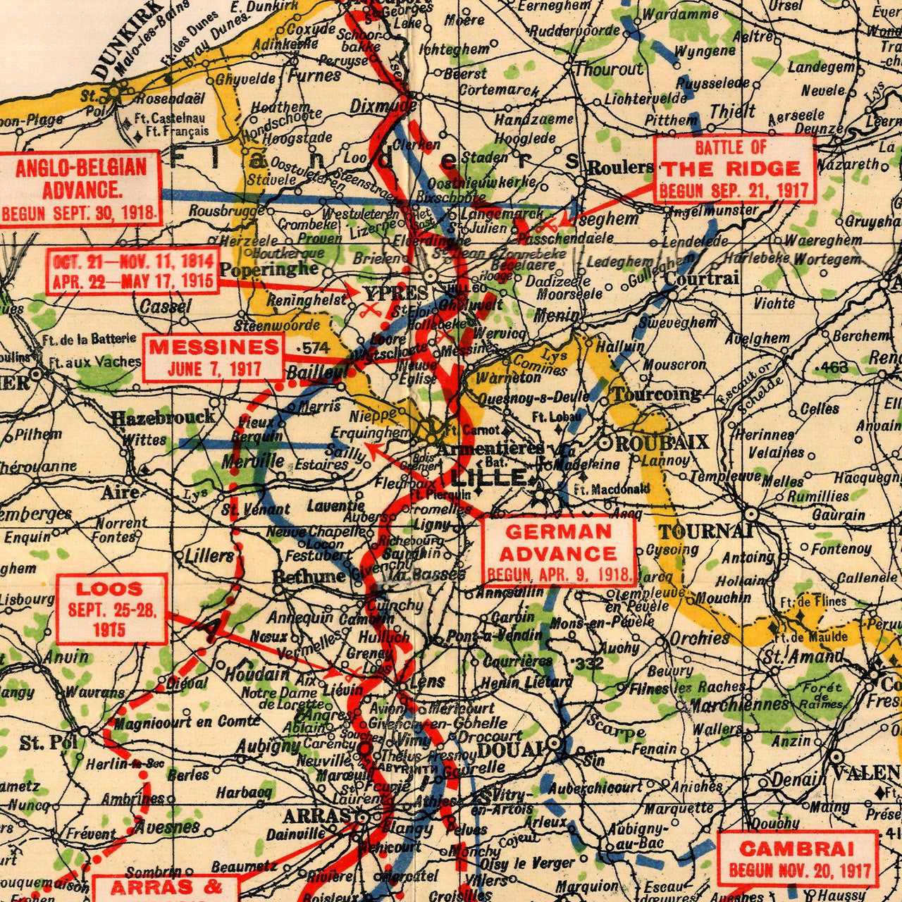

A WWI map of the Western Front in Europe — France, Belgium, Luxemburg, and Western Germany, from 1914 through 1918. The map shows battle fronts and limits of advances, principle battle sites, fortified sites, spot heights, wooded areas, railroads, and international boundaries. Title: Strategical Record Map of the Western Front, 1914–1918: War Record of the Western Front at various dates, 1914–1918.
• Strategic record map of the Western Front in Europe during WWI, 1914-1918
• Premium Giclée Print (Ultra Premium Presentation Enhanced Matte Paper)
• Made in USA