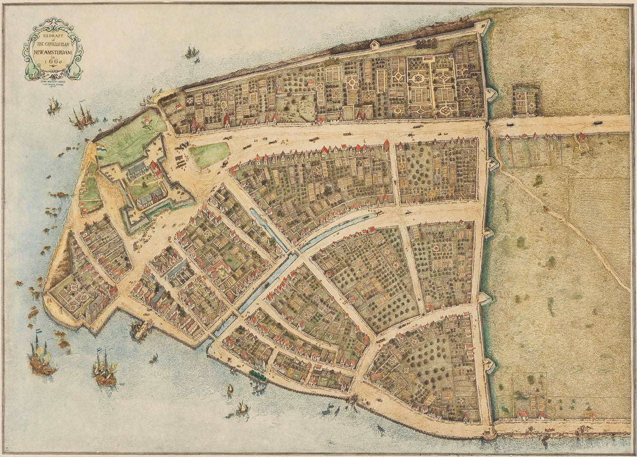
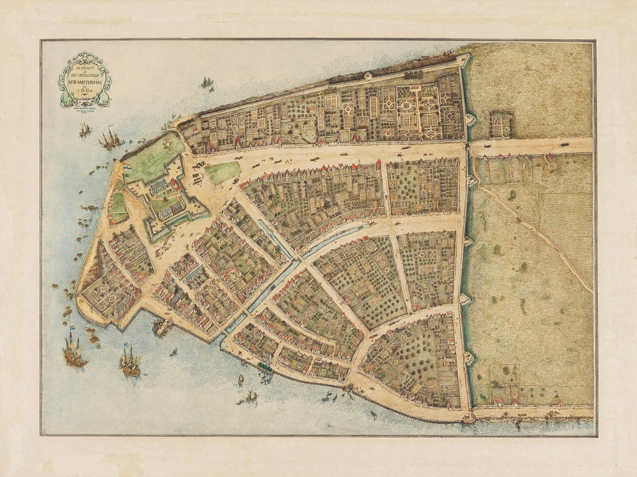
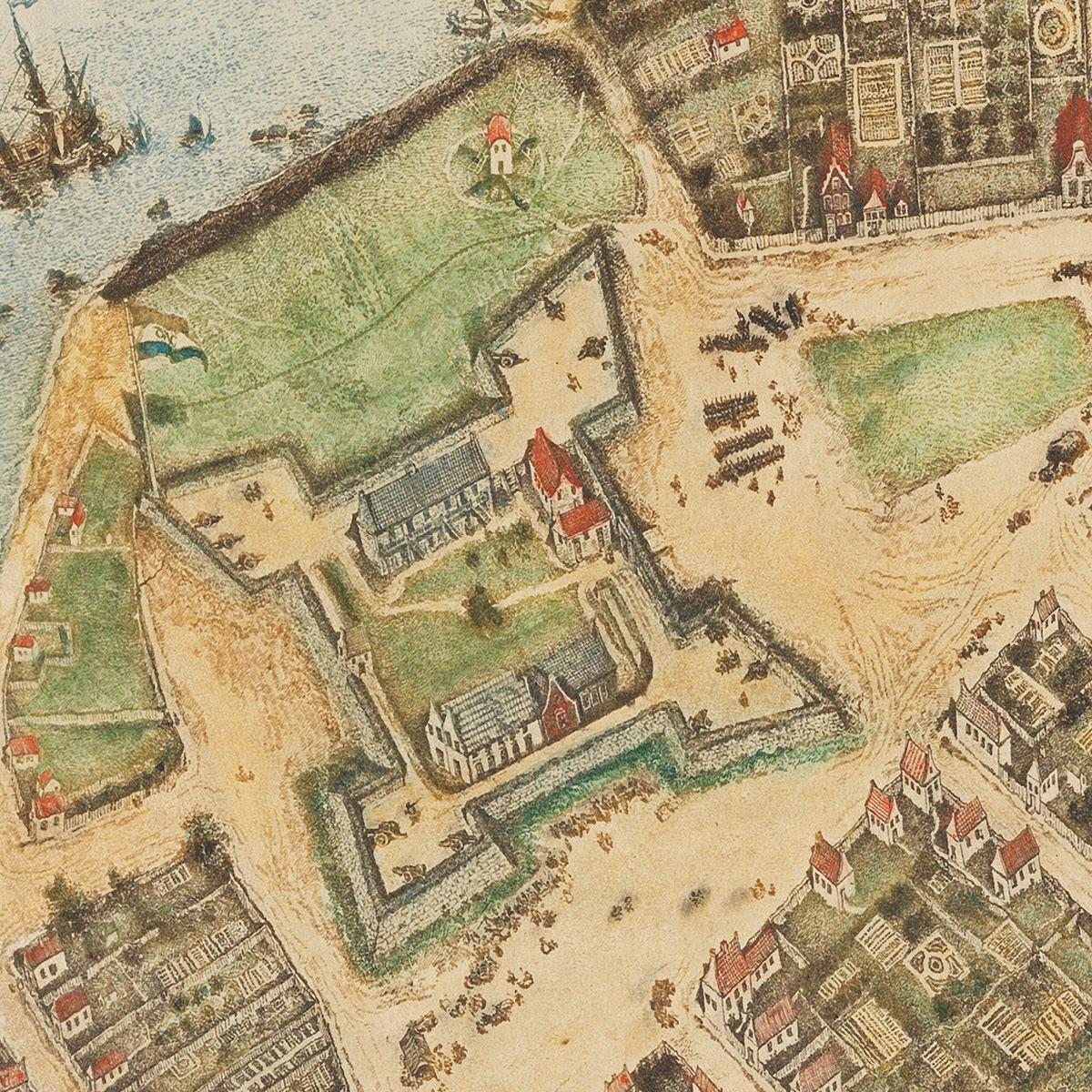
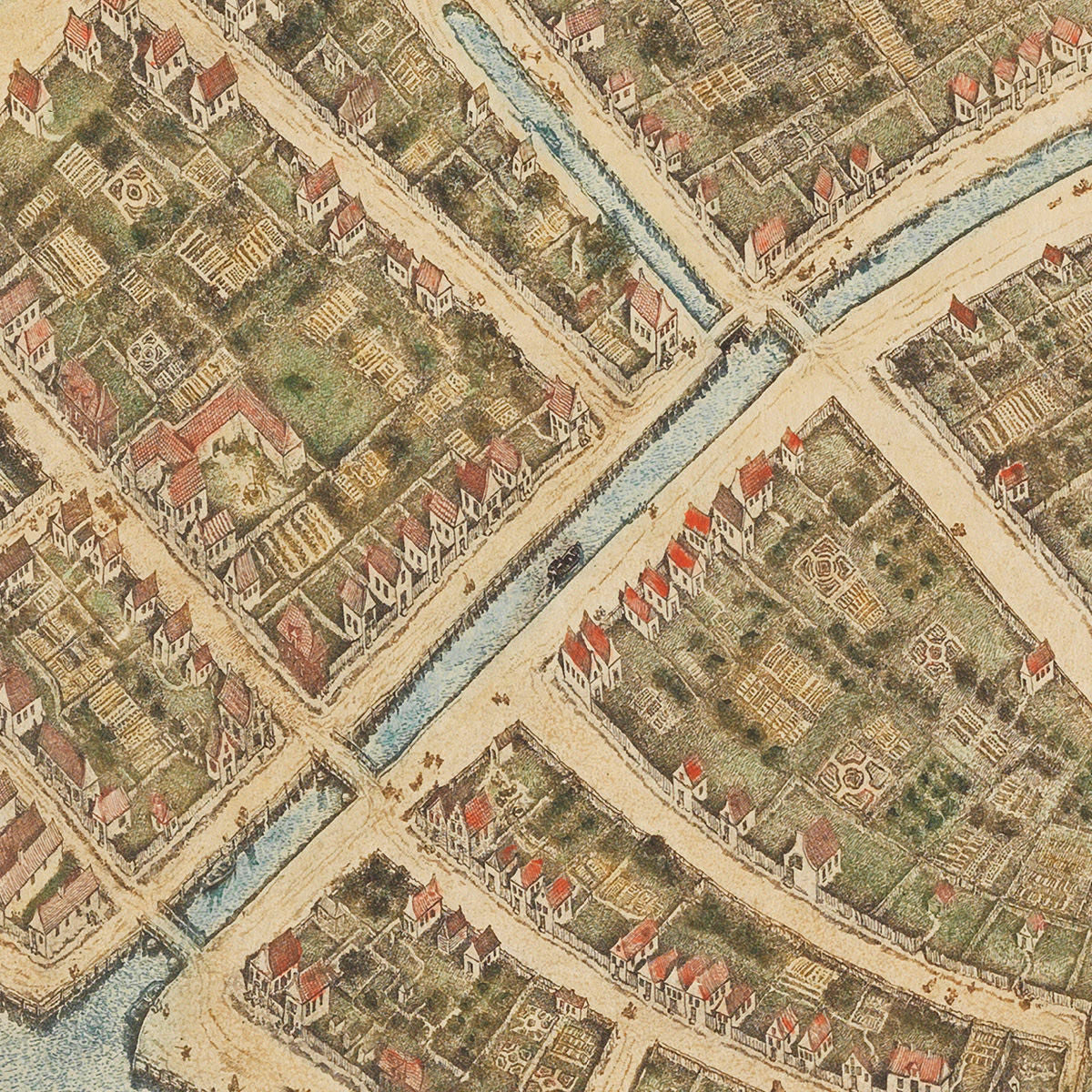
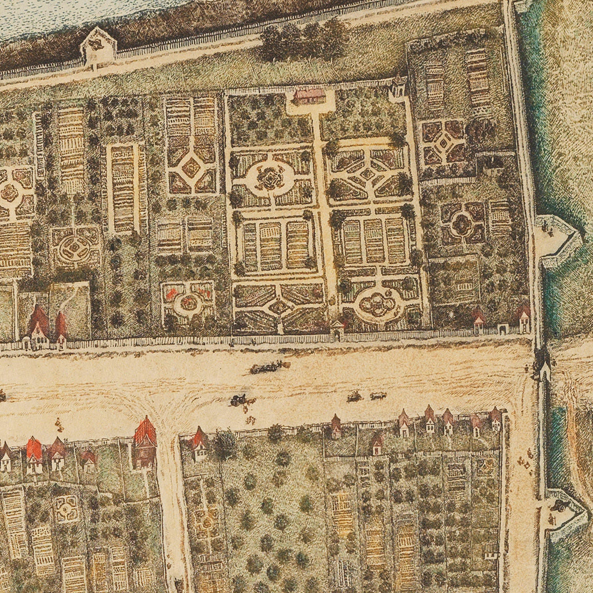

The Castello Plan is the earliest known map of New York City. The perspective bird’s-eye-view plan would have been a radically novel idea in both city planning and cartography at the time. The original plan was drawn in 1660 by Jacques Cortelyou, surveyor general of New Netherland in employ of the VOC (Dutch West India Company). The plan, oriented with NW at the top, contained a great deal of visual information of the walled city (today Lower Manhattan), with detailed depiction of individual buildings, streets, squares, canals, gardens, docks, Peter Stuyvesant’s house, the Wall Street wall, and Fort Amsterdam flying the VOC flag. Ships and boats are visible in the waters surrounding Manhattan, along with several beached vessels. In 1667 Joan Blaeu bound and sold the plan to the Tuscan prince, later Grand Duke of Tuscany. It resurfaced 233 years later, in 1900, at Villa di Castello — a Medici family estate near Florence, Tuscany. So, Cortelyou’s historic map was nicknamed “the Castello Plan”. Today the precious manuscript is kept at the Biblioteca Medicea Laurenziana in Florence. The original plan’s title reads: Afbeeldinge van de Stadt Amsterdam in Nieuw Neederlandt.
In 1916 John Wolcott Adams redrew the famous map for Isaac Newton Phelps Stokes’ six-tome study Iconography of Manhattan Island. The result was the current spectacular facsimile of the Castello Plan, which far outstrips the original in artistic value.
• The earliest known city plan of New York (New Amsterdam), aka the Castello Plan, showing the city around 1660
• Title: Redraft of the Castello Plan New Amsterdam in 1660 John Wolcott Adams, I. N. Phelps Stokes 1916
• Fine Art Premium Giclée (Gouttelette) Print (100% cotton 340 gsm watercolor textured fine art paper)
• Made in USA