
Blog
Maps of HMS Phoenix
This is the initial entry in a series about the H.M.S. Phoenix, a 44 gun, 5th rate Frigate that was one in a long line of ships with the same name to serve in the Royal Navy. The series will cover the actions of the Phoenix during the American War of Independence and the maps that are relevant to her service.
The Phoenix entered British service in 1759, with her first action against the French during the Seven Years War. The summer of 1775 saw the start of the American rebellion and the British Army under siege in the city of Boston. With just 26 ships, Vice Admiral Samuel Graves, commander of the North American Station, needed re-enforcement, so the Admiralty dispatched the Phoenix to America. Accurate charts of the North American coast were also needed and the Admiralty gave the Captain of the Phoenix, Hyde Parker, fifty charts of the Boston Harbor by J.F.W. Des Barres.
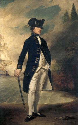
Captain Hyde Parker
Sailing conditions during the winter on the north-eastern coast of North America were unpredictable and dangerous and accurate charts were needed to reduce the risk to ships. Des Barres was already working on producing an atlas of the North American coast for the admiralty called the Atlantic Neptune. Given the situation in Boston Des Barres published the chart of the Boston Harbor separately in August and fifty charts were rushed to the Phoenix before she sailed for America. Parker and the Phoenix delivered the charts early in November 1775.
The Boston chart was created using surveys conducted by Samuel Holland and George Callendar during the 1760s. The complete Atlantic Neptune would be published in 1777.
Bibliography:
Gates, W. (1905). Ships of the British Navy: A Record of Heroism, Victory and Disaster, Volume 2 (Vol. 2). Portsmouth: W.H. Long.
"CAPTAIN (later Admiral) SIR HYDE PARKER, Kt (1739- 1807) by George Romney, (1734-1802) on the Staircase at Melford Hall." National Trust Prints. Accessed December 12, 2014. http://www.ntprints.com/image/347611/captain-later-admiral-sir-hyde-parker-kt-1739-1807-by-george-romney-1734-1802-on-the-staircase-at-melford-hall
Hornsby, Stephen J. Surveyors of Empire: Samuel Holland, J.F.W. Des Barres, and the Making of the Atlantic Neptune. Montréal, Québec: McGill-Queen's UP, 2011. Print.
"A Chart of the Harbour of Boston | Library of Congress." A Chart of the Harbour of Boston | Library of Congress. Accessed January 8, 2015. http://www.loc.gov/item/75693436/
"Atlantic Neptune." Wikipedia. Wikimedia Foundation, 29 Nov. 2014. Web. 12 Dec. 2014.
- See more at: https://www.battlemaps.us/blog/maps-of-hms-phoenix/#sthash.sIELUWEM.dpuf