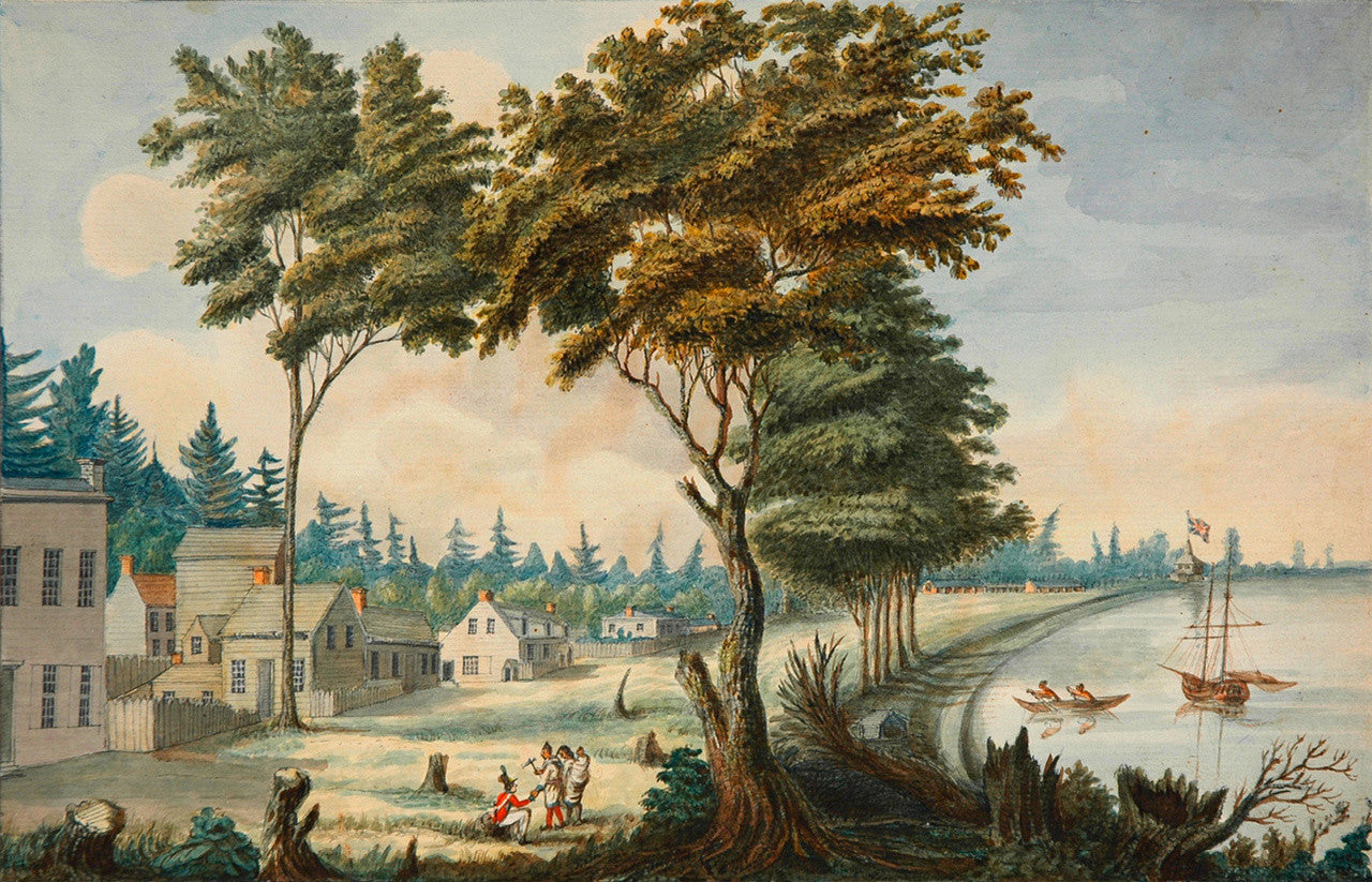
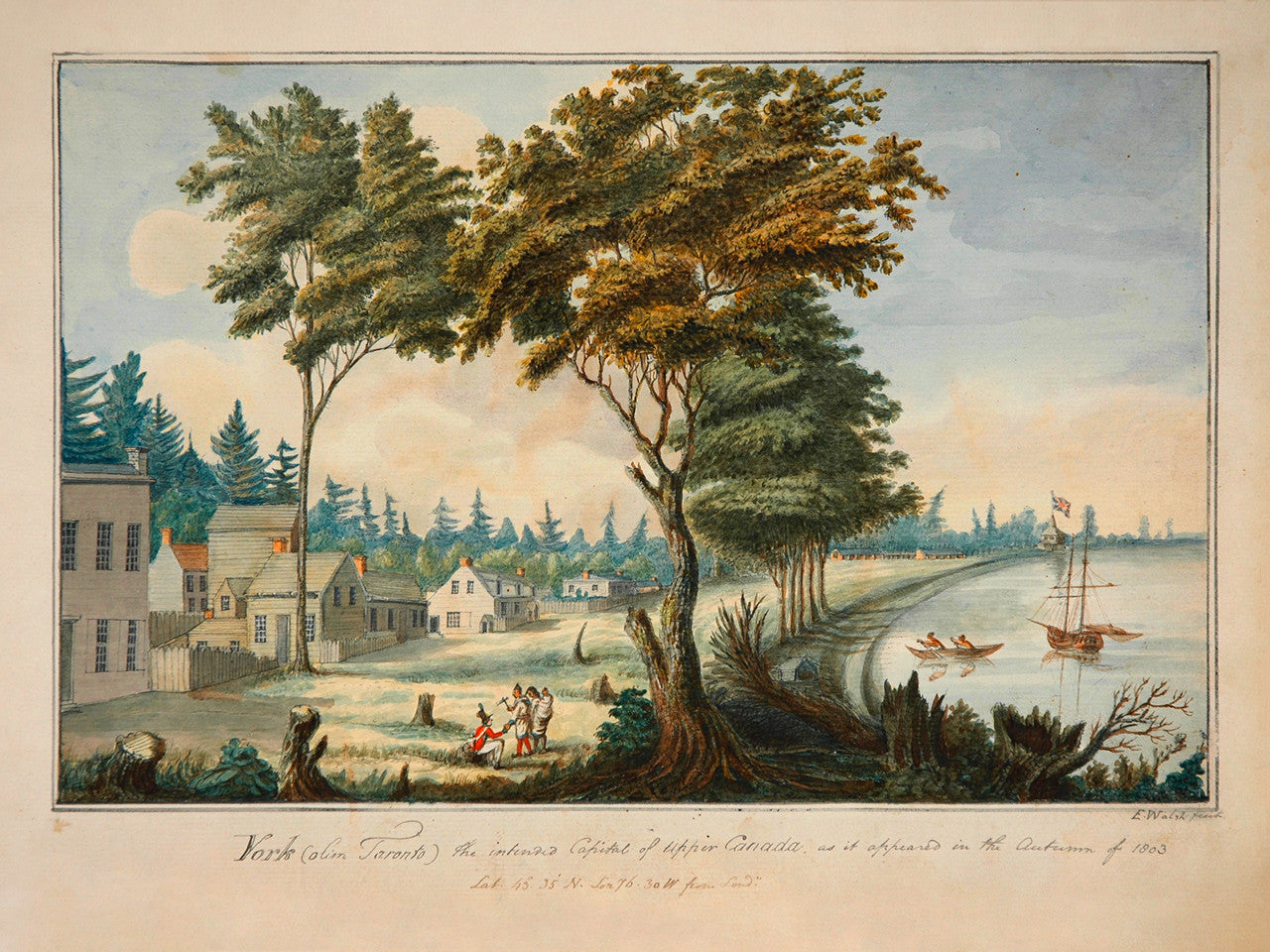
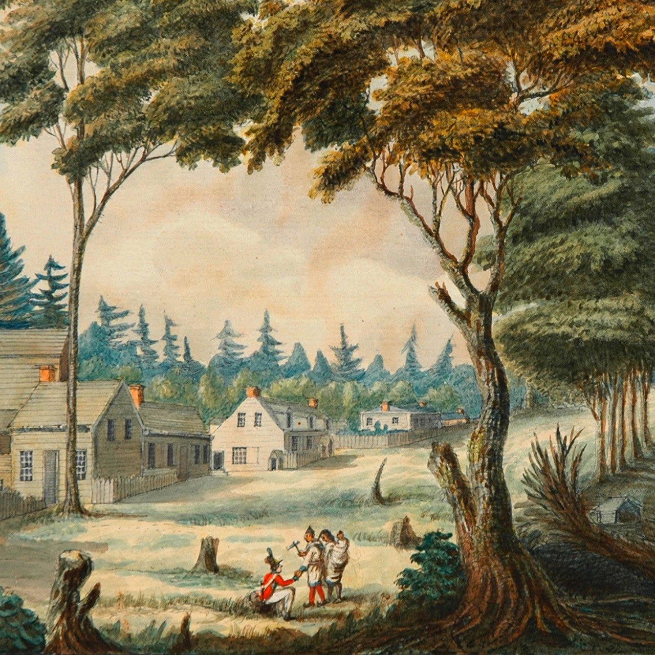

A watercolor view of York, Upper Canada (present-day Toronto, Ontario), showing the town in 1803, exactly ten years after it was founded by Lieutenant Governor John Graves Simcoe as a small encampment on the shore of Lake Ontario. Below the view, in the lower margin, the title is inscribed in pencil: York (olim Toronto) the intended Capital of Upper Canada, as it appeared in the Autumn of 1803 / E. Walsh fecit; underneath, another inscription in ink reads: Lat. 43° 35’ N. Lon 76. 30 W from Lond”. Those coordinates (43° 35’ N 76° 30’ W, based on London Prime meridian), being wildly inaccurate, would place York (Toronto) in Oswego, New York, on the diametrically opposite side of Lake Ontario. Most probably the coordinates were added later and erroneously, citing a location near Fort Ontario and Fort Oswego in Oswego, New York. The location of Edward Walsh’s beautiful landscape in present-day Toronto is Front Street east of Jarvis. Front Street, which was initially named “King Street” in Simcoe’s 1796 plan, was renamed in 1797 to “Palace Street”. The artist, Edward Walsh, M.D. (1756–1832), was an eminent Irish physician, who held the post of Surgeon to the 49th (Hertfordshire) Regiment in the British Army. Walsh was stationed in Canada (then British North America) from 1802 to 1807.
• 1803 view of the Town of York (Toronto), Upper Canada, Edward Walsh, watercolor, pencil, pen-and-ink on paper
• Fine Art Premium Giclée (Gouttelette) Print (100% cotton 340 gsm, watercolor textured fine art paper)
• Made in USA