
The Spanish Treasure Fleet ~ La Flota de Indias
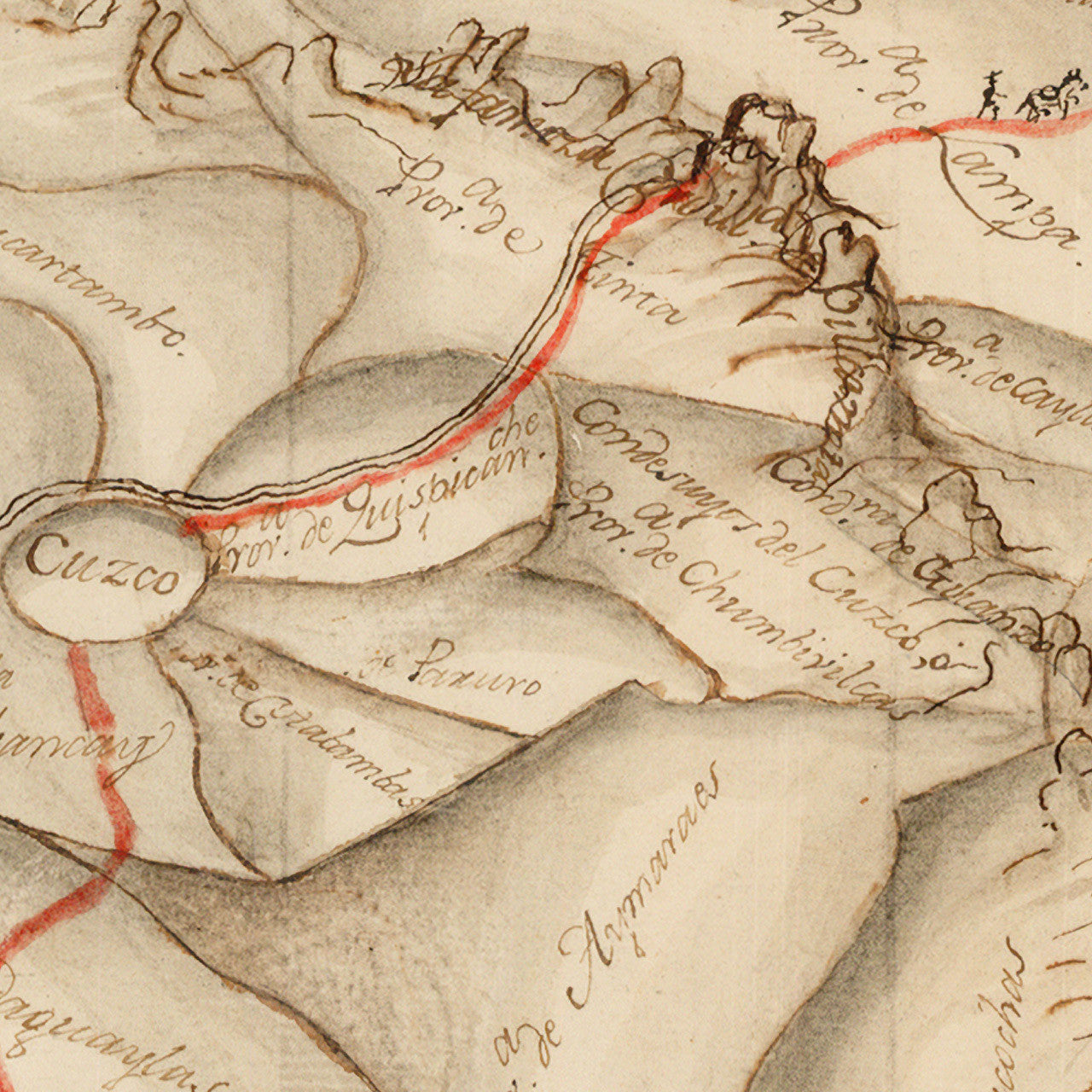
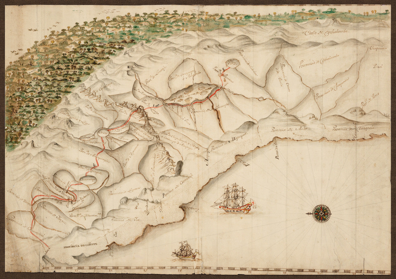
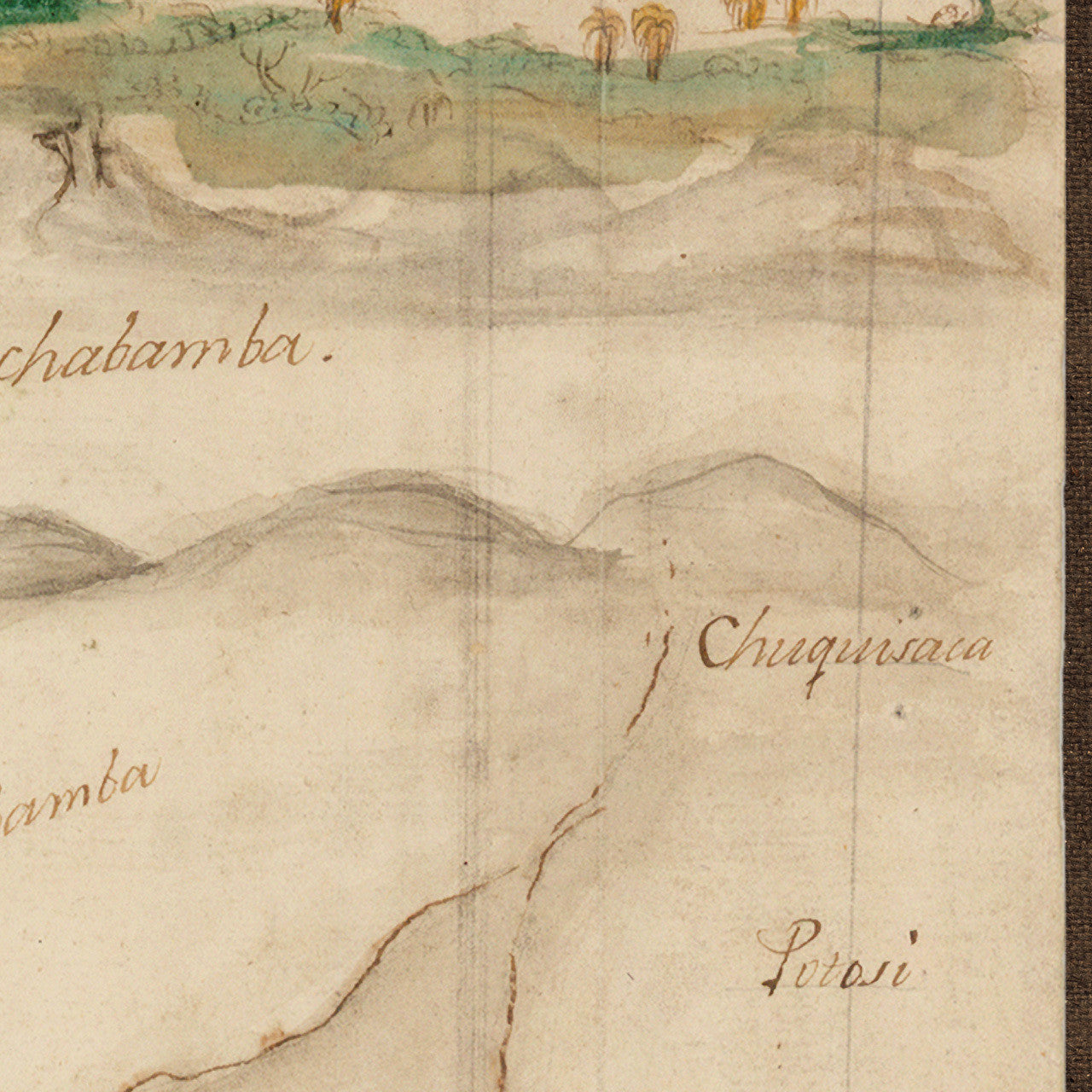
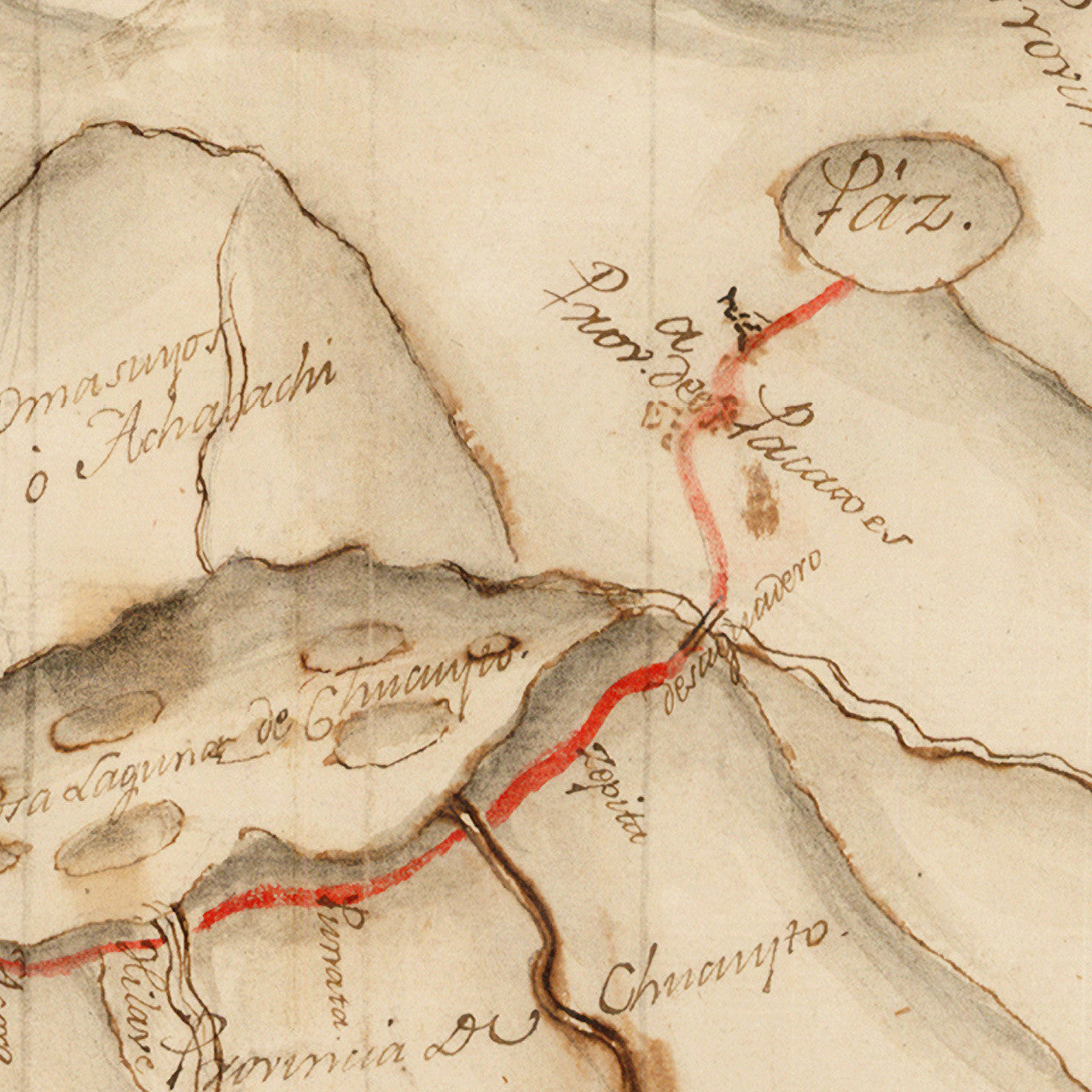
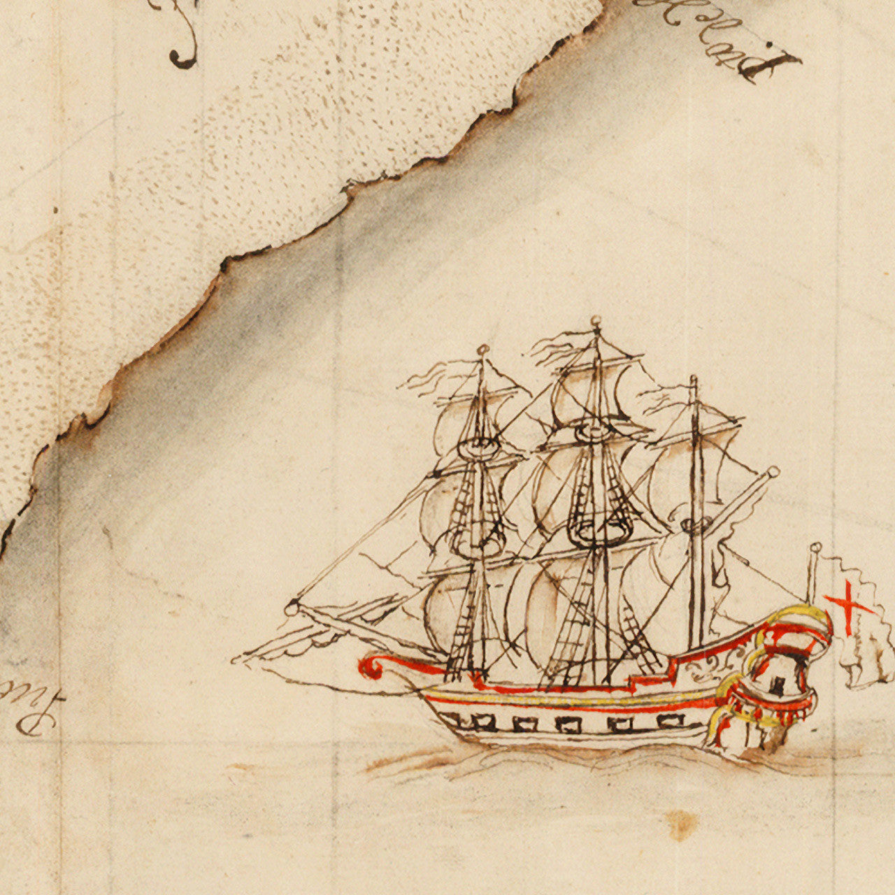
A manuscript, pictorgraphic map of the Spanish trading routes in the Andes, from La Paz, to Cuzco, to Lima. The map has been dated approximately at late 17th to early 18th century. It was drawn in pencil, color inks and watercolor. Needless to say, the information contained in the map had a strategic importance and was treated by the Spanish as a national secret.
Peruvian silver was a major commodity for the Spanish crown. It came from the Cerro Rico mines near Potosí, Upper Peru (today in Bolivia). The silver was taken to La Paz (Páz) on llama and mule trains, and then through the mountains to Lima via Cuzco. From Lima the silver was shipped north to Panama where it was carried again by mule train across the isthmus to Portobelo and Nombre de Dios, both in today’s Colón Province, Panama, and both major ports of call for the Spanish Treasure Fleet for over two hundred years. From there the silver and other goods were transported by the Flota de Indias to Havana and to Spain. For more maps depicting routes of the Spanish Treasure Fleet, please see Vingboons’ Chart of the Bahamas and Covens & Mortier’s Map of the Caribbean. The latter features a beautifully drawn illustration of the Spanish mining operations in South America, plans of the strategic ports in Panama and the Caribbean, and routes of the Spanish fleets through Havana and the Bahama Channel, and another one via Cartagena and the Lesser Antilles.
• Manuscript map of the Spanish trading routes from Lima to La Paz, ca. 1700, Anonymous
• Fine Art Premium Giclée (Gouttelette) Print (100% cotton 340 gsm textured fine art paper)
• Made in USA