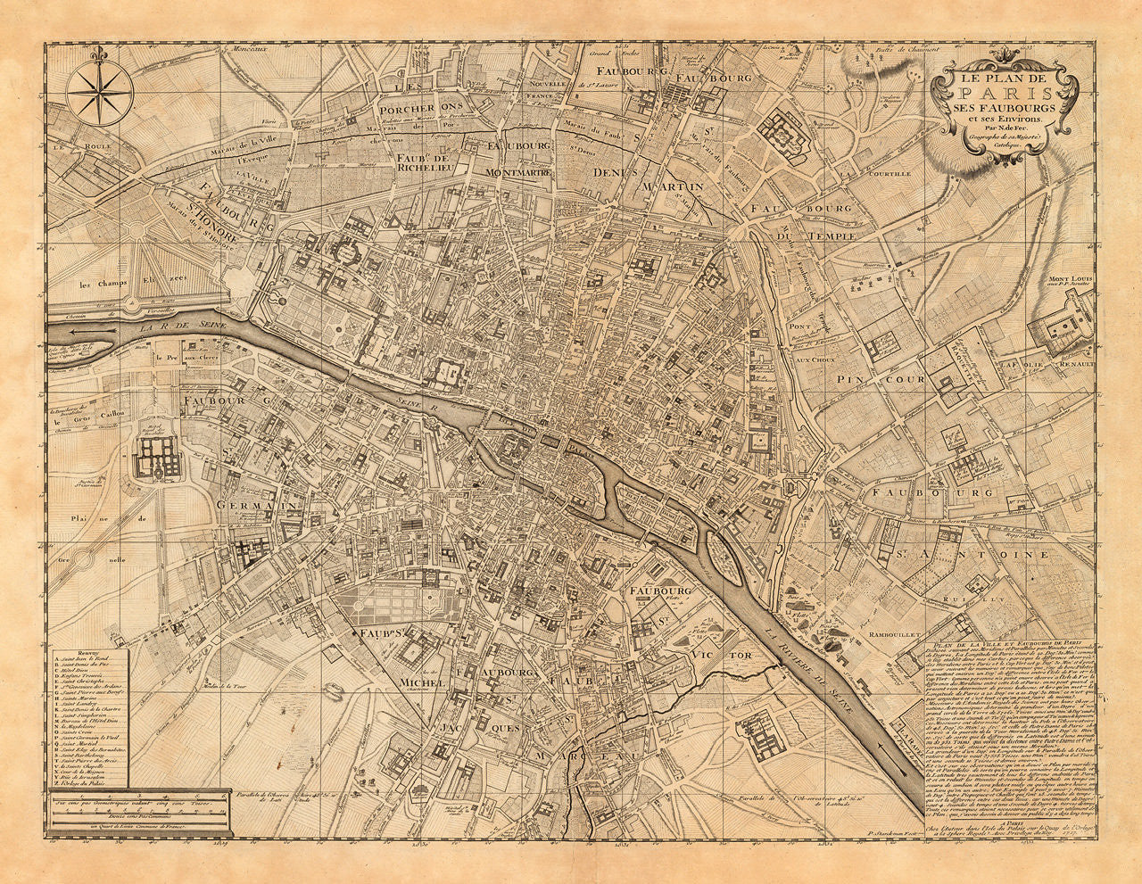
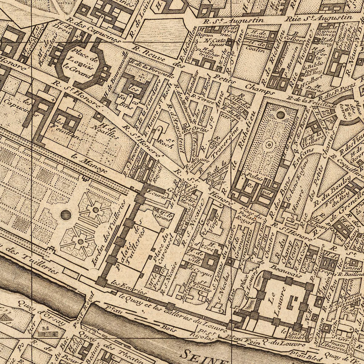
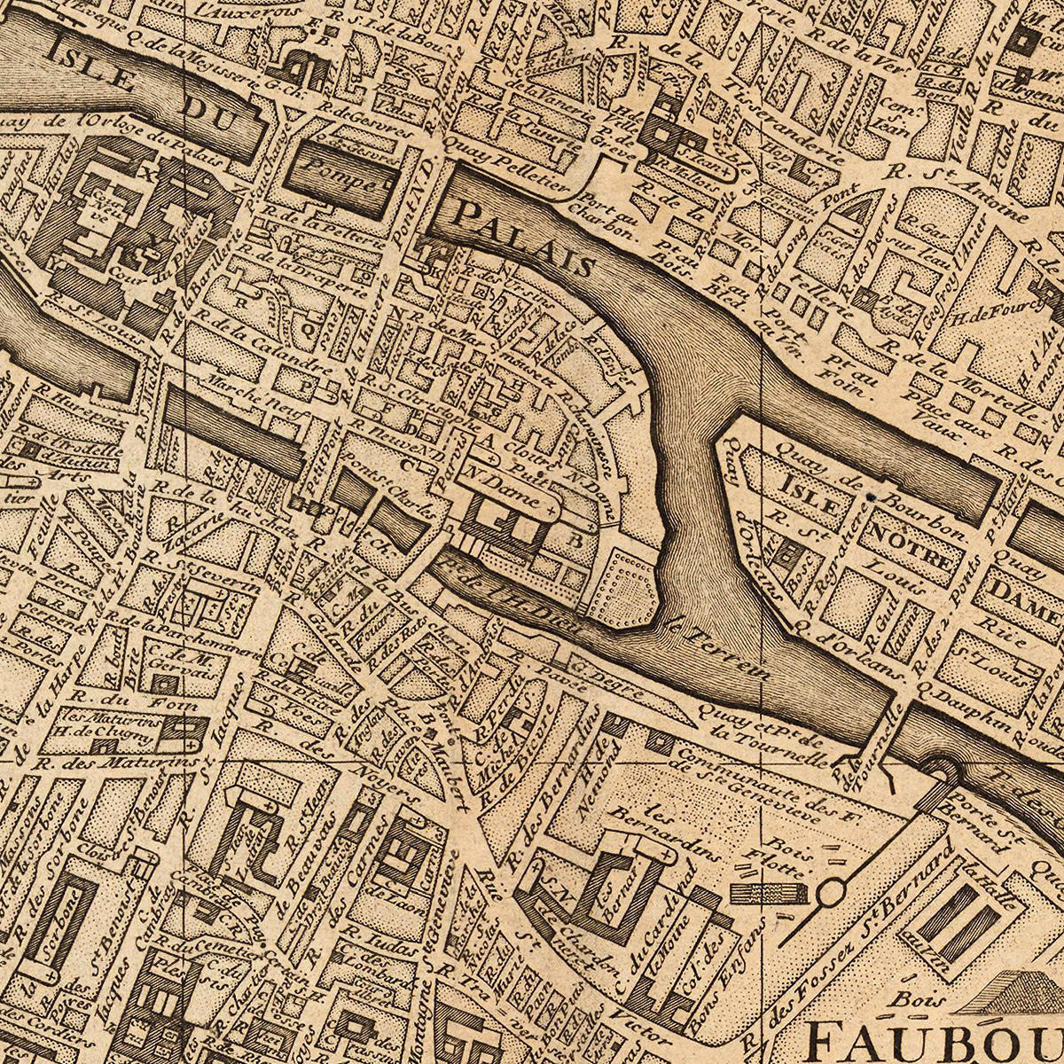
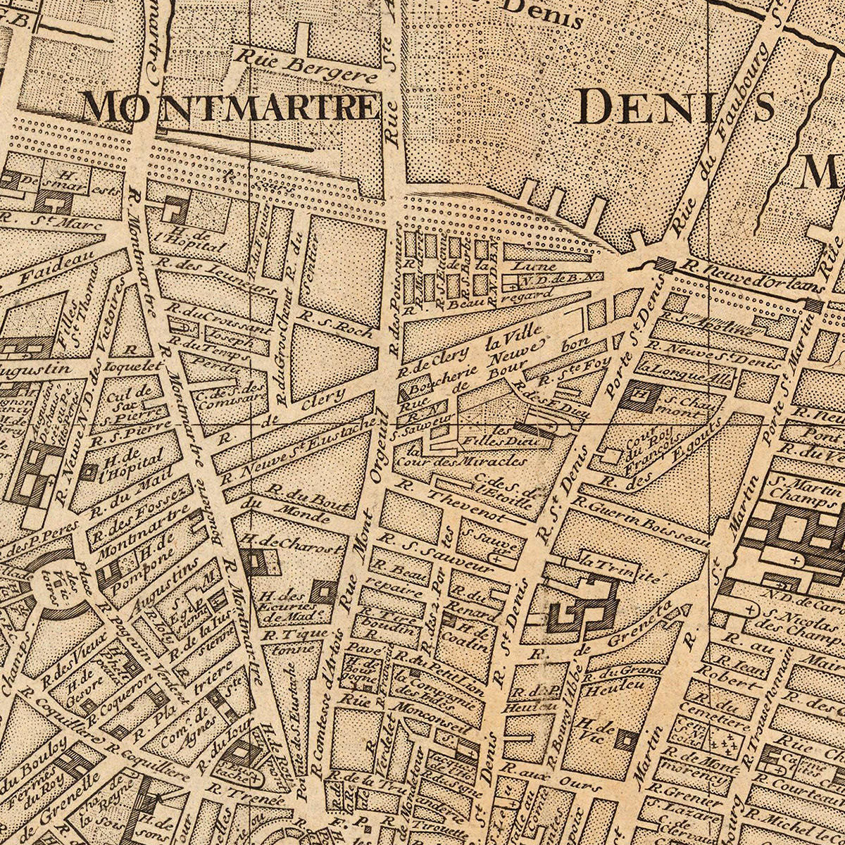
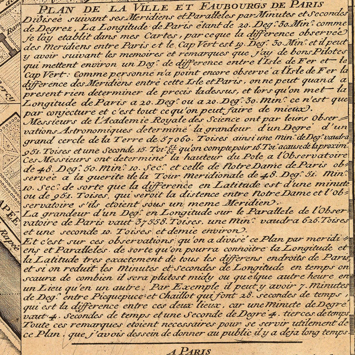

A historically important plan of Paris from the beginning of the eighteenth century, created and published by Nicolas de Fer. This masterfully engraved map provides a highly detailed look at Paris before Baron Haussmann’s transformation of the city under Napoleon III. De Fer’s plan is centered on the Seine with Île de la Cité (Isle de Palais) and Île Saint-Louis (Isle Notre Dame) in the middle. It spans from Île des Cygnes (Isle aux Cignes) and Champs-Élysées (les Champs Elizees) to the West, to Mont Louis and Faubourg St. Antoine to the East; from Les Porcherons and Faubourgs St. Denis and St. Martin to the North, to Faubourg St. Marceau to the South. All streets, parks, buildings, palaces, estates are thoroughly noted. The map contains a topographic description of the survey, and a key identifying important landmarks, some still in existence today. Map title: Le Plan de Paris ses Faubourgs et ses Environs par N. de Fer Geographe de sa Majesté Catolique.
• City plan of Paris, France, 1717 (1707), Le Plan de Paris ses Faubourgs et ses Environs, N. de Fer
• Fine Art Premium Giclée (Gouttelette) Print (100% cotton 340 gsm fine art paper)
• Made in USA