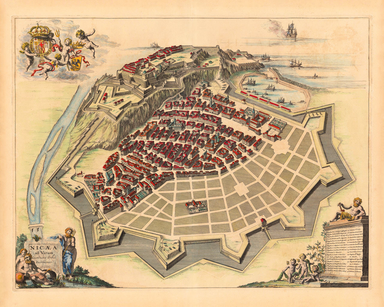
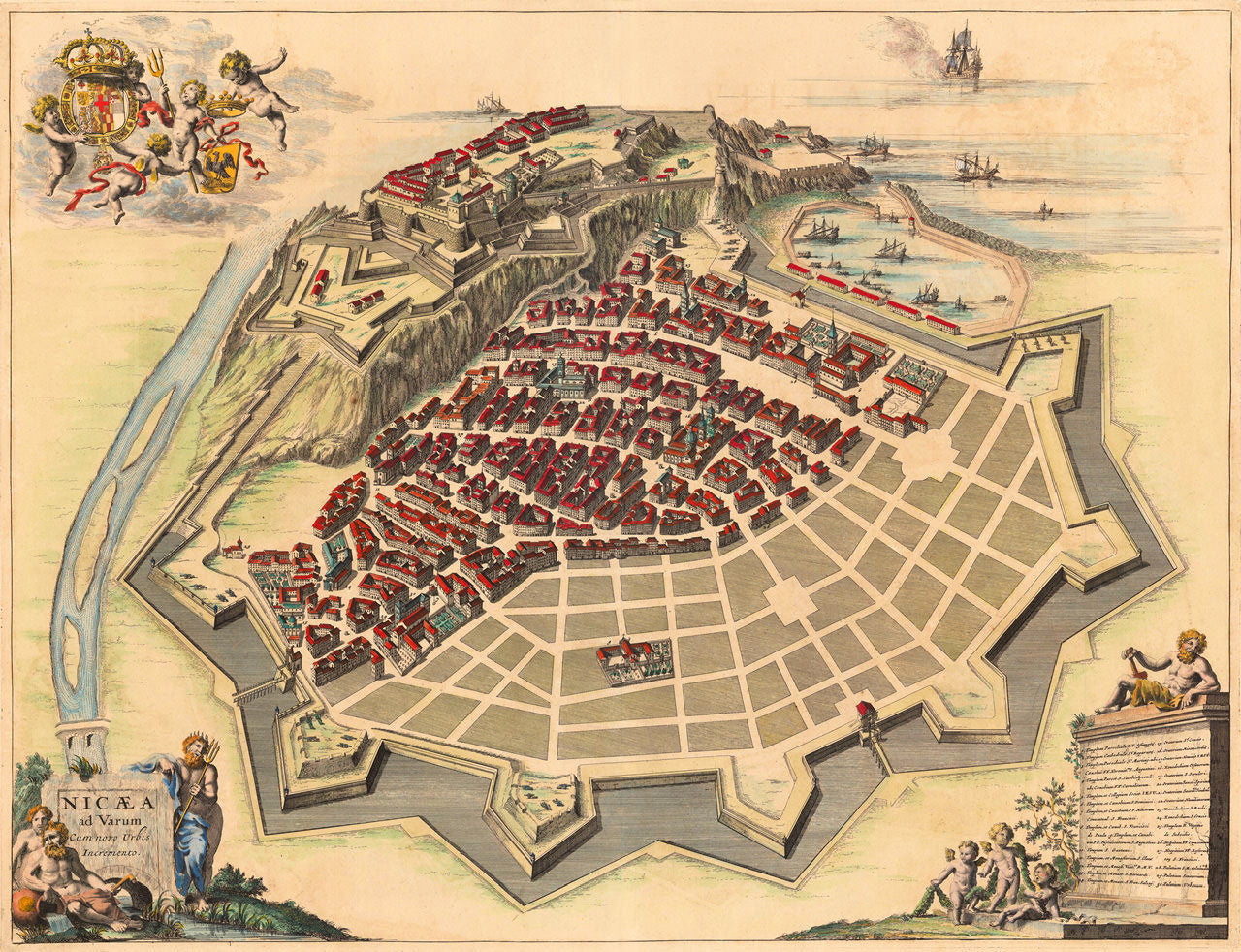
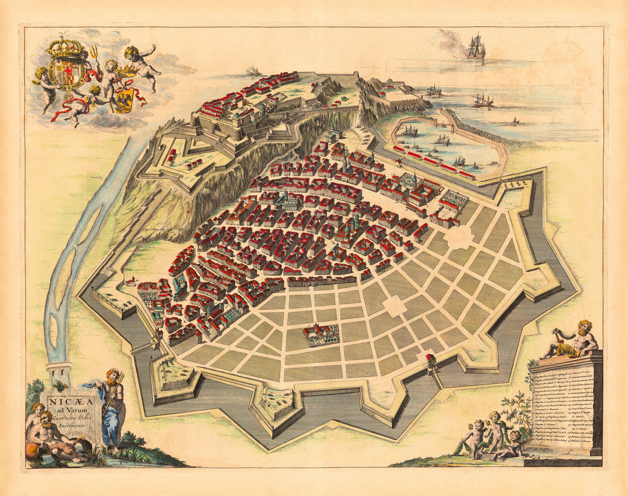

Nicæa ad Varum cum Novo Urbis Incremento
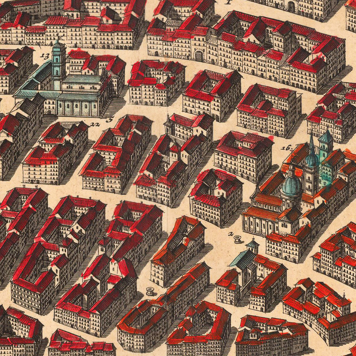
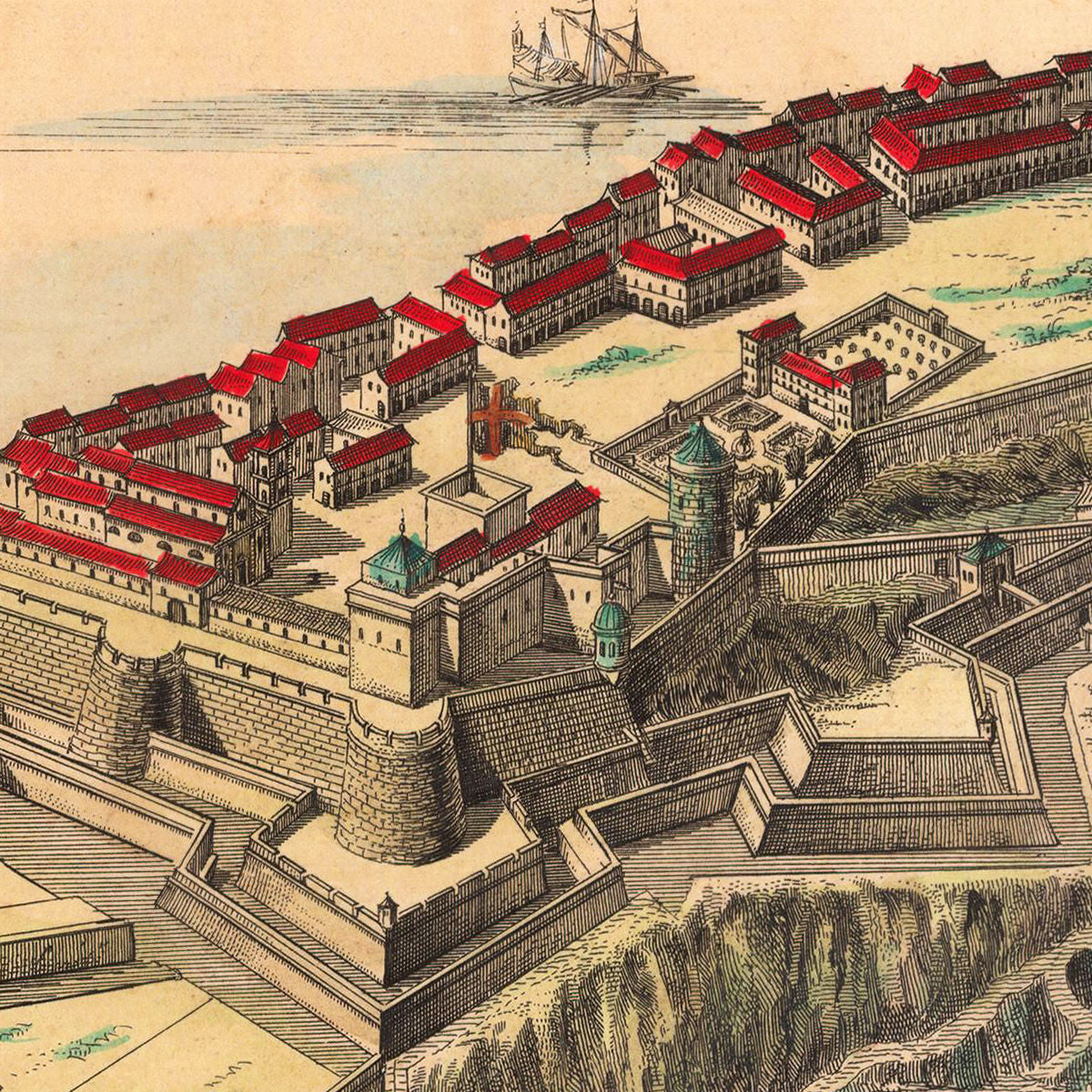
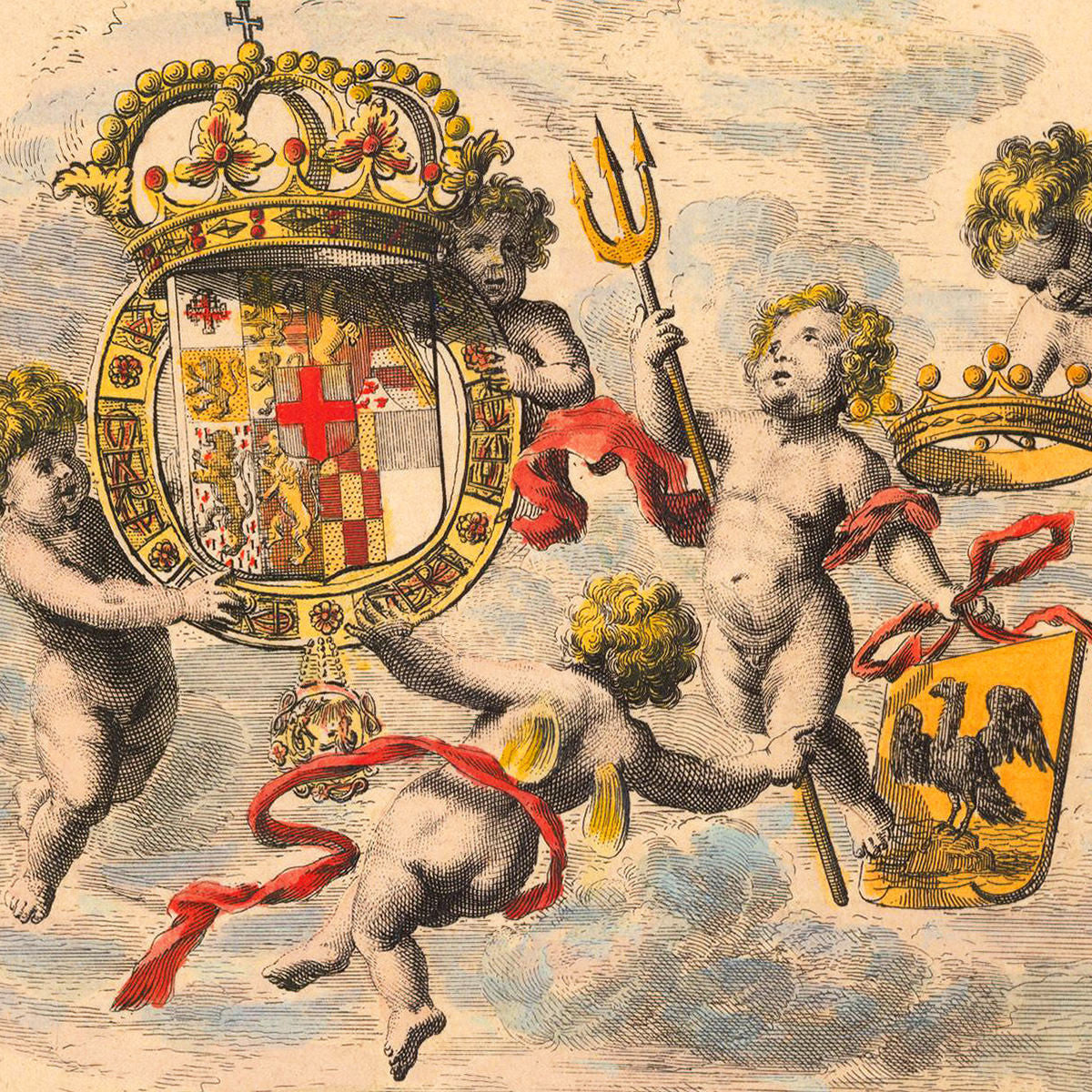
A stunning, 17th-century map of Nice (Nizza) in the South of France. The perspective bird’s-eye-view plan of the Savoyard citadel presents a southerly view, with the castle sitting atop of a hill, and the Mediterranean visible on the horizon. Var, although mentioned in the title, is out of sight. The river drawn on the left is Paillon (Paulon, Palhon). The map was created by the Blaeu publishing house in Amsterdam. The Duke of Savoy had invited Joan Blaeu and sons to create a comprehensive atlas of all the States of the House of Savoy. The result was one of the finest of Blaeu’s town books, the Theatrum Sabaudiae. The duke, Carlo Emanuele II, was seeking recognition from the European powers for his new advancements and territorial acquisitions. One such advancement was the development of the port of Nice. Blaeu’s map of Nice shows the city in a state of growth, as well as strength. The map is richly ornate and very detailed. One of the allegorical cartouches contains a key to all major buildings and structures within the fortified city. An allegorical vignette at the top shows putti supporting the coat of arms of the House of Savoy. The title cartouche features Neptune (Poseidon) holding a trident, resting on a granite block with the inscription: Nicaea ad Varum cum novo Urbis Incremento (Nice towards Var with the New Expanding City).
• A 1661 map of Nice, France (then Duchy of Savoy), by Joan Blaeu & sons
• Fine Art Premium Giclée (Gouttelette) Print (100% cotton 340 gsm fine art paper)
• Made in USA