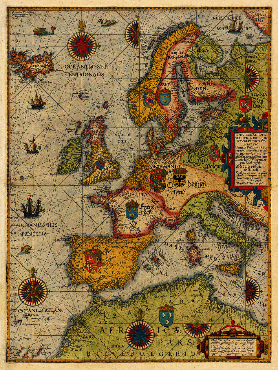

Earliest Printed Sea Chart of Europe
Waghenaer’s General Sea Chart of Europe (Generale pascaerte van Europa), first published in 1583, is the earliest printed sea chart of Europe. It covers Western and Northern Europe — Scandinavia, the Baltic region, parts of Russia, the Barents Sea, the British Isles, the Atlantic Coast, Spain, Porugal, France, Germany, the Netherlands, Italy, Poland, parts of the Mediterranean with Southern Europe, parts of North Africa, and the mythical Atlantic island of Brasil (Hy-Brasil, O’Brasil). The author of the map, Lucas Janszoon Waghenaer (Wagenaer, Waggoner), who hailed from Enkhuizen, North Holland, was an ace pilot and a master cartographer. His sea atlas Spigel der Zeevardt was the first comprehensive mass-produced collection of nautical charts of Northern Europe. His maps are usually richly embellished with sea monsters, sailing ships, compass roses, coats of arms, and elaborate heavy baroque title cartouches.
• Map of Europe (General Sea Chart), 1592 (1583), Lucas Janszoon Waghenaer
• Title: Universe Europae Maritime Eiusque Navigationis Descritio
• Fine Art Premium Giclée (Gouttelette) Print (100% cotton 340 gsm fine art paper)
• Made in USA