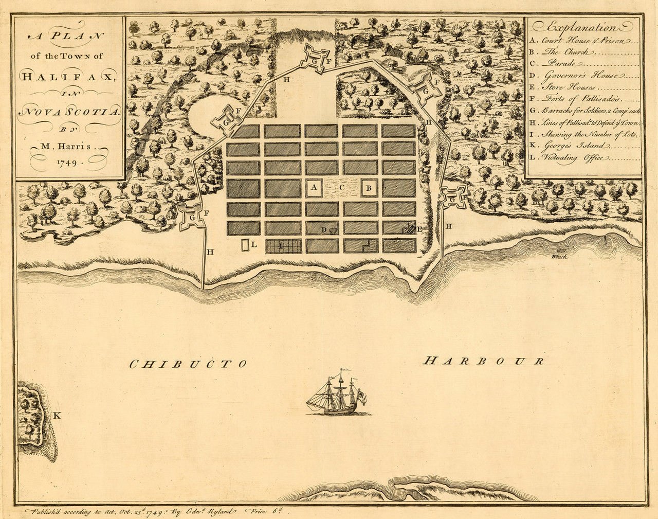
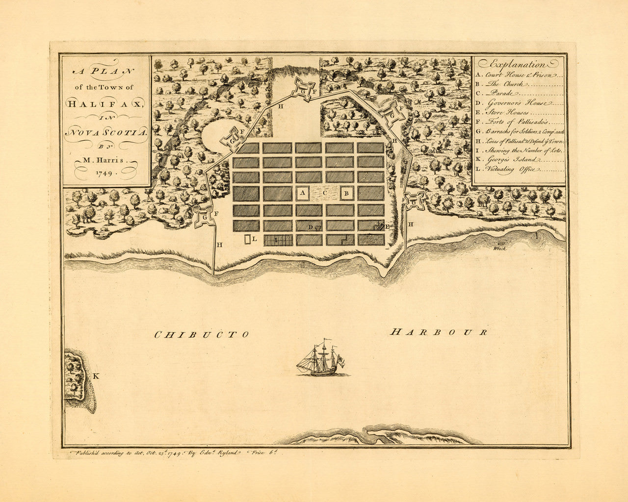

The First Printed Map of Halifax
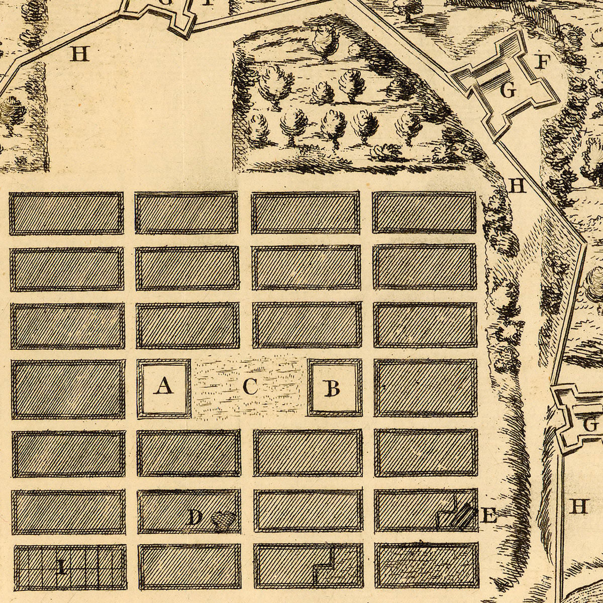
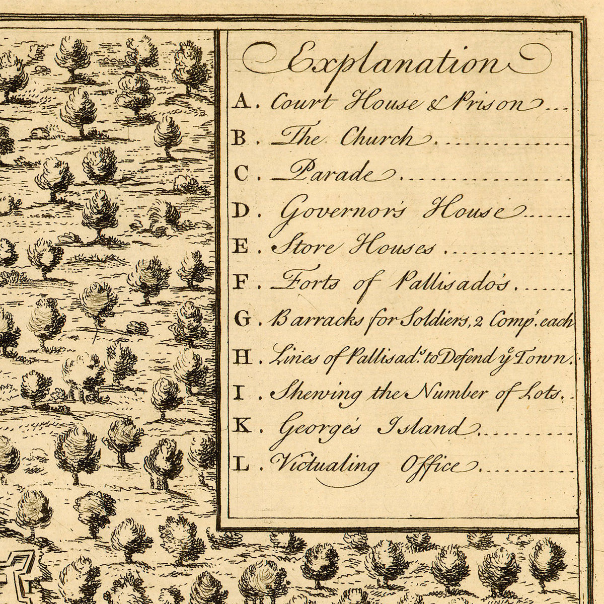
The Town of Halifax, Nova Scotia was founded by the British in 1749, although the area had long been inhabited by Native Mi'kmaq tribes, as well as early Acadian settlers of French descent. The current plan is the first known printed map of Halifax, showing the newly established settlement at its earliest stages. The plan was published in London only four months after the initial landing of Edward Cornwallis’ expedition on June 21st. Moses Harris drew the plan, as evident in the title: “A Plan of the Town of Halifax, in Nova Scotia by M. Harris. 1749.” The layout contains an indexed “Explanation” key to the depicted locations, e.g. ‘A. Court House & Prison’; ‘B. The Church’; ‘C. Parade’, etc. This compact plan is a must-have item for any student of the early history of Atlantic Canada.
• Earliest known plan of Halifax, Nova Scotia from 1749, drawn by Moses Harris
• Fine Art Premium Giclée (Gouttelette) Print (100% cotton 340 gsm fine art paper)
• Made in USA