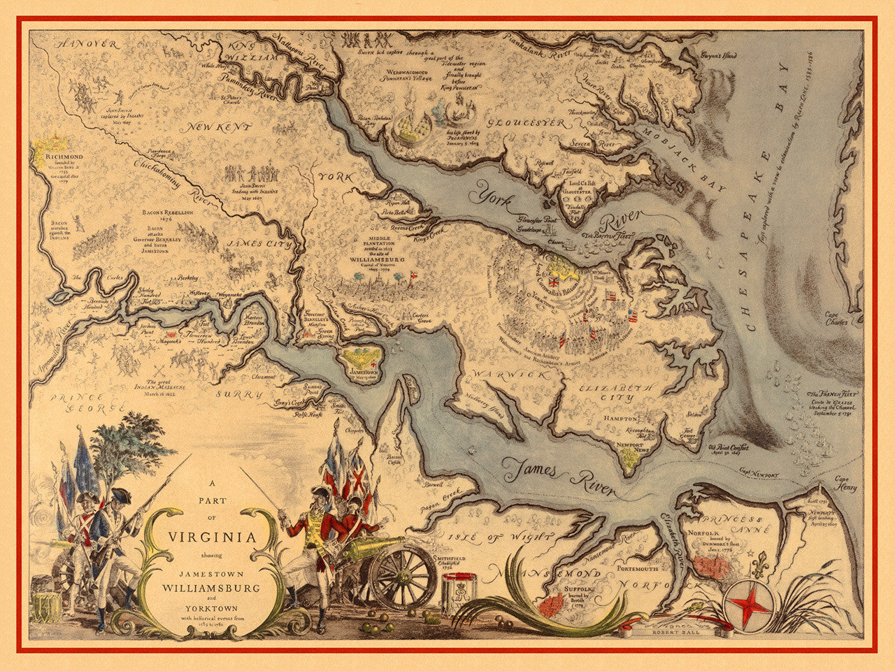


Map of Virginia and Chesapeake Bay, featuring the historic Williamsburg, Jamestown and Yorktown region, and depicting events in the Virginia Colony since its founding until the last days of the Revolutionary War. This detailed and informative map contains explorations, battles, names and settlements of two centuries in Virginia. Designed and drawn by Robert Ball in 1939, the map’s full title reads: A Part of Virginia showing Jamestown, Williamsburg and Yorktown, with historical events from 1585 to 1781.
• Pictorial map of Virginia (1585–1781) showing historical events in the colony in detail
• Title: A Part of Virginia showing Jamestown, Williamsburg and Yorktown…
• Fine Art Premium Giclée (Gouttelette) Print (100% cotton 340 gsm fine art paper)
• Made in USA