, Antique Map "Pin It")
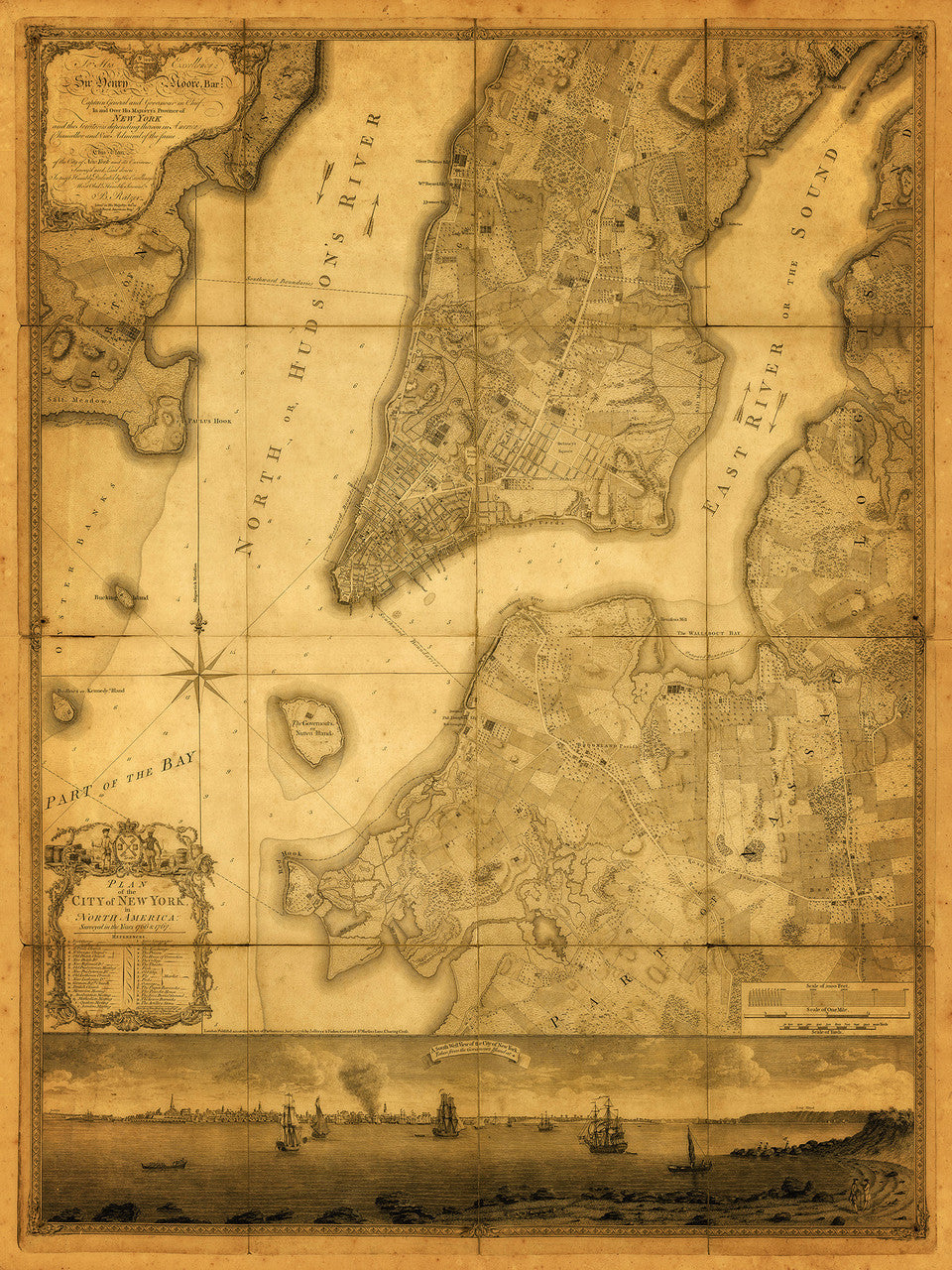
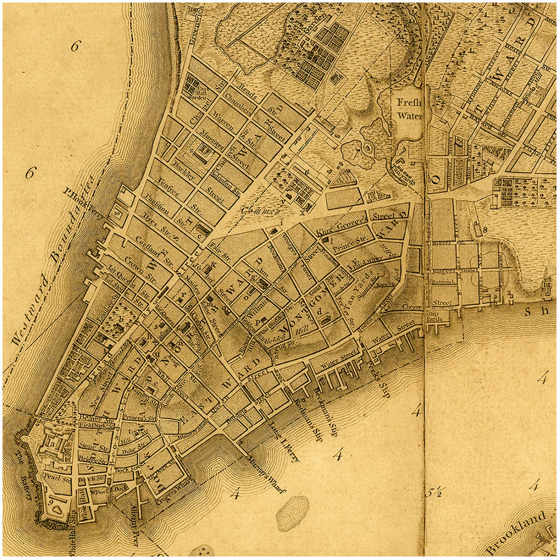
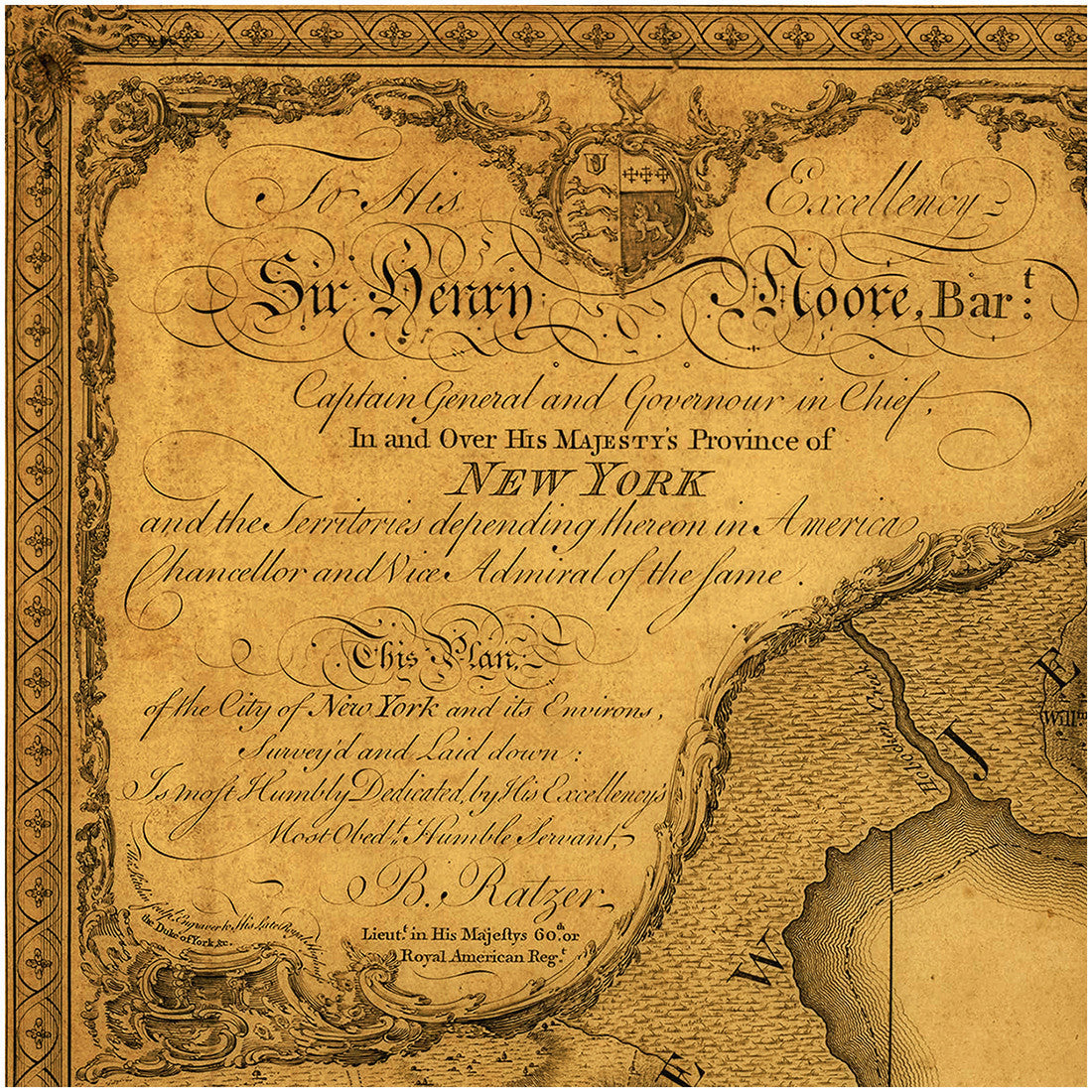
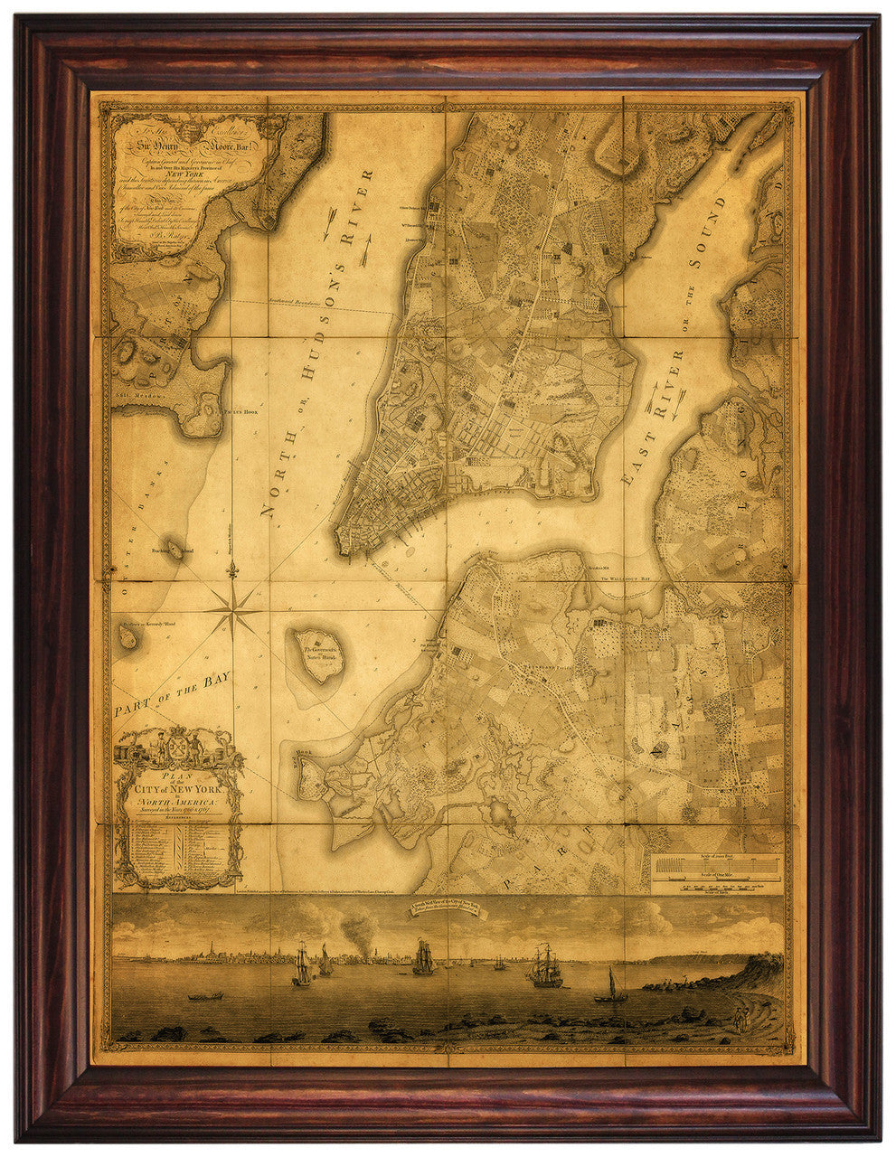
“Plan of the City of New York in North America, surveyed in the years 1766 & 1767”, is Bernard Ratzer’s most famous map. It is also the most famous map of New York City ever produced. This particular reproduction contains both plates of the large-scale plan — Manhattan (top half), and Brooklyn (bottom half), the lower part of which features a beautiful southwest panoramic view of the city from Governors Island. (Frame shown is not included; this map is also available framed as a separate item.)
• Plan of the City of New York in North America... 1776, by Bernard Ratzer (surveyed in 1766 & 1767)
• Fine Art Premium Giclée (Gouttelette) Print (100% cotton 340 gsm fine art paper)
• Made in USA
Customer Reviews
Based on 1 review
Write a review