New York, 1776, Province of New York, Mohawk Valley, Hudson Valley, Old Map
Brand: Battlemaps.us

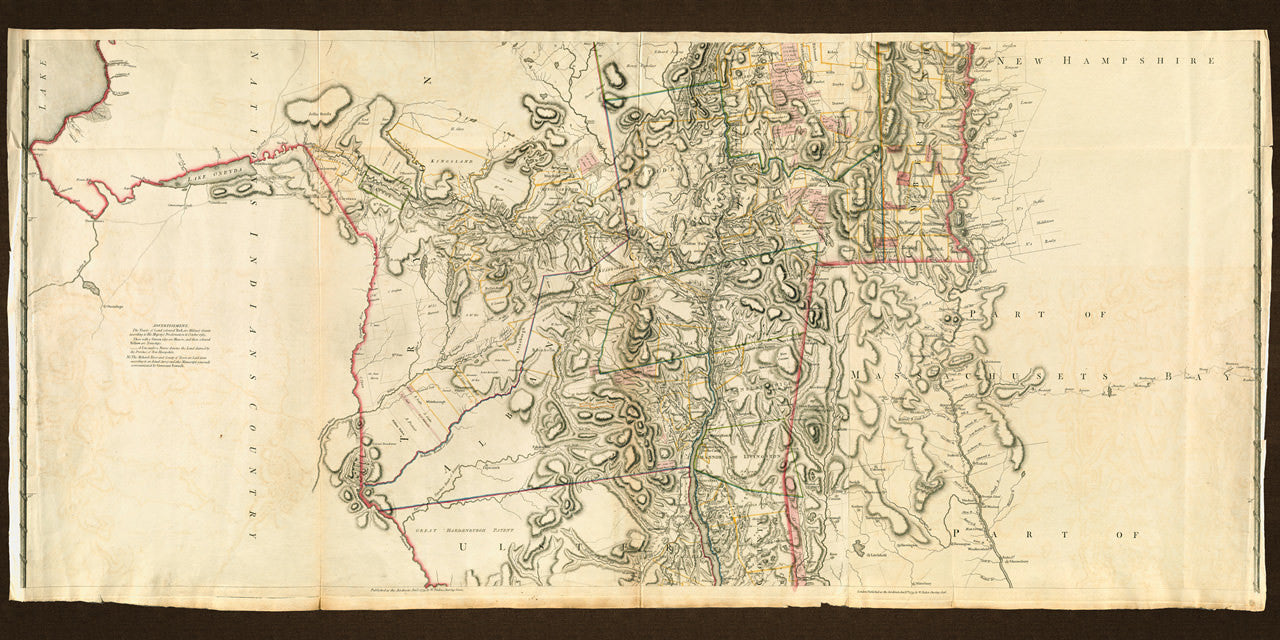
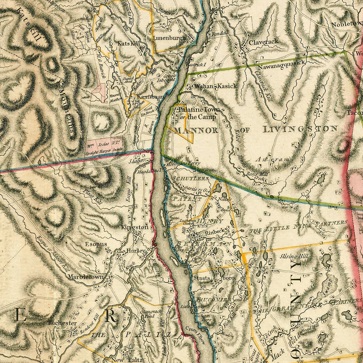
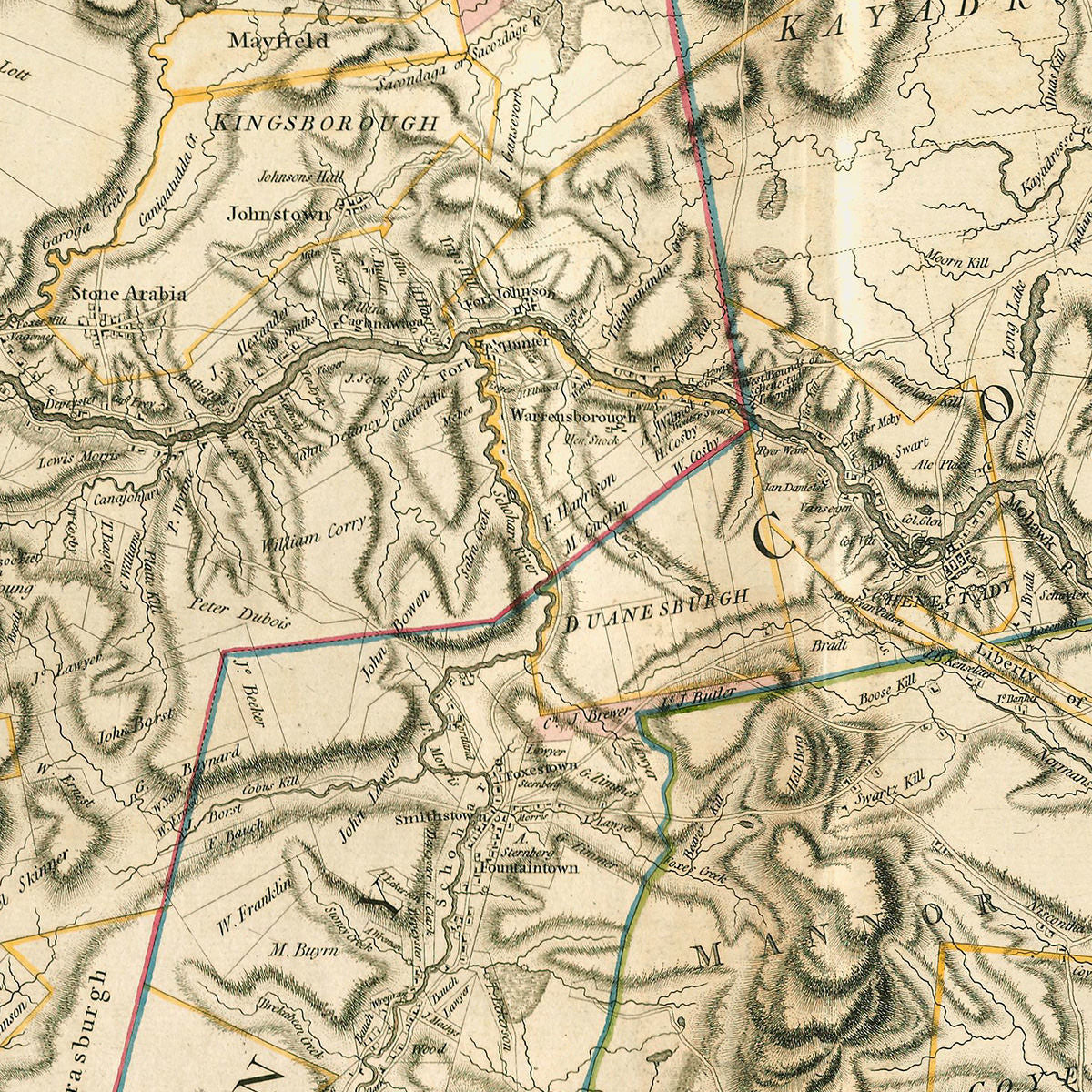
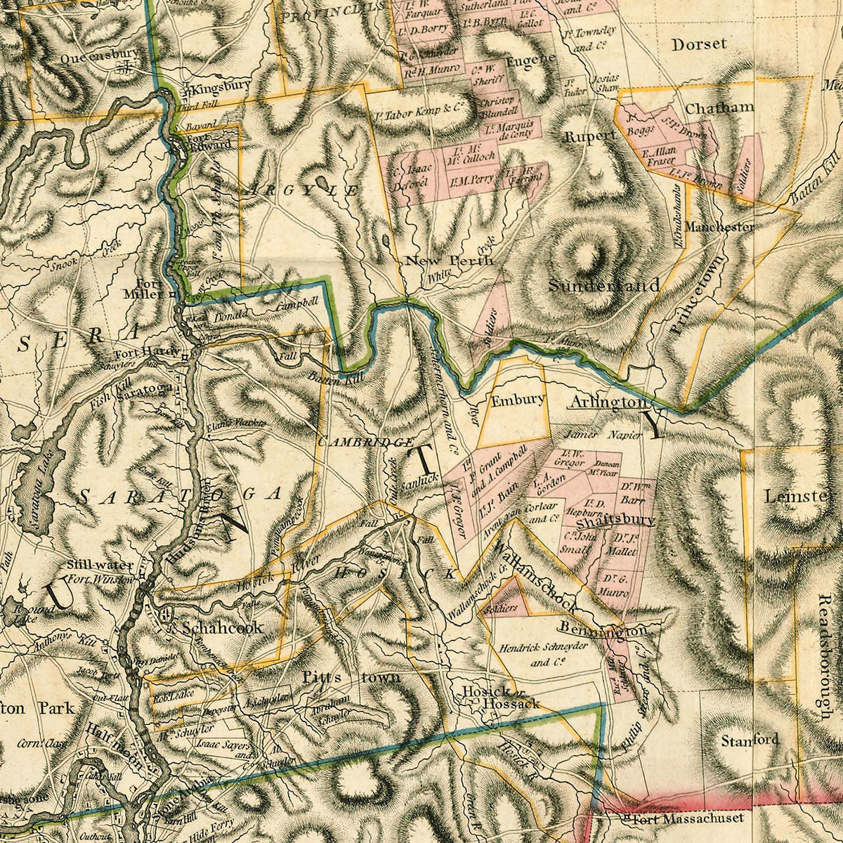
The middle part of an eighteenth-century map of the Province of New York, surveyed by Claude Sauthier from 1771 to 1775, while working for William Tryon, the Colonial Governor of New York. The map was first published in Thomas Jefferys’ American Atlas in 1776, and reissued by William Faden in 1779. The map was made of three sheets. This is the middle part, depicting territories east of Lake Ontario and the Finger Lakes, to the Connecticut River Valley in the west, with parts of present-day Vermont, New Hampshire, Massachusetts and Connecticut, and centered on the Mohawk Valley, and the Hudson River Valley from Lake George to Poughkeepsie. This highly detailed, large-scale map is an indispensable tool for any student of the history of the region.
Full map title reads: A Chorographical Map of the Province of New-York in North America, Divided into Counties, Manors, Patents and Townships; Exhibiting likewise all the private Grants of Land made and located in that Province; Compiled from Actual Surveys deposited in the Patent Office at New York, By Order of His Excellency Major General William Tryon, by Claude Joseph Sauthier, Esqr.
Inscription: “To His Excellency Major General William Tryon, Governor of the Providence of New York and the Islands thereunto belonging Colonel of His Majesty’s 70th Regt. of Foot This Map, Undertaken by His Order Is, with His Permission Most Humbly Inscribed by His Excellency’s most obliged devoted and obedient Servant Claude Joseph Sauthier.”
• Map of the Province of New York (middle part), late 18th c., Sauthier, Jefferys, Faden
• Fine Art Premium Giclée (Gouttelette) Print (100% cotton 340 gsm fine art paper)