New York, 1776, Battles of White Plains, Long Island, Revolutionary War Map
Brand: Battlemaps.us

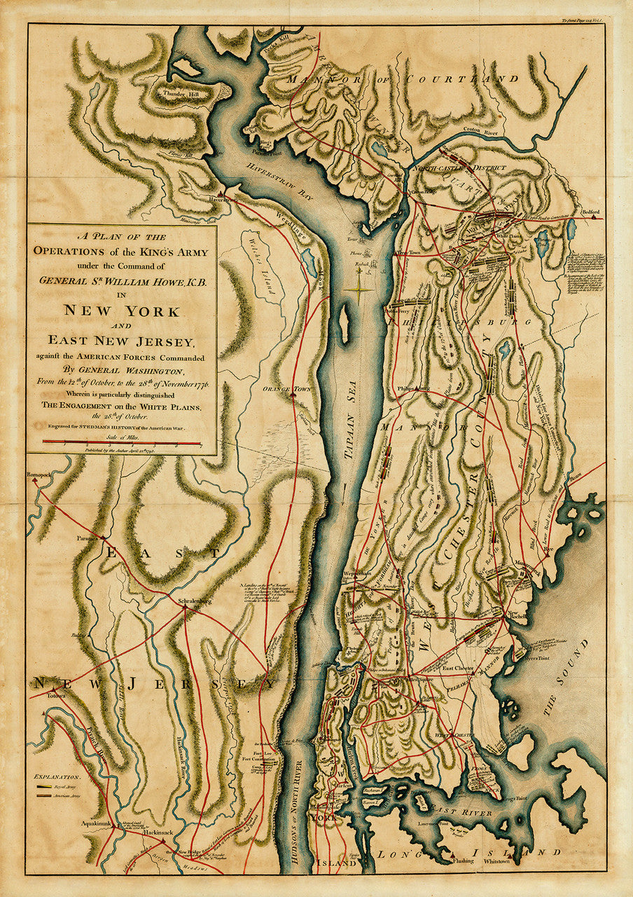
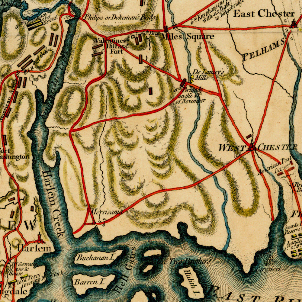
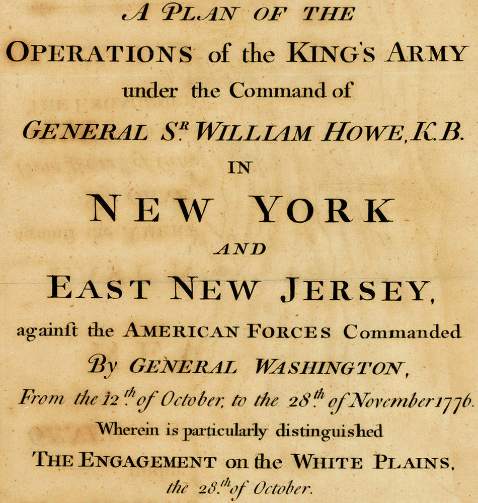
Early Revolutionary War battle map, showing operations in the New York and New Jersey area in late 1776. First published by William Faden in 1777, the map depicts the various campaigns of October and November 1776 in northern Manhattan, lower Westchester, and East New Jersey. “It is the most accurate published delineation of the movements of the armies of Washington and Howe in Westchester, from the time of the British landing through November 28, particularly focusing on the Battle of White Plains.” (Nebenzahl, Atlas). The British and Hessian troop landings in the areas of Mamaroneck, Larchmont, New Rochelle, Pelham Manor, and the Bronx are clearly outlined. Also shown is Cornwallis’ capture of Fort Lee and his pursuit of the American army through New Jersey that would end in Washington’s crossing of the Delaware River. Map title reads: A Plan of the Operations of the King’s Army under the Command of General Sr. William Howe, K.B. in New York and East New Jersey, against the American Forces Commanded By General Washington, From the 12th of October to the 28th of November 1776. Wherein is particularly distinguished The Engagement of the White Plains, the 28th of October.
• Battle map from the New York and New Jersey area in 1776, American Revolutionary War
• Fine Art Premium Giclée Print (100% cotton 340 gsm textured fine art paper)
• Made in USA