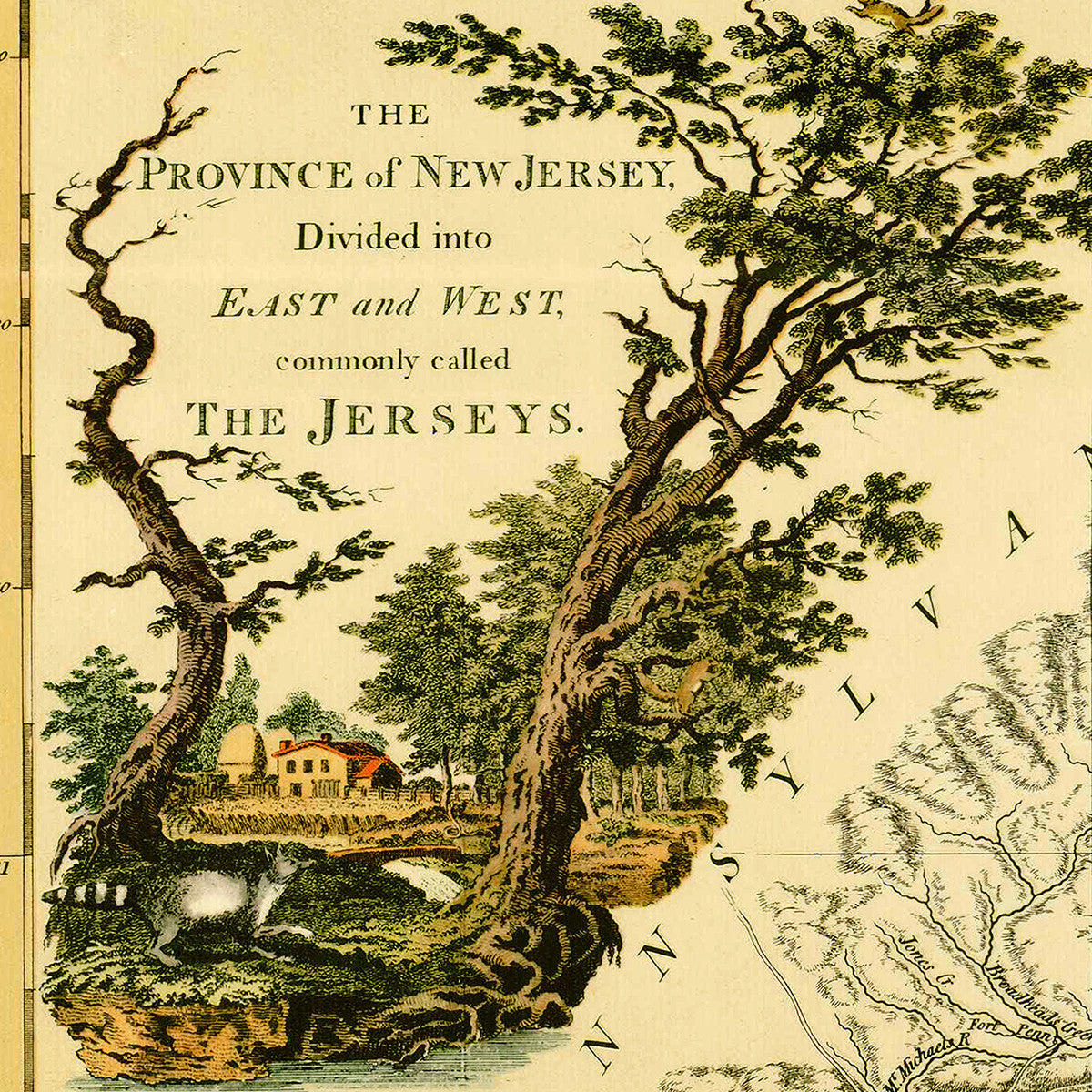
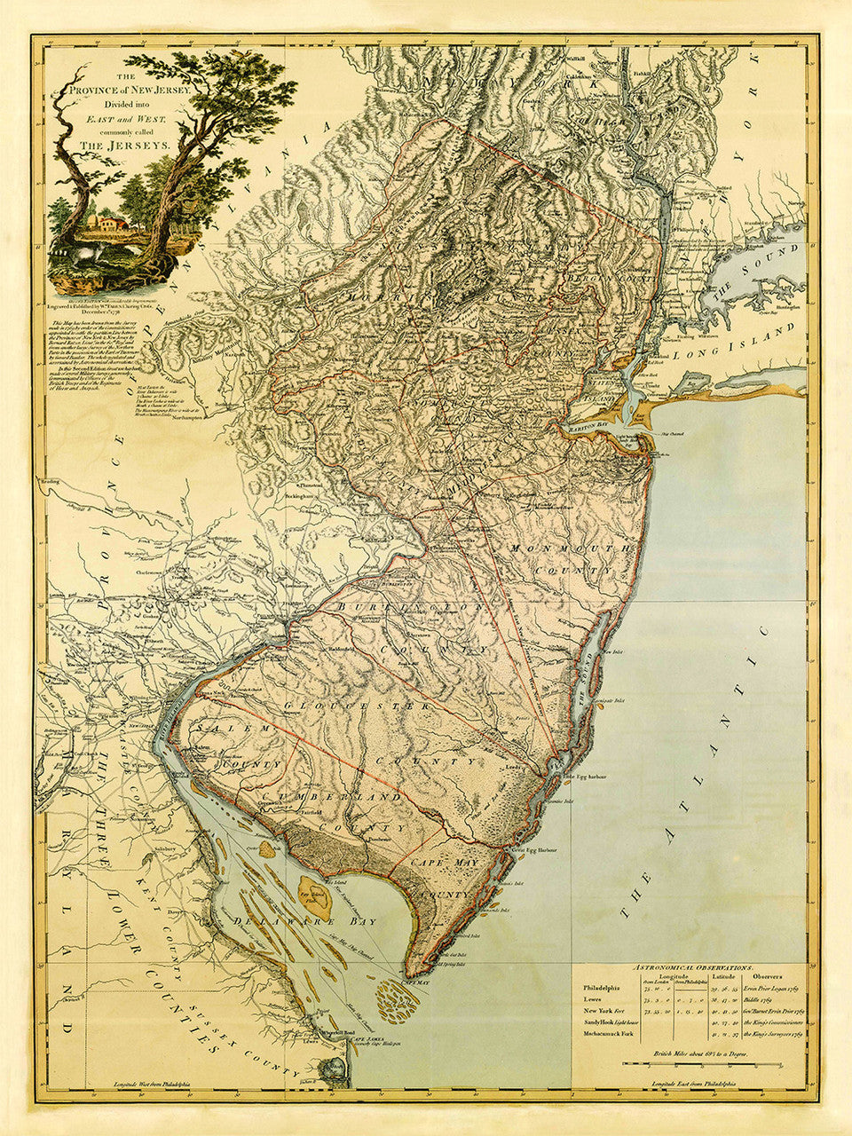
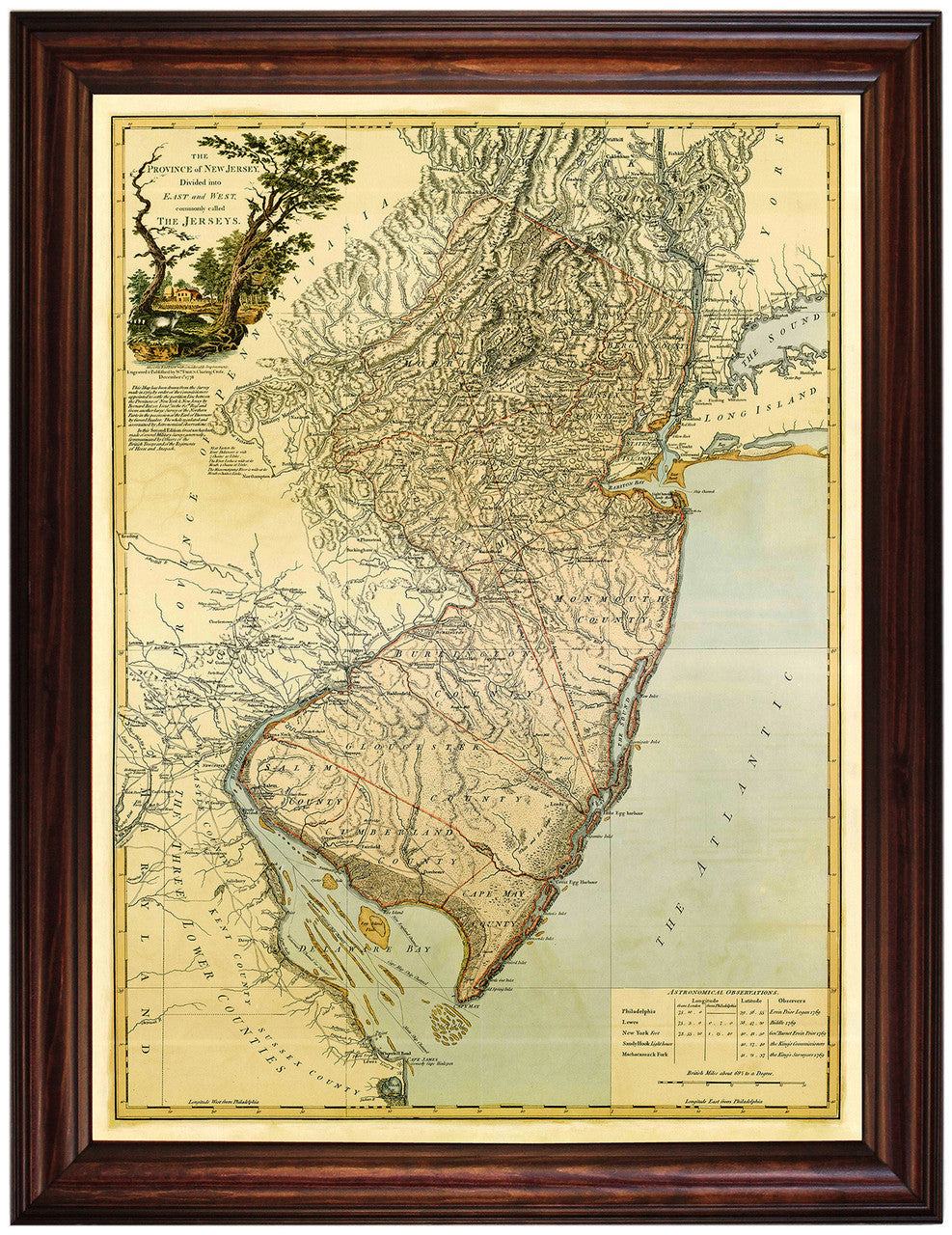

Antique map of New Jersey, issued by William Faden in 1778 and drawn from Bernard Ratzer’s survey made in 1769 just prior to the American Revolutionary War. The first edition was prepared for Faden’s The North American Atlas of 1777; includes parts of Pennsylvania, Maryland, New York and Long Island. In its bottom right corner, the map features a table of ‘Astronomical observations’. In this second edition, it added that, “Great use has been made of several Military Surveys generously Communicated by Officers of the British Troops and of the Regiments of Hesse and Anspach”. (Shown frame is not included.)
• Title: The Province of New Jersey, divided into East and West, commonly called the Jerseys, 1777 (1769) Bernard Ratzer
• Fine Art Premium Giclée (Gouttelette) Print (100% cotton 340 gsm fine art paper)
• Made in USA