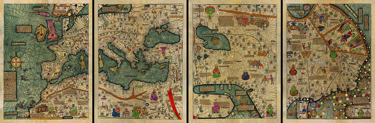
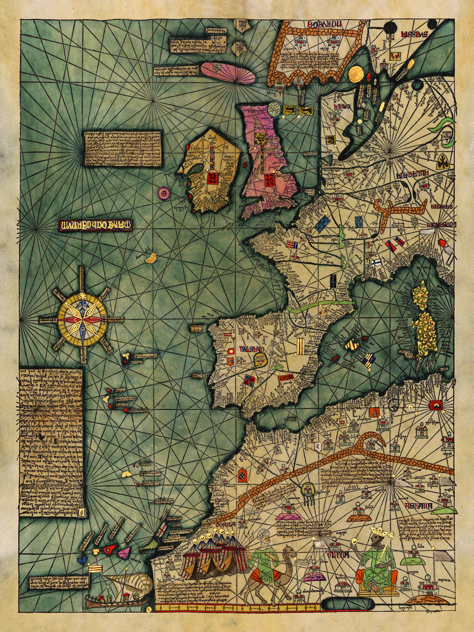

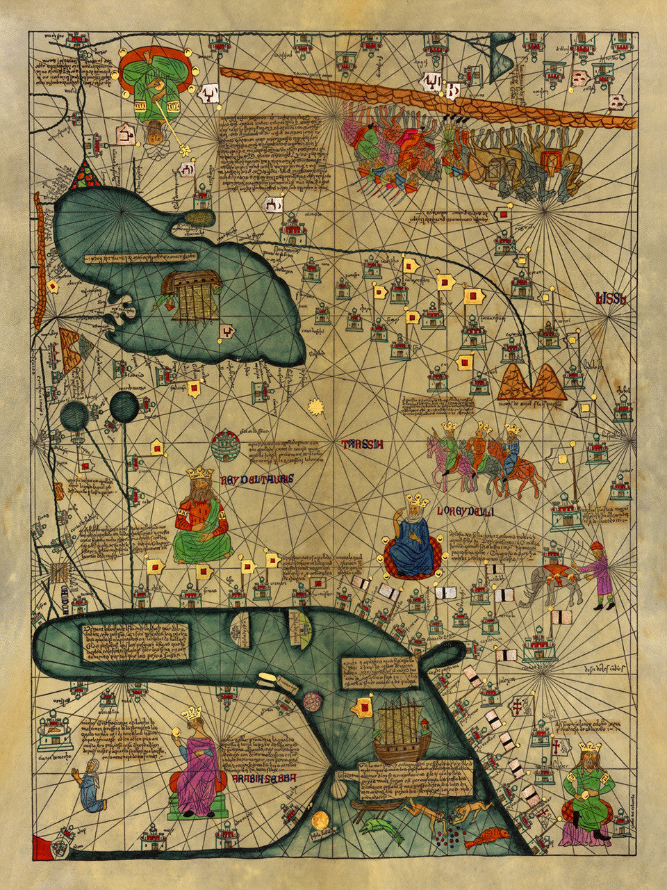
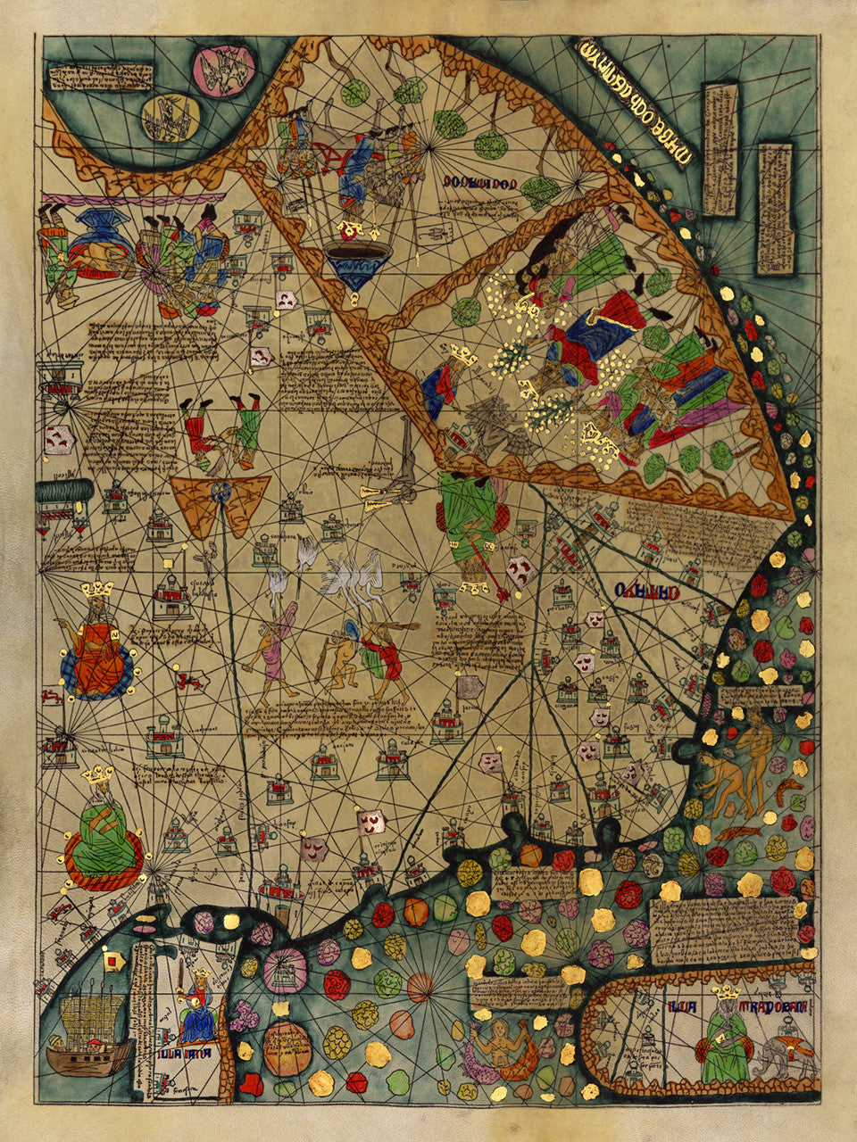

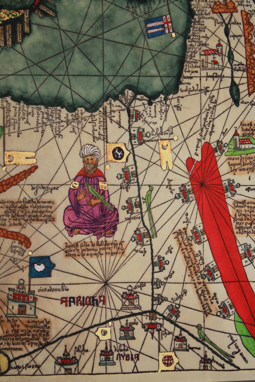
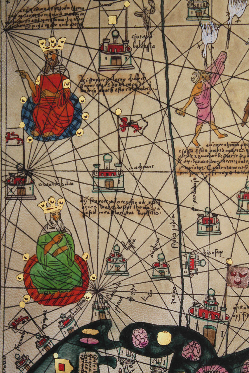
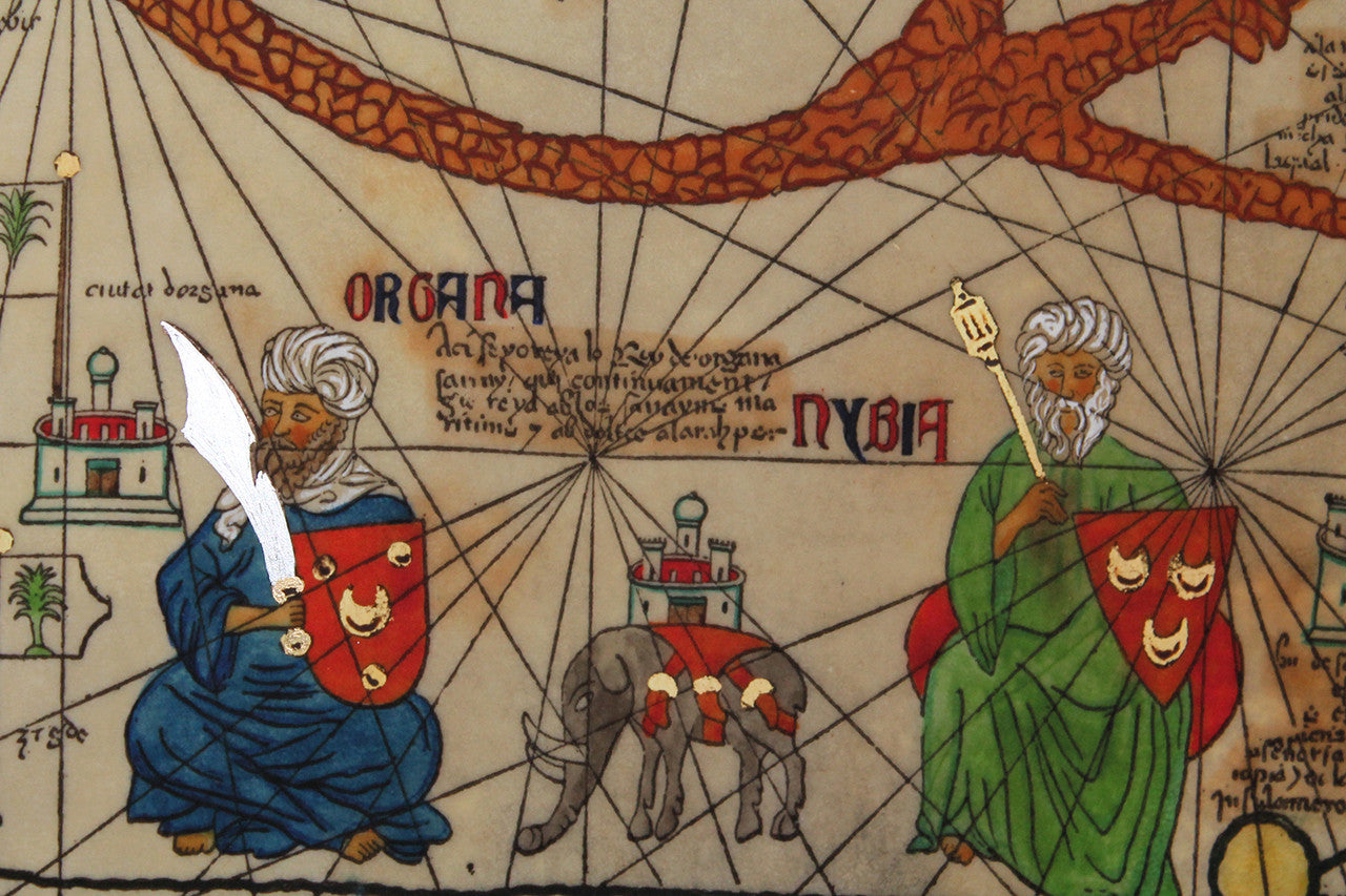
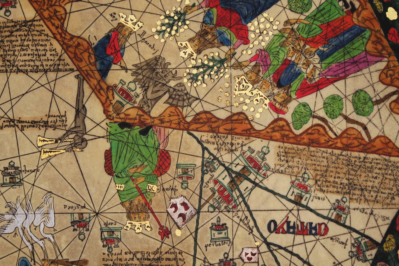

Abraham Cresques’ (Crescas) medieval depiction of the known world, All Kingdoms of the World, spanning from the North Atlantic to the South China Sea. The four maps are a part of Cresques’ 1375 illuminated manuscript known as the Catalan Atlas (Atles català), the greatest example of the Majorcan cartographic school of Catalonia and Mallorca. Panel #1 of the mappamundi depicts Western Europe, the Atlantic Ocean and parts of Northwestern Africa. Panel #2 is centered around the eastern Mediterranean and the Black Sea, with central and southern Europe, northeastern Africa and the Near East. Panel #3 shows parts of central Asia with the Caspian Sea, the Arabian Peninsula and the Persian Gulf. Panel #4 depicts the predominant European 14th-century idea of the Far East (as conveyed by Marco Polo), with China and Southeast Asia. The Catalan Atlas is widely considered the pinnacle of cartographic and artistic achievement of its time.
One of a kind, handcrafted quadriptych, featuring 12+ color premium optimized gouttelette print, with several “illumination” pigments hand-overlaid by a limner illustrator. (*This set is available framed as a separate item in our collection. **When ordering this item, please allow for some extra time for your order to be prepared for shipment, due to the complexity of the set. As always, quality is our highest priority.)
• Catalan Atlas, All Kingdoms of the World, 1375, Abraham & Jehuda (Jafuda) Cresques (four-panel set, unframed)
• Fine Art Premium Giclée (Gouttelette) Print (100% cotton 340 gsm fine art paper)
• Size single panel: 24” x 32” / 61 x 81 cm• Size total: 32” x 96” / 81 x 244 cm
• Handcrafted in the United States