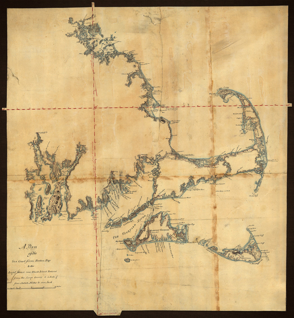
Massachusetts, 1775, Cape Cod, Nantucket, Martha’s Vineyard, Manuscript Map
Brand: Battlemaps.us

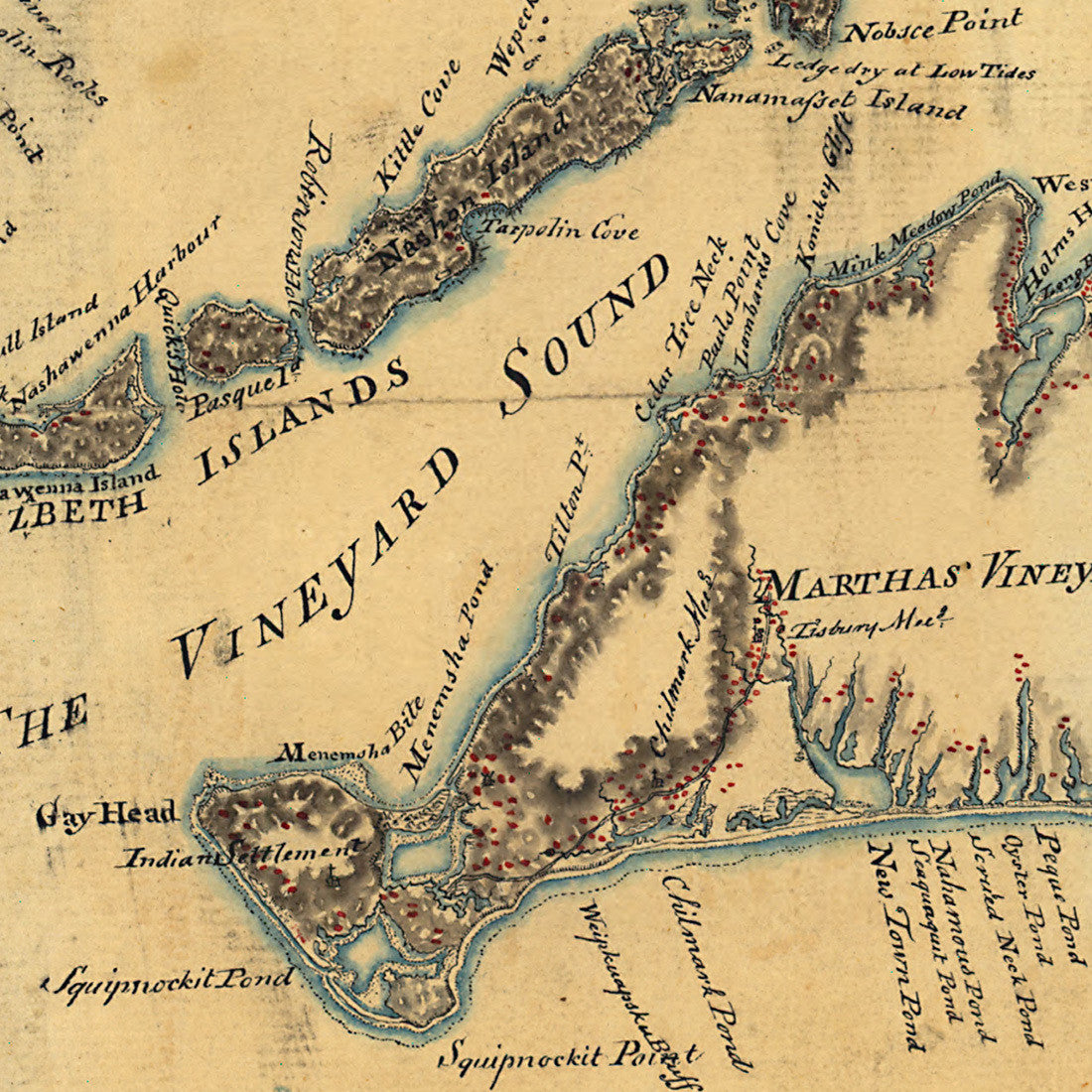
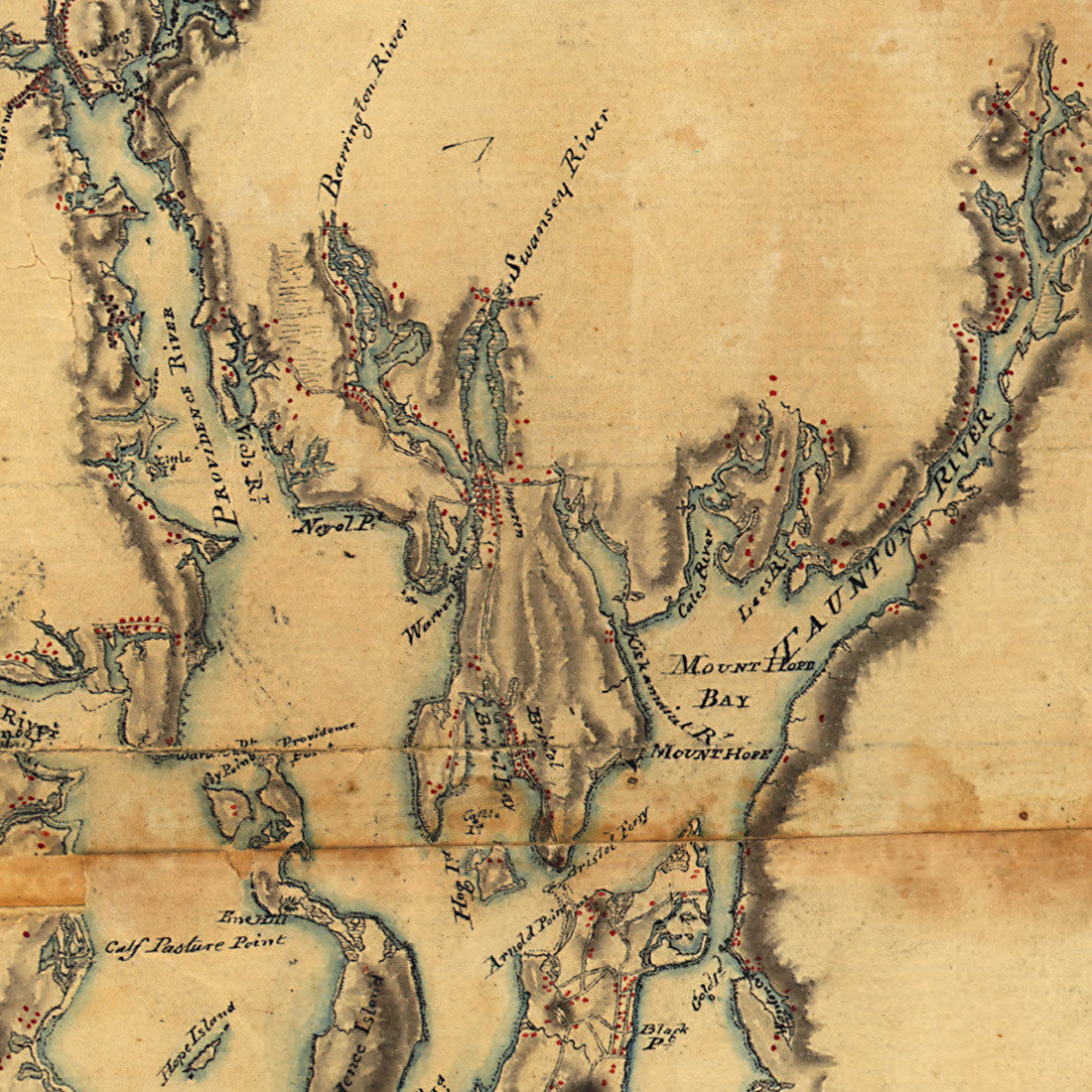
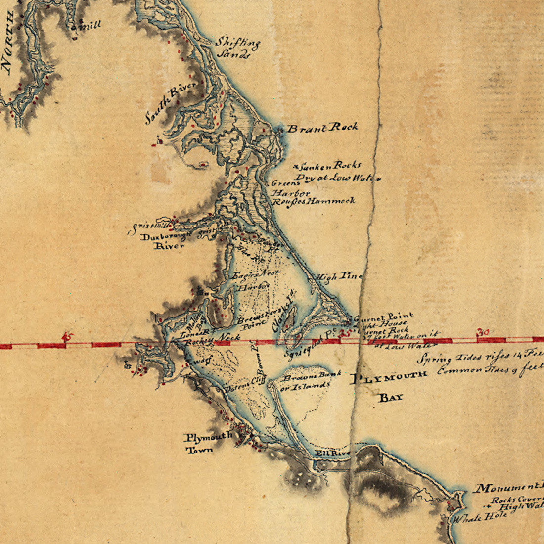
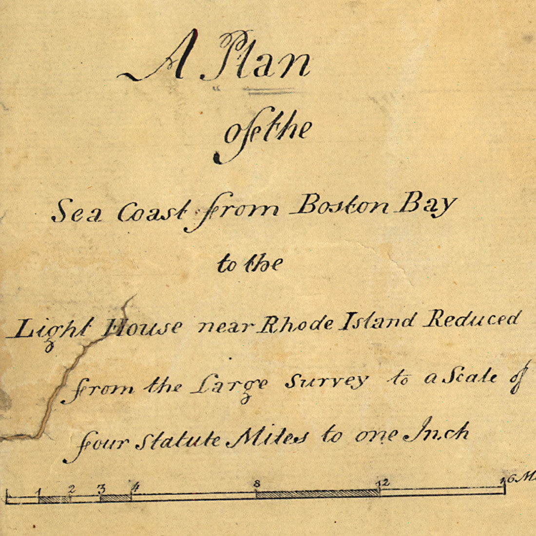
A manuscript map of the New England coast “from Boston Bay to the Light House near Rhode Island”. A rather detailed drawing of the coastline, the map includes Cape Cod, Nantucket, Martha’s Vineyard and adjacent islands. It was drawn in pencil, watercolor and ink by Charles Blaskowitz ca. 1774–75, while he was working in the region together with Thomas Wheeler, a fellow surveyor in the British Army. Map title: A Plan of the Sea Coast from Boston Bay to the Light House near Rhode Island, Reduced from the Large Survey to a Scale of four Statute Miles to one Inch. (1 Statute mile = 1 International mile today.)
• 1775 Manuscript map of the coast of Massachusetts by Charles Blaskowitz, Revolutionary War Era
• Fine Art Premium Giclée (Gouttelette) Print (100% cotton 340 gsm textured fine art paper)
• Made in USA