Malta, 1722, L'Isle de Malthe, Knights of St. John, Grand Masters, de Fer Map (II)
Brand: Battlemaps.us
 "Pin It")
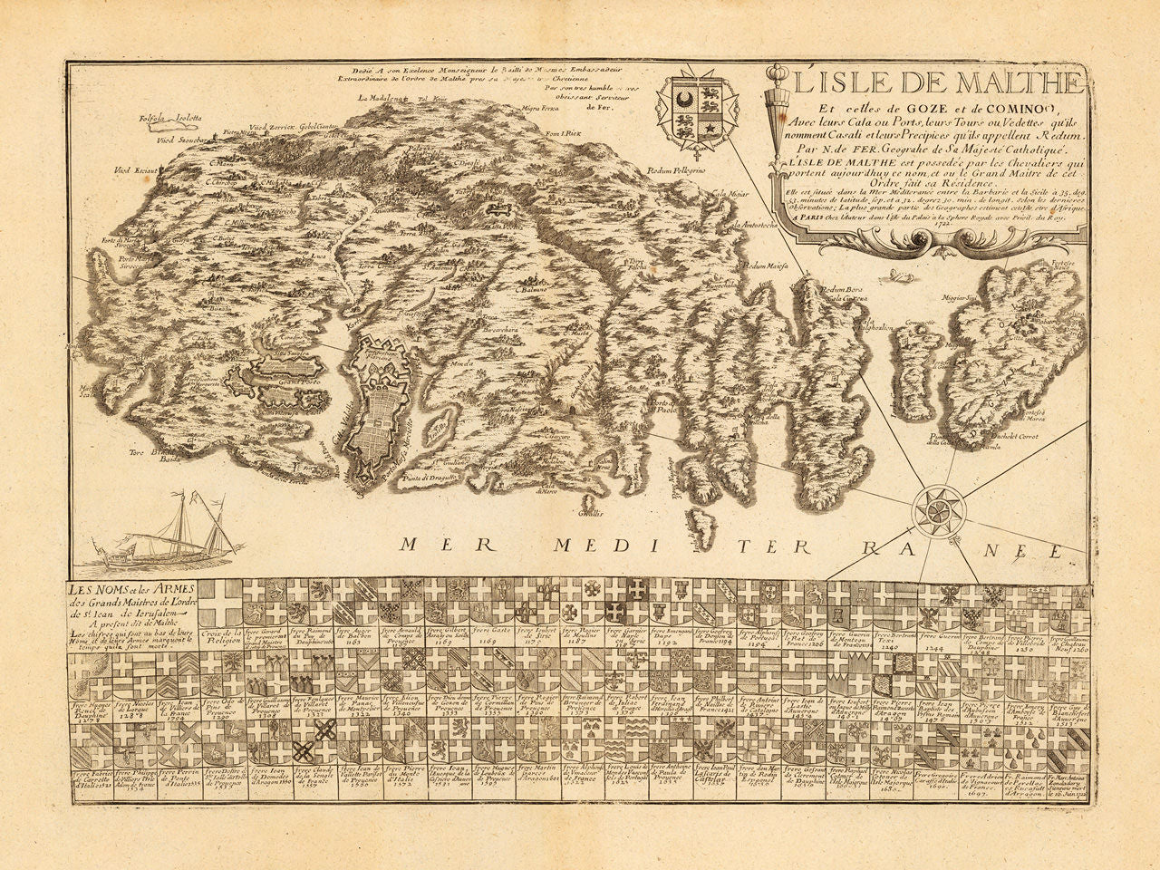
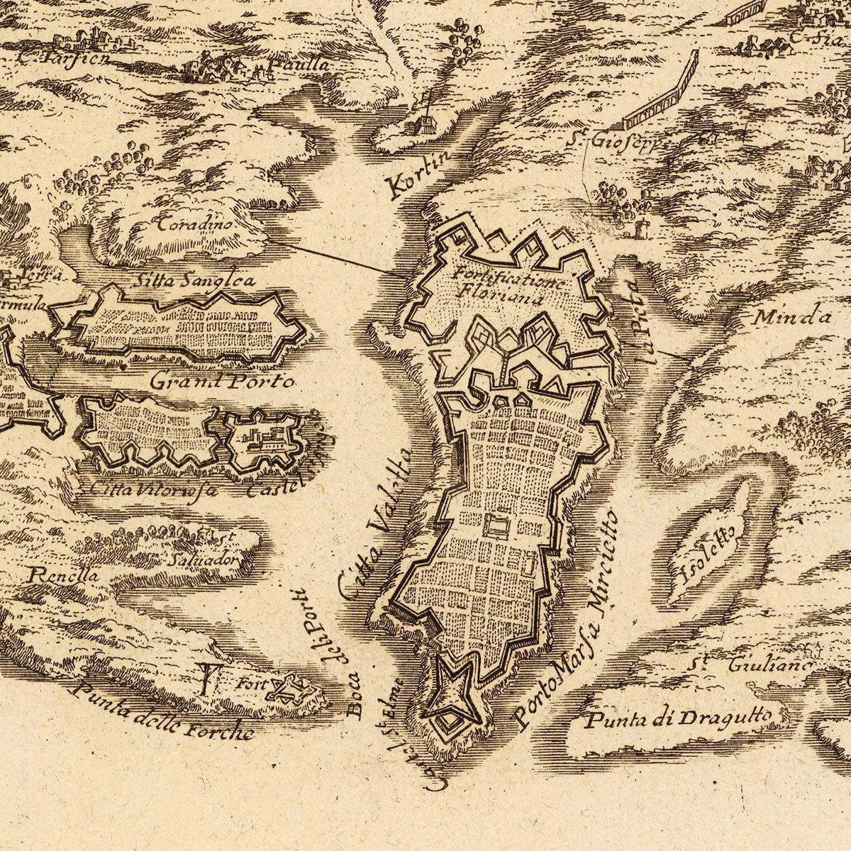
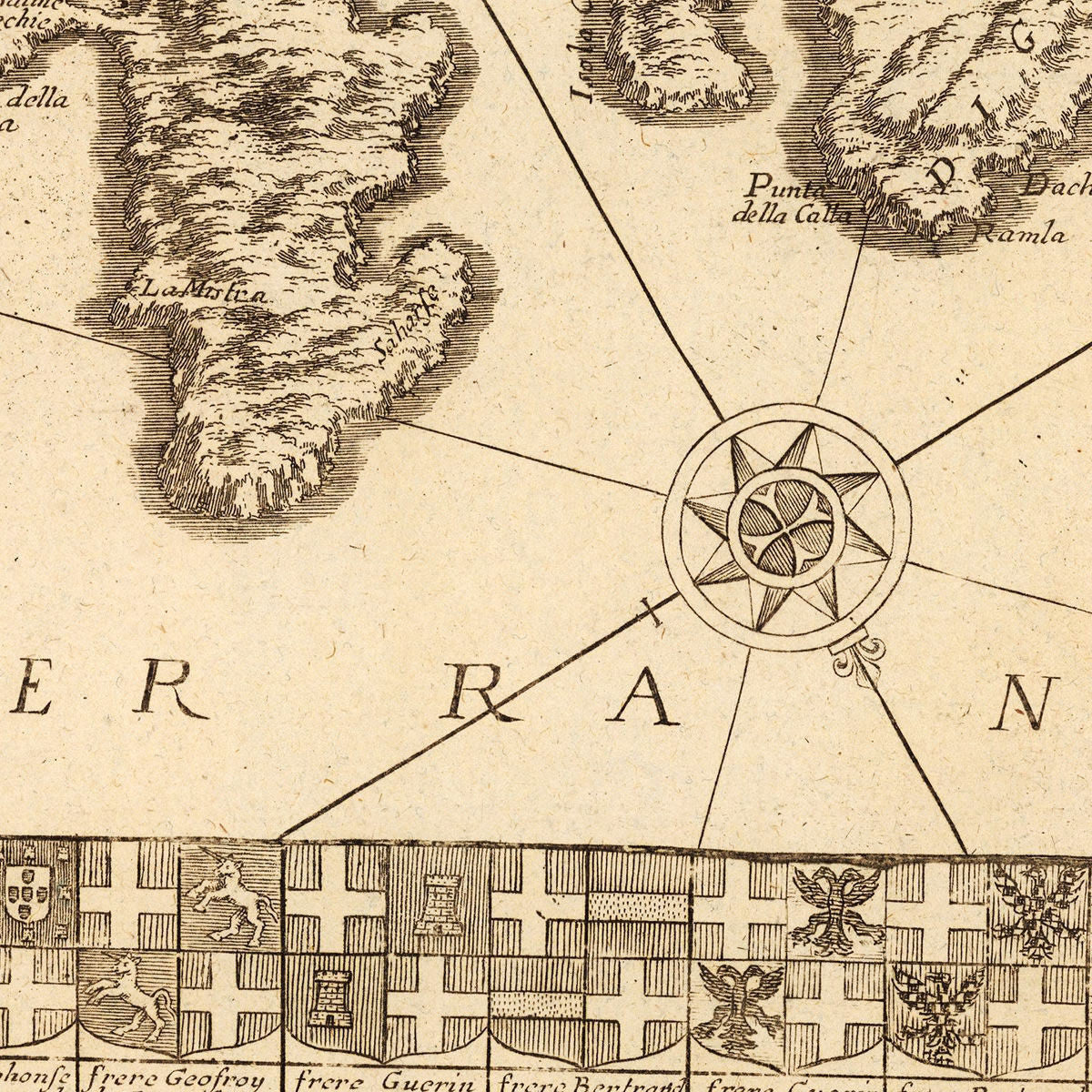
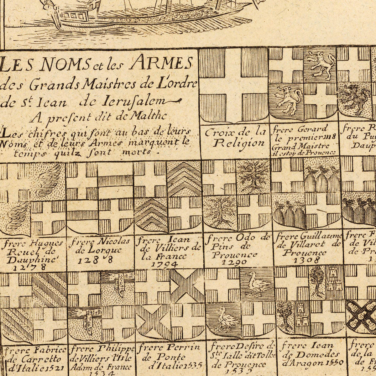
An early-eighteenth-century map of the Maltese archipelago of Malta, Gozo and Comino by Nicolas de Fer. The map is an updated version of a seventeenth-century map by Estienne Vouillemont. The lower part of the layout is occupied by the coats of arms of the Grand Masters of the Order of the Knights of St. John (SMOM), from the order’s founding to the date the map was created in 1722. There are 65 coat of arms in the cluster, while the first segment is reserved for “Croix de la Religion” — the emblematic white latin cross on a red field. The secondary title nested in the coat-of-arms section reads: Les Noms et les Armes des les Grands Maistres de L’ordre de St. Iean (Jean) de Ierisalem (Jerusalem), A present dit de Malthe… (The Names and Arms of the Grand Masters of the Order of the Knights of St. John of Jerusalem, at present called of Malta…).
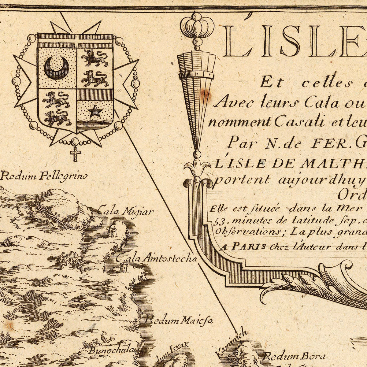
The main map title in the title cartouche reads: L’Isle de Malthe et celles de Goze et de Comino, Avec leurs Cala ou Ports, leurs Tours ou Vedettes, qu’ils nomment Casati et leurs Precipices qu’ils appellent Redum… (The island of Malta and those of Gozo and Comino, with their cala or harbors, their watchtowers, they call casati and their precipices they call redum…).
• Old map of Malta with the arms of the Grand Masters of the Order of Malta, 1722, Nicolas de Fer (uncolored)
• Fine Art Premium Giclée (Gouttelette) Print (100% cotton 340 gsm fine art paper)
• Made in USA