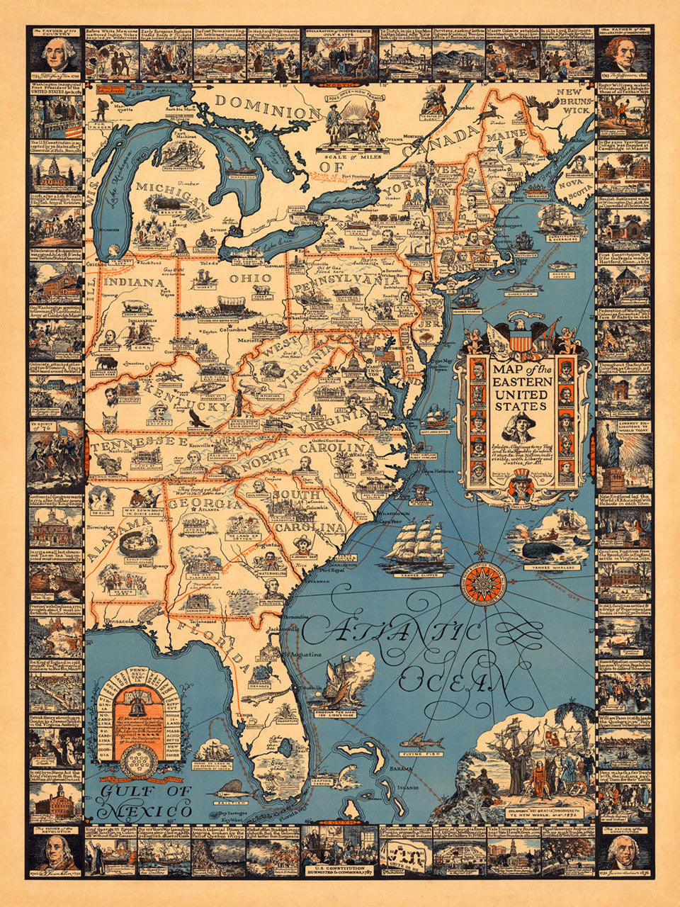
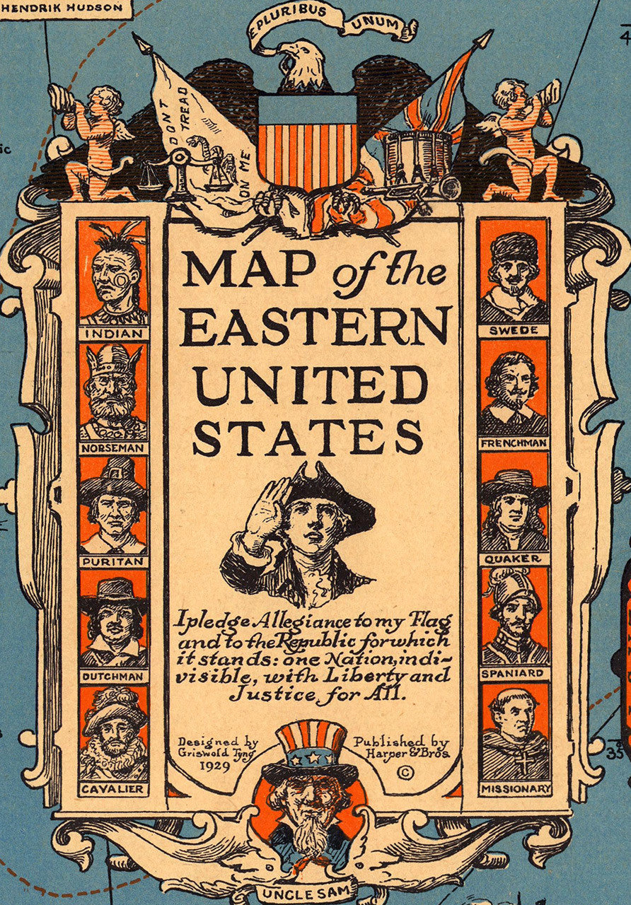
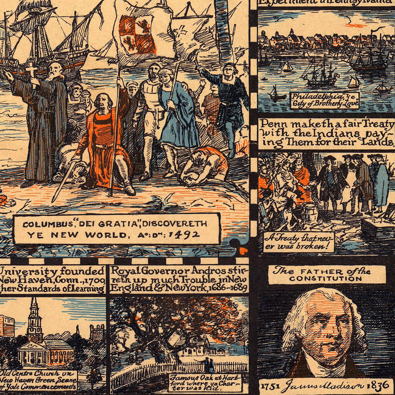
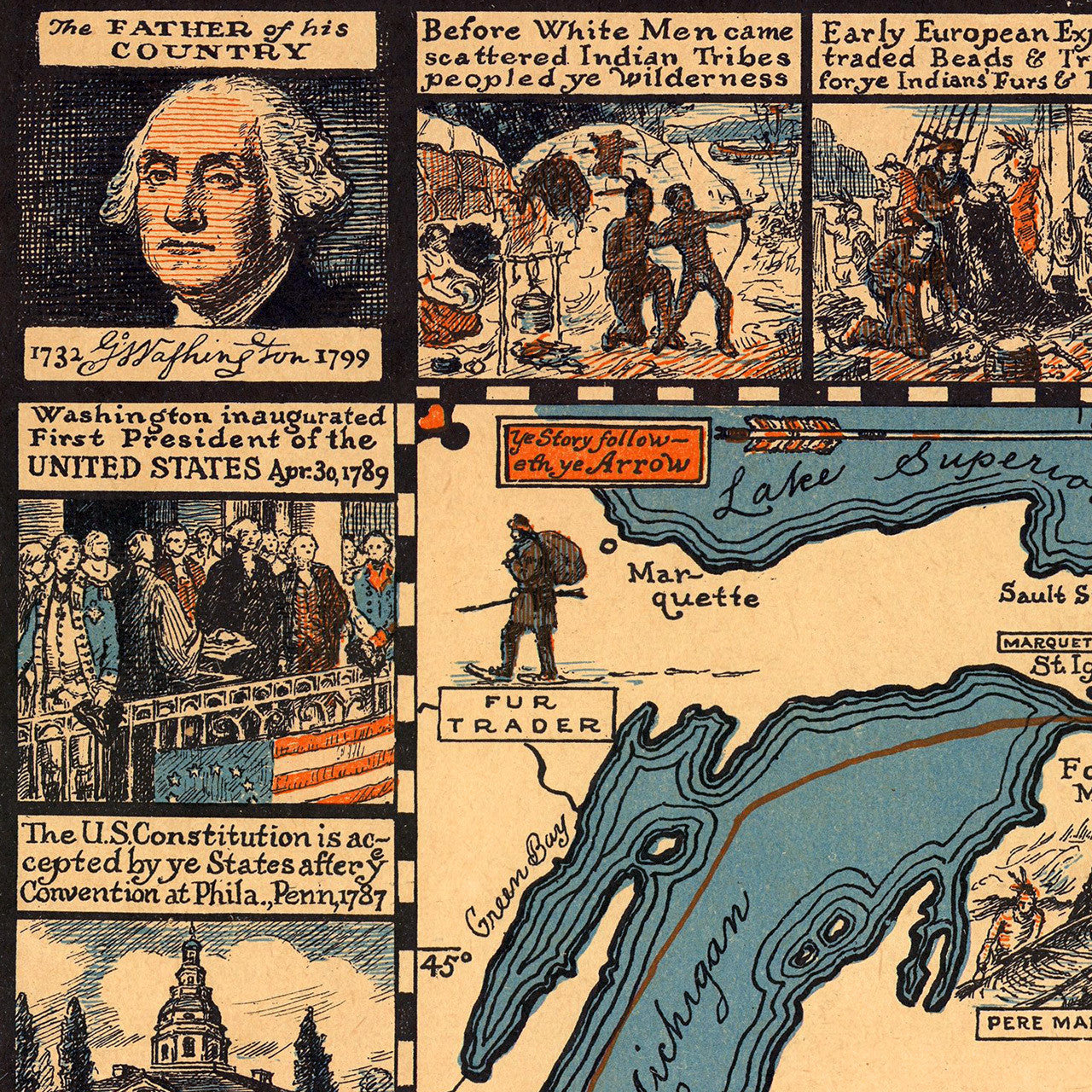
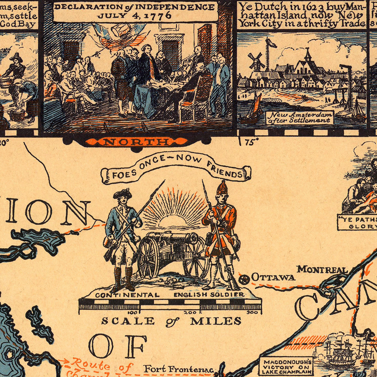
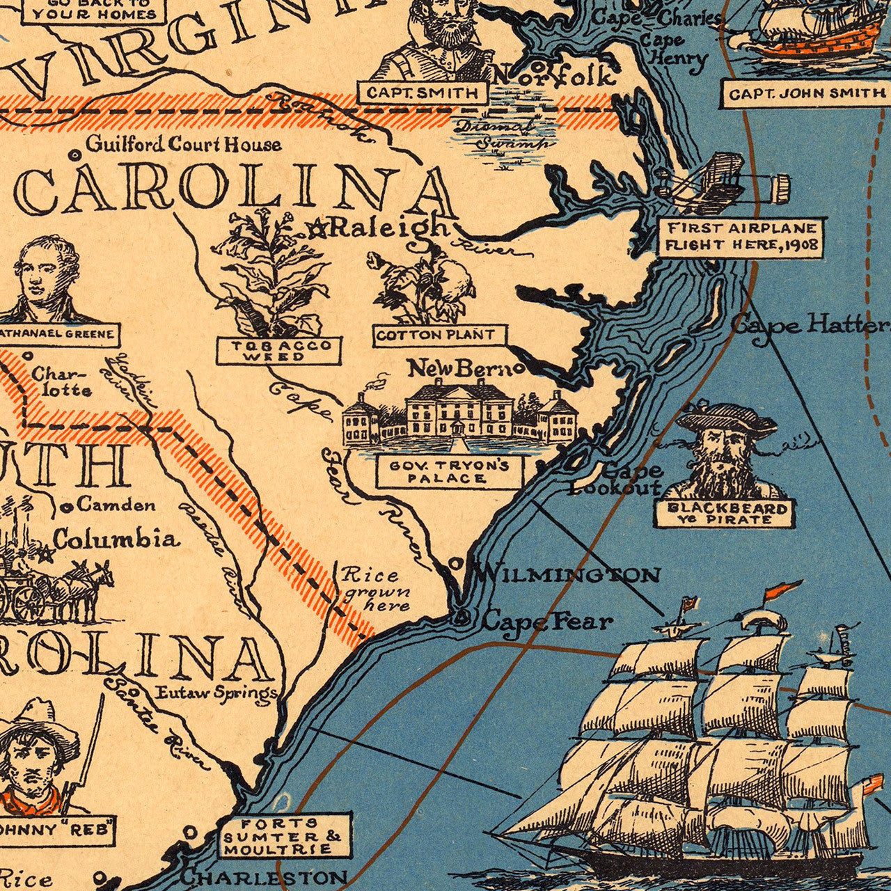
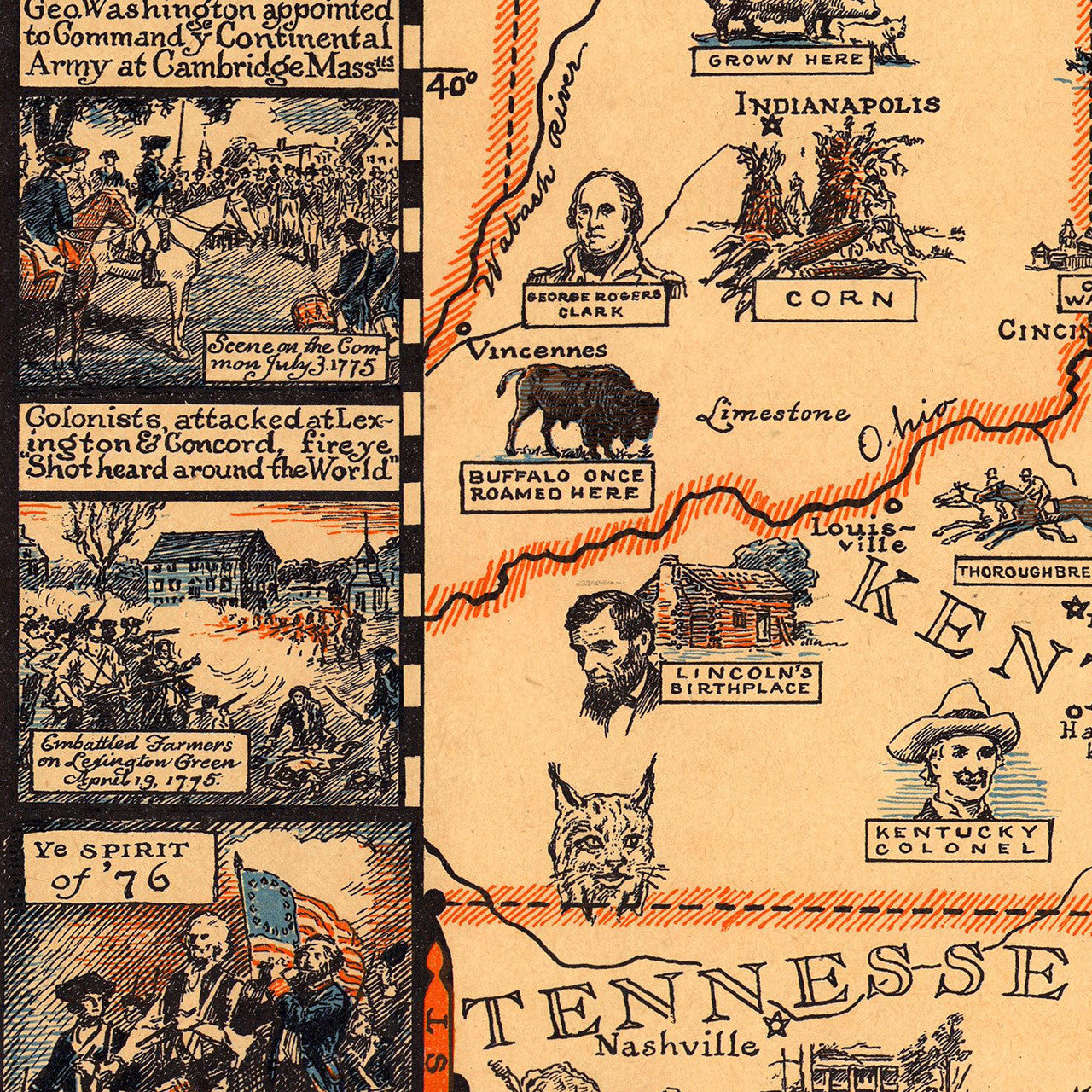
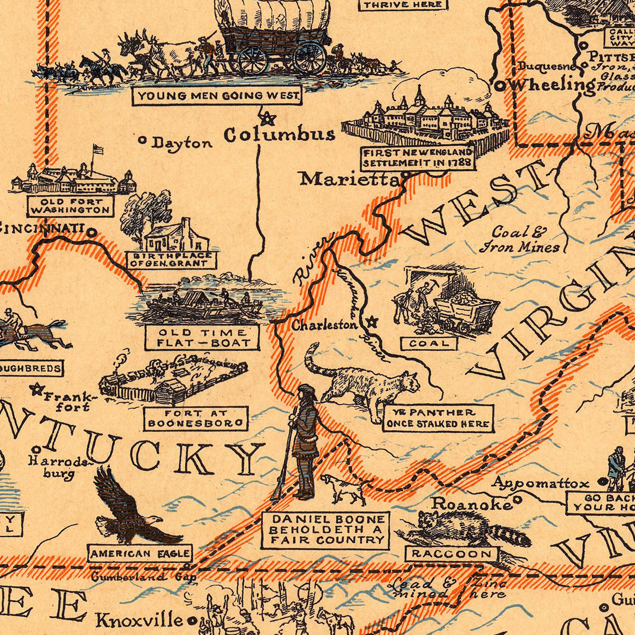
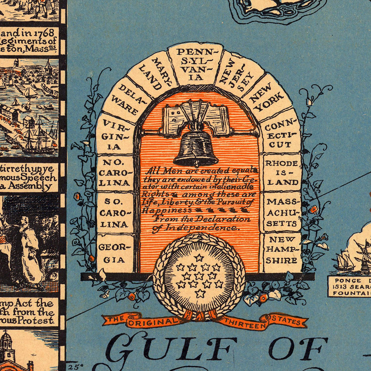
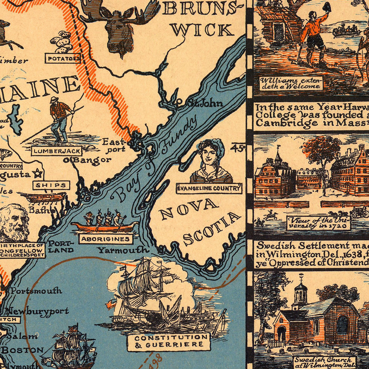

Pictorial map of the Eastern United States; features dozens of historical vignettes with text all around the border. The interior of the map is filled with illustrations of historic figures, important places, and the local economies of each state. This beautifully crafted and very informative map makes for a delightful learning tool for the very young, and a great conversation piece for the rest. Griswold Tyng designed and drew the map in 1929. The original issue was a lithograph. The current copy is a fine art premium giclée print.
• 1929 Historical map of the Eastern United States with vignettes, illustrations and text
• Fine Art Premium Giclée (Gouttelette) Print (100% cotton 340 gsm fine art paper)
• Made in USA