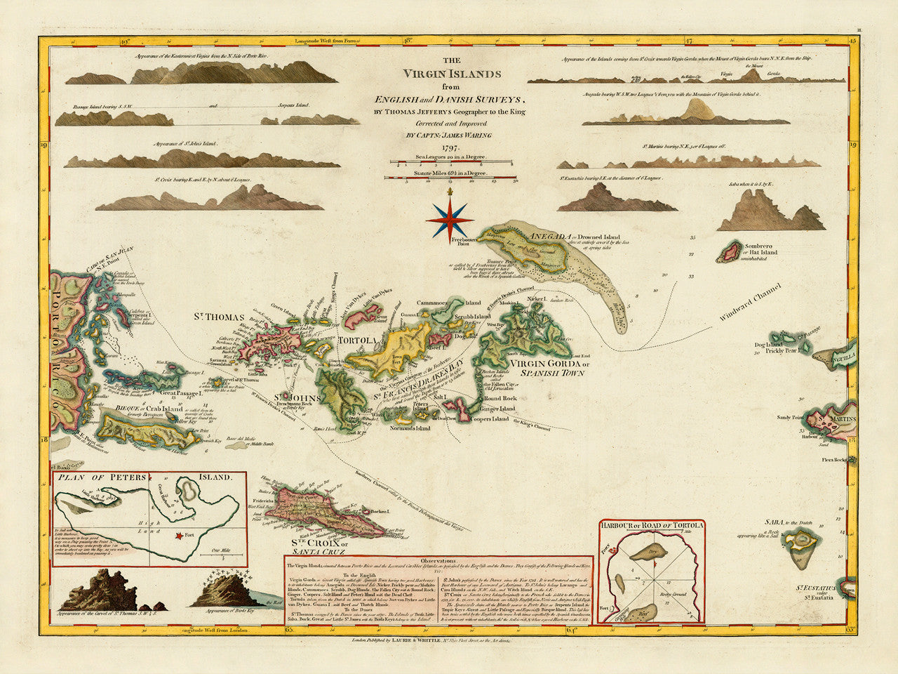

A late-eighteenth-century map of the Virgin Islands. Includes the British Virgin Islands, the Danish Virgin Islands (Danish Antilles, or Dansk Vestindien/Jomfruøerne, nowadays the U.S. Virgin Islands), and the Spanish Virgin Islands of Vieques and Culebra, (nowadays part of Puerto Rico). The map also shows the easternmost coast of Puerto Rico and adjacent small islands. It also covers Saba, and parts of Anguilla, St. Eustatius (Eustatia), and St. Martins (Sint Maarten / St. Martin). The upper part of the layout includes 12 island profiles. Full map title reads: The Virgin Islands from English and Danish Surveys, By Thomas Jefferys Geographer to the King, Corrected and Improved by Captn: James Waring, 1797. (For a larger-size, detailed version of this map, please see the Virgin Islands 1775 map.)
• 1797 (1775) map of the Virgin Islands, (BVI, USVI), West-India Atlas, Jefferys, Waring, Laurie & Whittle
• Fine Art Premium Giclée (Gouttelette) Print (100% cotton 340 gsm fine art paper)
• Made in USA