Account login →
Home
Gallery
−
American History
+
Colonial Period
Revolutionary War
Westward Expansion
Civil War
WWI
WWII
World
−
World Maps
Africa
America
+
Caribbean & Central America
North America
South America
The Americas
Asia
Europe
Oceania
Cities
+
New York
London
Paris
Jerusalem + Holy Land
Bird’s-Eye Views
Sets of Cities
Pictorial Maps
Wall Art Sets
+
Framed Sets
Unframed Sets
Blog
About
Contact
Gift Certificates
←
World / North america
Share this:
Tweet
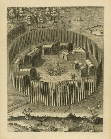
Virginia, 1590, Pomeiooc Village, John White, Thomas Hariot, De Bry, Engraving, Fine Art Print (I)
→
Virginia, 1590, Pomeiooc Village, John White, Thomas Hariot, De Bry, Engraving, Fine Art Print (II)
→
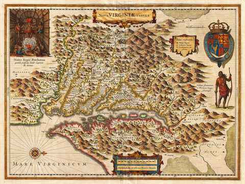
Virginia, 1630, Nova Virginiæ Tabula, John Smith Map
→
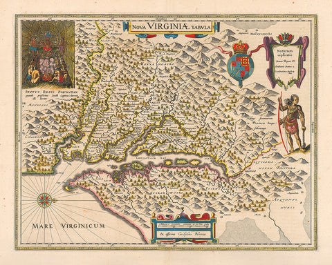
Virginia, 1640, Nova Virginiæ Tabula, John Smith Map
→
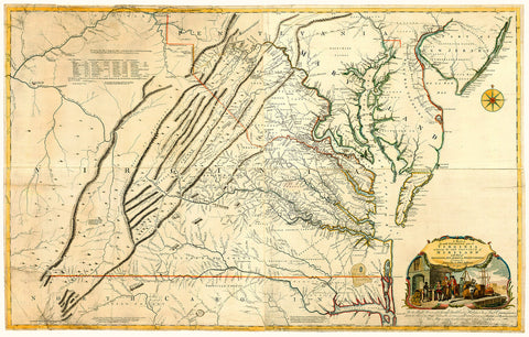
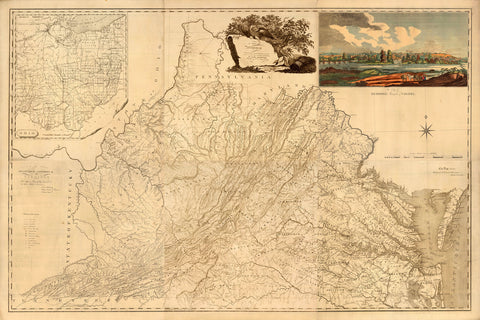
Virginia, 1755, Fry-Jefferson Map
→
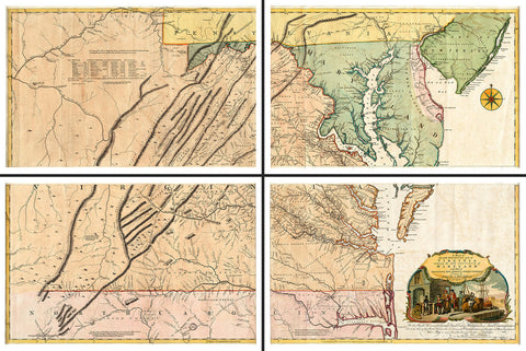
Virginia, 1755, Fry-Jefferson Map, 4-Sheet Large Wall Map
→
Virginia, 1807, James Madison, Richmond, Antique Map
→
Washington Crossing the Delaware, Fine Art Print
from
→
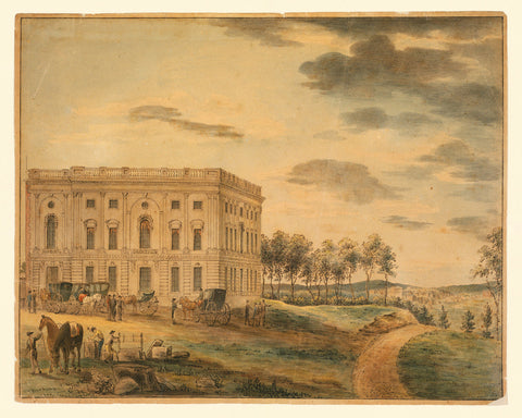
Washington, D.C., 1800s, U.S. Capitol Before the Fire, Watercolor View
→
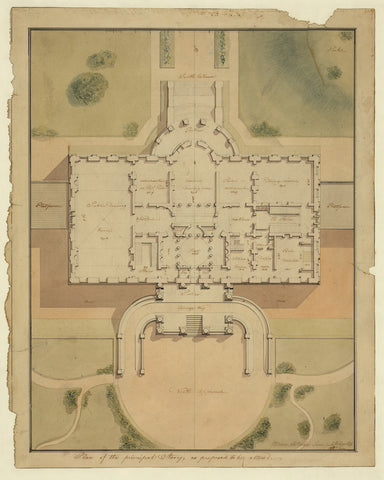
Washington, D.C., 1800s, White House Plan, Watercolor
→
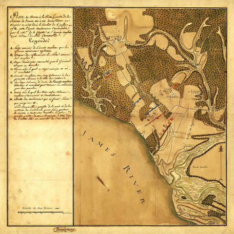
Williamsburg, 1781, Virginia, Battle of Green Spring, Revolutionary War Map
→
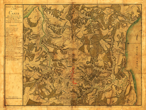
Williamsburg, 1781, Virginia, Rochambeau’s Army, Revolutionary War Map
from
→
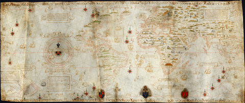
World, 1502, Cantino Planisphere
from
→
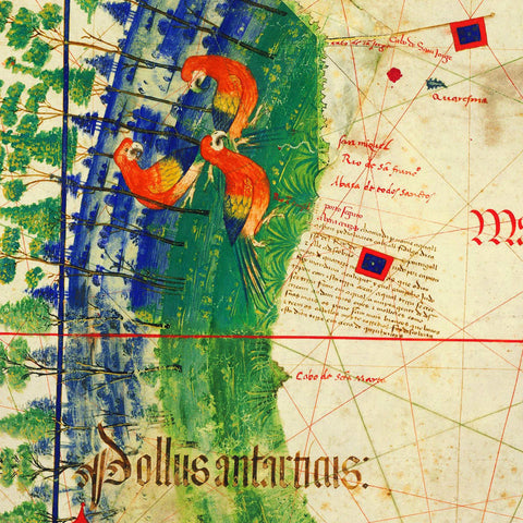
World, 1529, Planisphere, Carta Universal, Padrón Real, Ribeiro, “Propaganda Map”
from
→
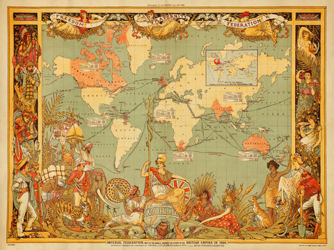
World, 1886, British Empire, Imperial Federation, Walter Crane, Vintage Map
→
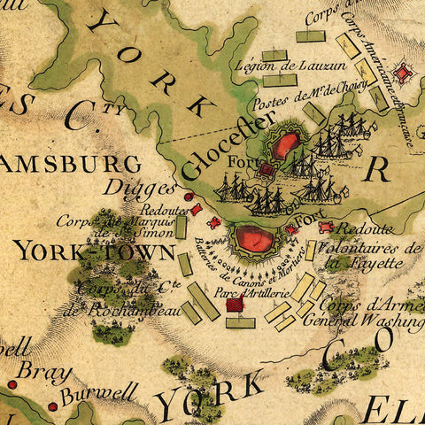
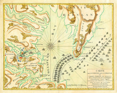
Yorktown, 1781, French Naval Plan (I), Revolutionary War Map
from
→
Yorktown, 1781, French Naval Plan (II), Revolutionary War Map
from
→
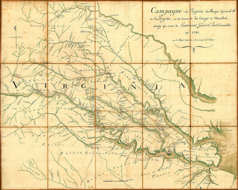
Yorktown, 1781, Lafayette’s Campaign, Cornwallis, Revolutionary War Map
→
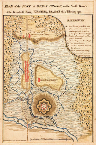
Yorktown, 1781, Virginia, Chesapeake, Great Bridge, Revolutionary War Plan
→
Previous page
1
2
3
top