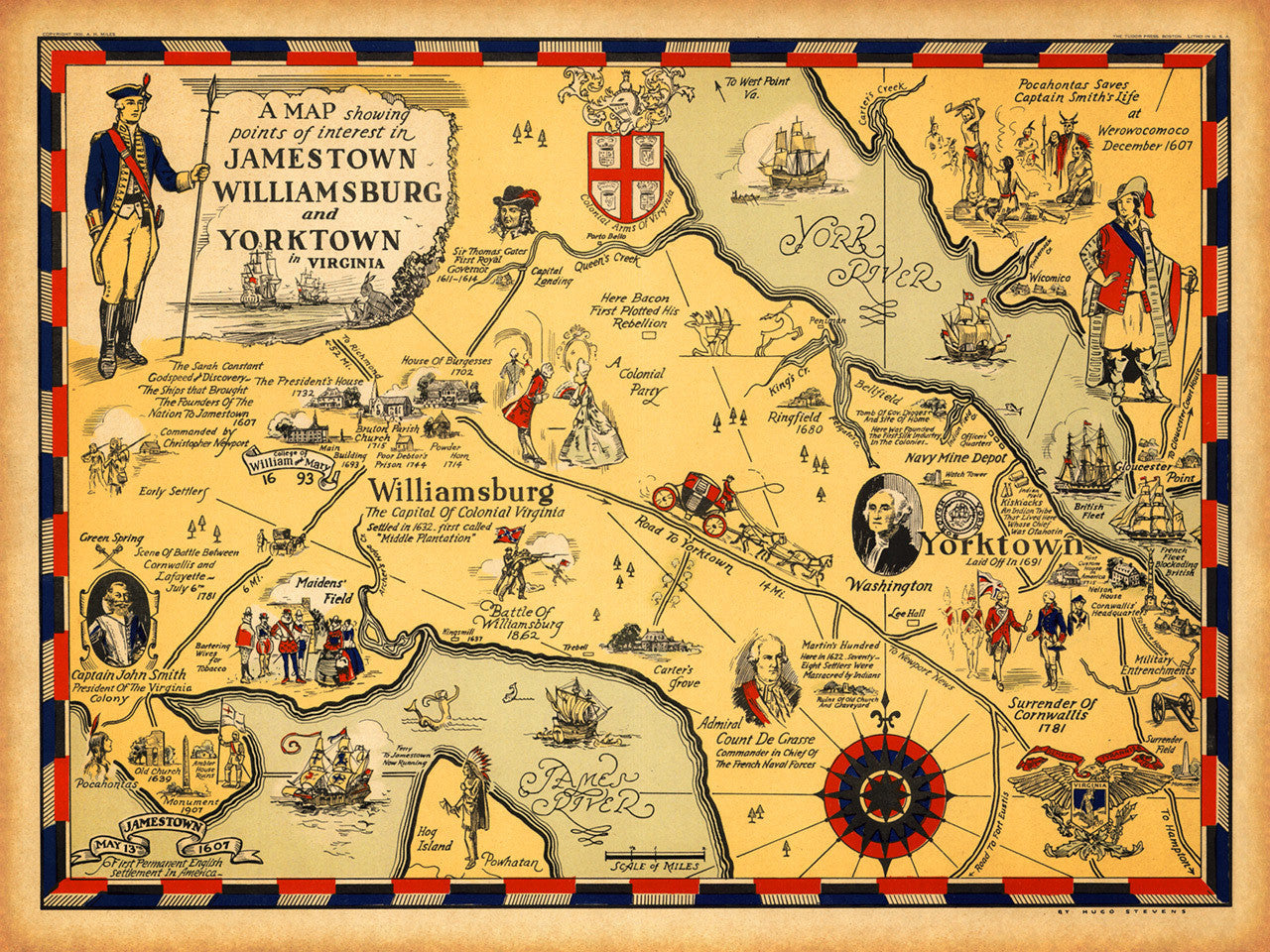
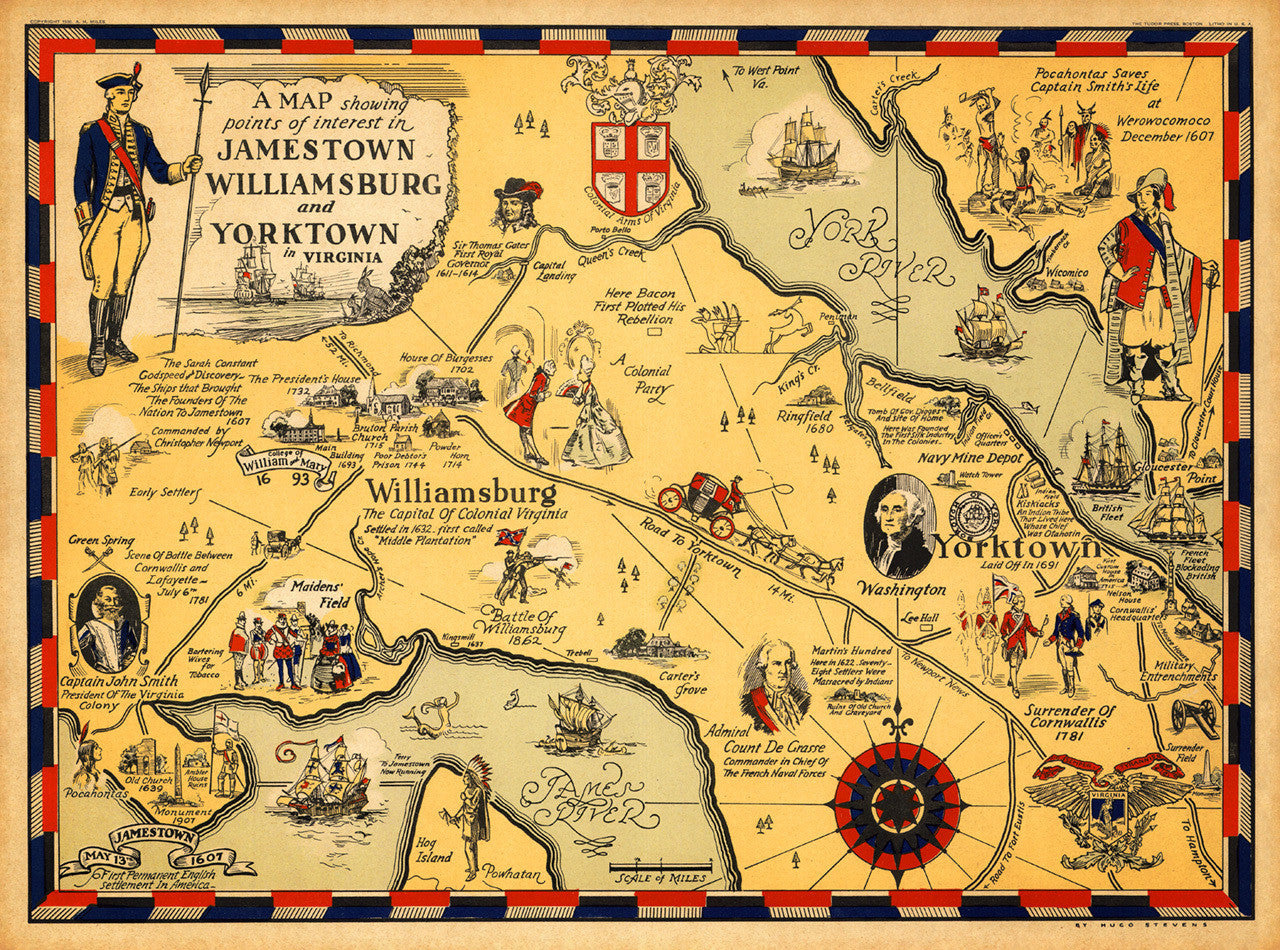

Pictorial map of the historic Williamsburg, Jamestown and Yorktown area, showing places of interest — events, landmark buildings, and scenes from the rich history of the region, starting in 1607, when the first permanent English settlement in America was established. The map, designed and drawn by H. Stevens, is full of vignettes and illustrations featuring Captain John Smith, George Washington, Sir Thomas Gates, Admiral Comte de Grasse, and many more.
• Pictorial historical map of the Williamsburg, Jamestown and Yorktown region with illustrations
• Title: “A Map Showing Points of Interest in Jamestown, Williamsburg and Yorktown in Virginia”
• Fine Art Premium Giclée (Gouttelette) Print (100% cotton 340 gsm fine art paper)
• Made in USA