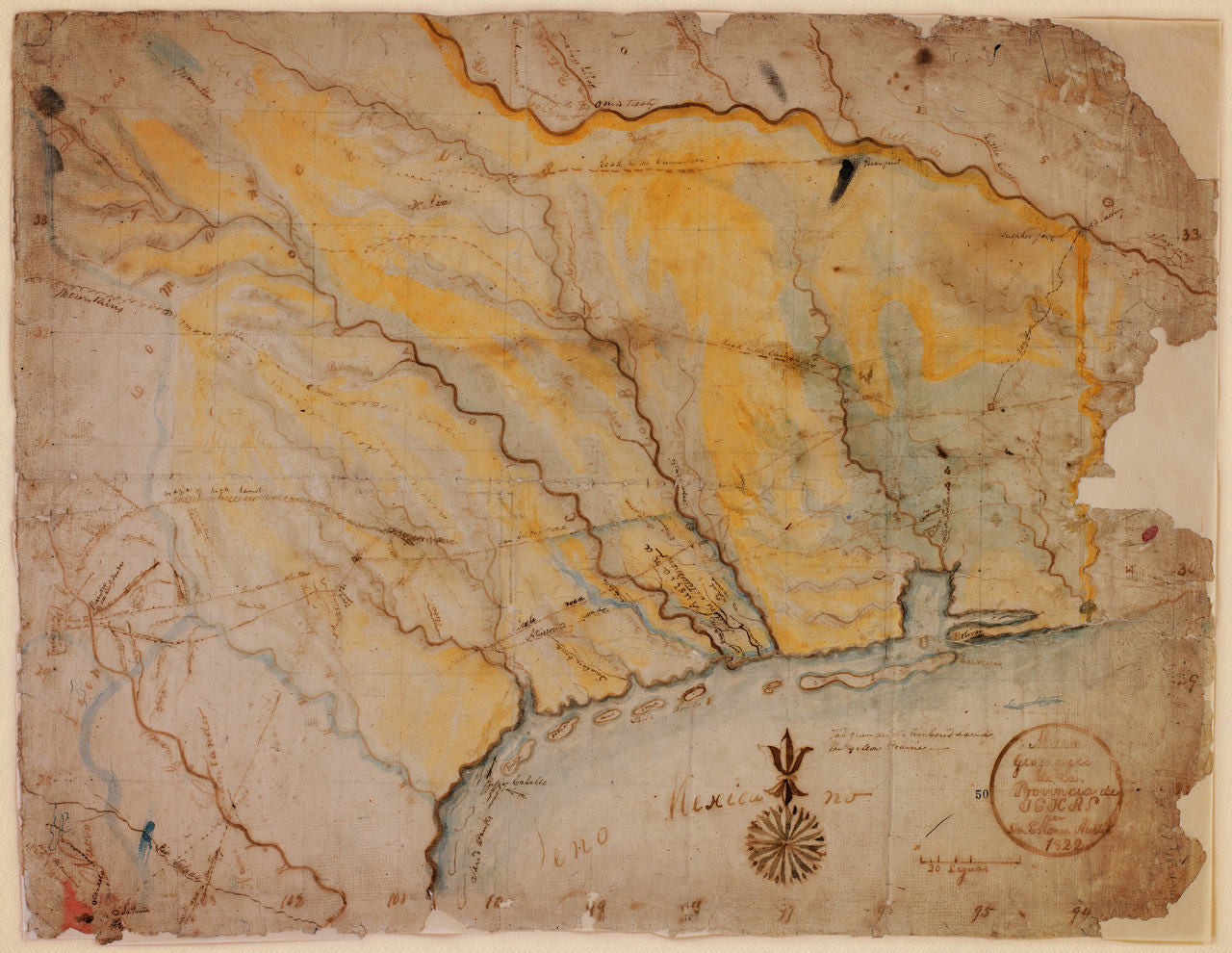
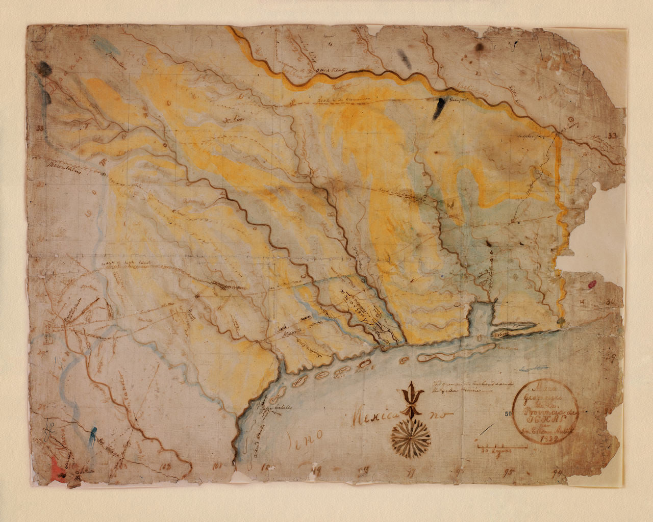
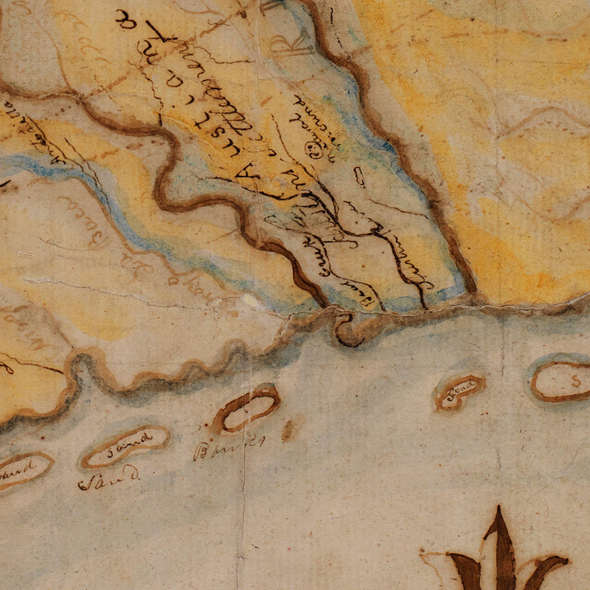
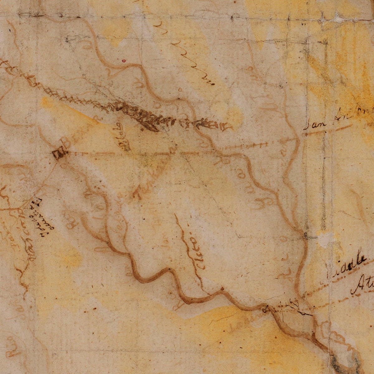
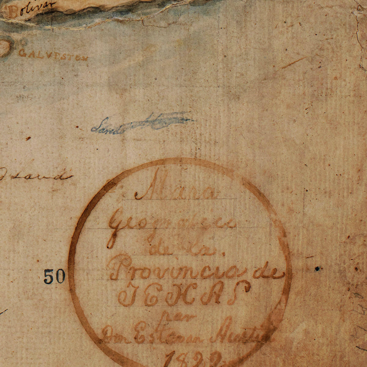

Stephen F. Austin’s First Map of Texas An 1822 manuscript map of the Province of Texas, created by Stephen F. Austin. The map, drawn in watercolor and ink, was the first of several manuscript maps by Austin, made between 1822 and 1829. Austin, an American empresario, widely regarded as the Father of Modern Texas, collaborated on the creation of the map with Nicholas Rightor, known as the first surveyor of Texas. The strikingly beautiful, hand drawn and colored map, was possibly based on an earlier survey by Fray José María de Jesús Puelles, a Franciscan monk at the Convent at Zacatecas and later Guardian of the College of Guadalupe de Zacatecas. The title within the hand-drawn round cartouche reads: “Mapa Geografico de la Provincia de TEXAS par Don Estevan Austin 1822”.
• The first map of Texas by the Father of Texas, Stephen F. Austin, 1822 (watercolor, ink)
• Title: Mapa Geografico de la Provincia de Texas par Don Estevan [Esteban] Austin 1822
• Fine Art Premium Giclée (Gouttelette) Print (100% cotton 340 gsm textured fine art paper)
• Made in USA