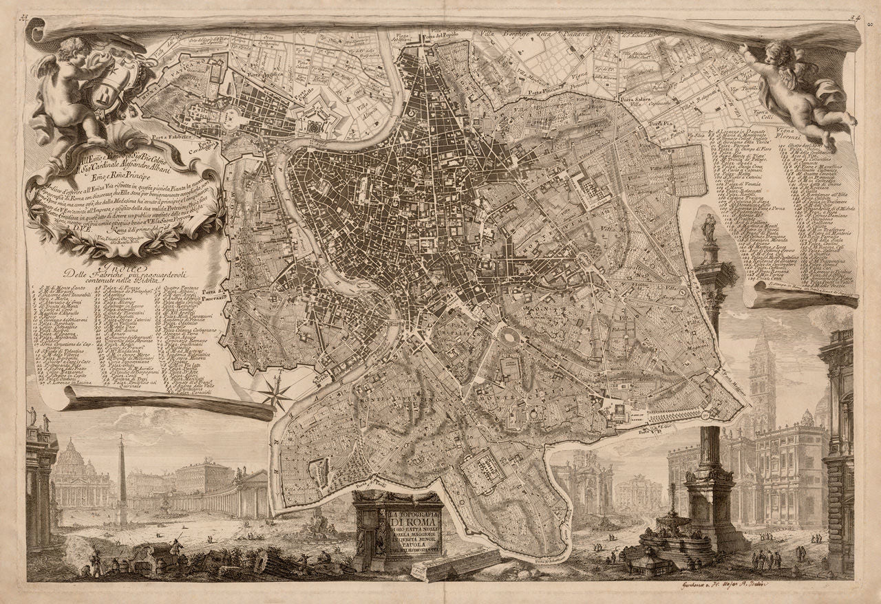
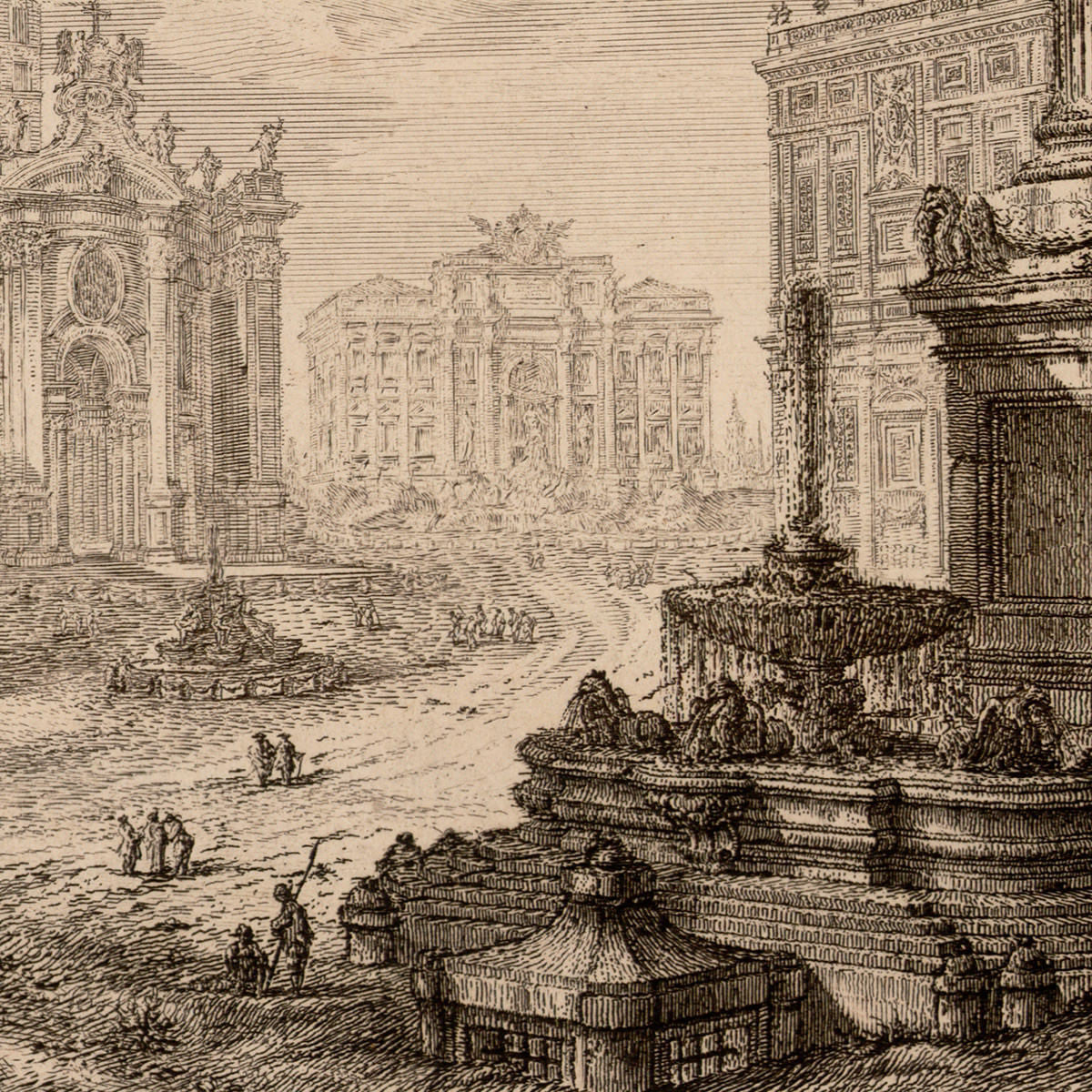
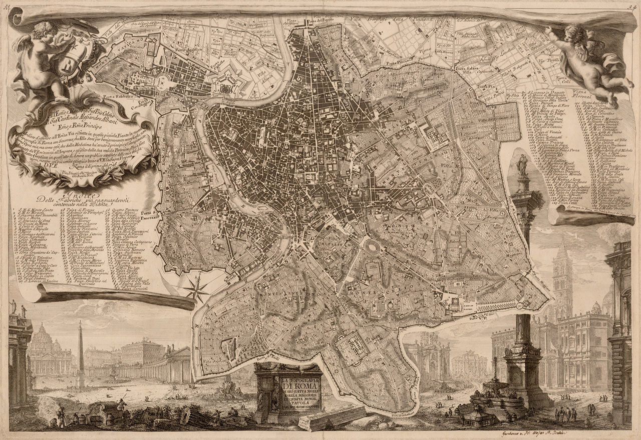

In 1748 Giovanni Battista (Giambattista) Nolli created and published the first accurate map of Rome — La Pianta Grande di Roma, commonly referred to in English as the Nolli Map of Rome. La Pianta Grande was above all… grand: a 12-sheet, large-scale, highly detailed map, richly decorated with views from the Eternal City. Nolli simultaneously published this scaled-down version of his magnificent plan, with slightly different vignettes and vedute. The reduced version was engraved by Nolli, while Giovanni Battista Piranesi engraved the surrounding views. The map title reads: La Topografia di Roma di Gio. Batta Nolli dalla Maggiore in Qvesta [Questa] Minor Tauola [Tavola] dal Medesimo Ridotta / Piranesi e Nolli incisero.
“The Most Glorious Place in the Universal World” ~ Robert Adam (1728 – 1792)
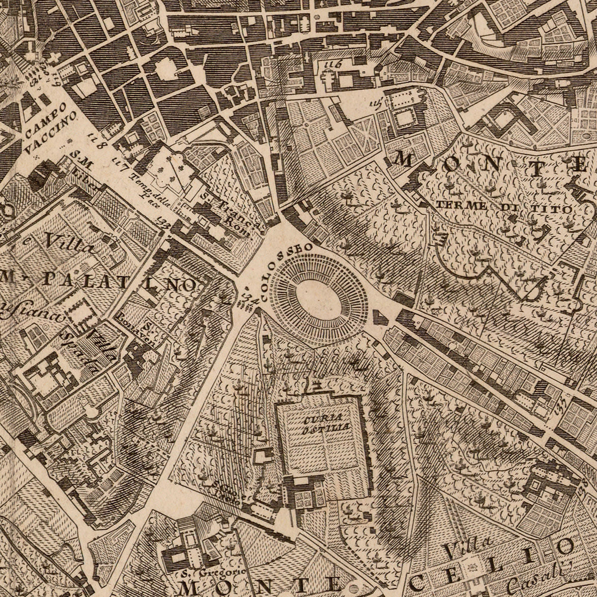
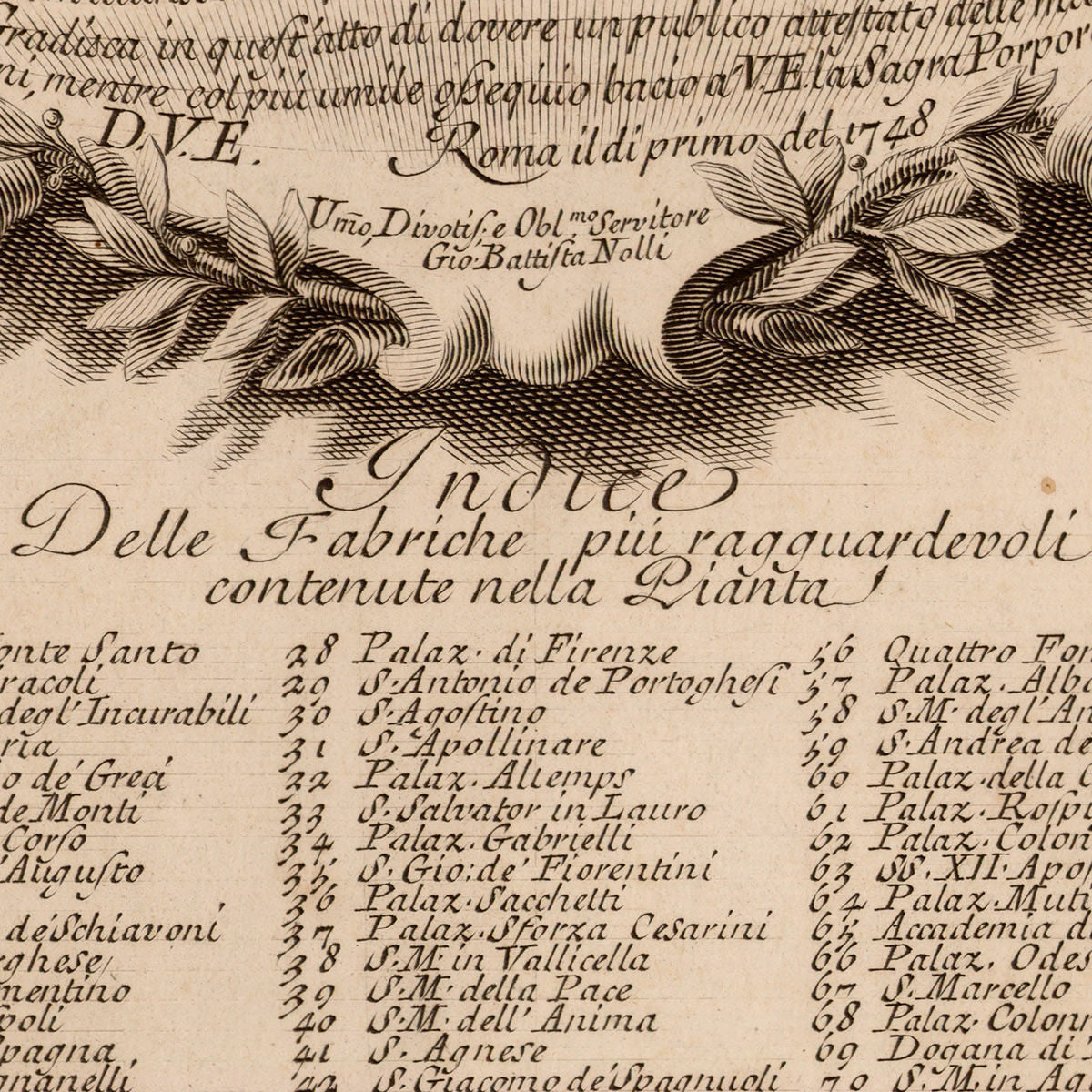
The eighteenth century was the Golden Age of the Grand Tour — a requisite trip throughout Europe, serving as sort of a finishing school and rite of passage for generations of aristocrats. Rome, with its monuments, ancient and new, was the ultimate destination for the person undertaking that months-long trip. Together with Vasi’s and Piranesi’s vedute of the city, Nolli’s plan would have been as much of a necessity for the young cultural pilgrim, as Google maps and Siri are today for the modern-day backpacker. Both the large and the reduced versions of the map came with an extensive index of landmarks of the Eternal City. The current reduced version features 170 entries, and hundreds more locations marked on the actual plan.
• A detailed and elaborate plan of Rome with vignettes, cartouches & vedute, 1748, Nolli / Piranesi
• Title: La Topografia di Roma… dalla Maggiore in Questa Minor Tavola dal Medesimo Ridotta
• Fine Art Premium Giclée (Gouttelette) Print (100% cotton 340 gsm fine art paper)
• Made in USA