 "Pin It")
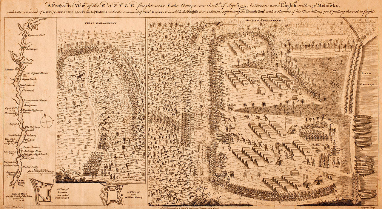
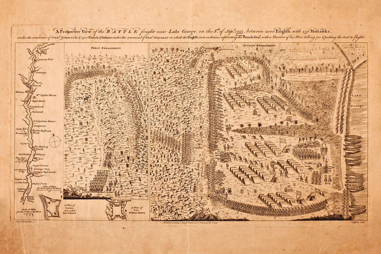
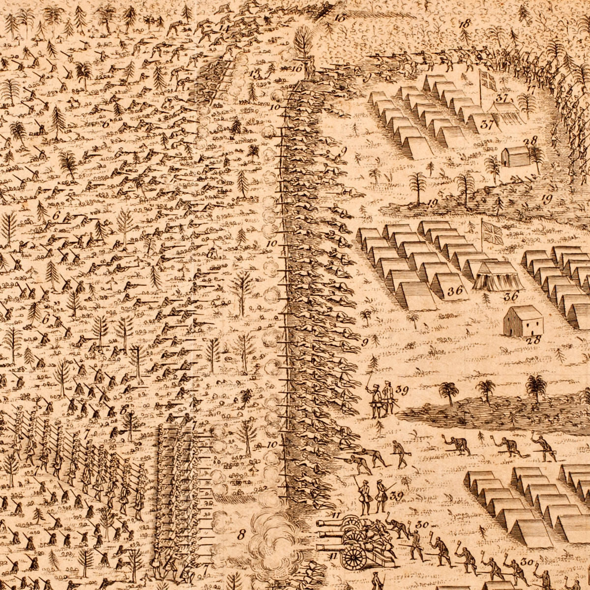
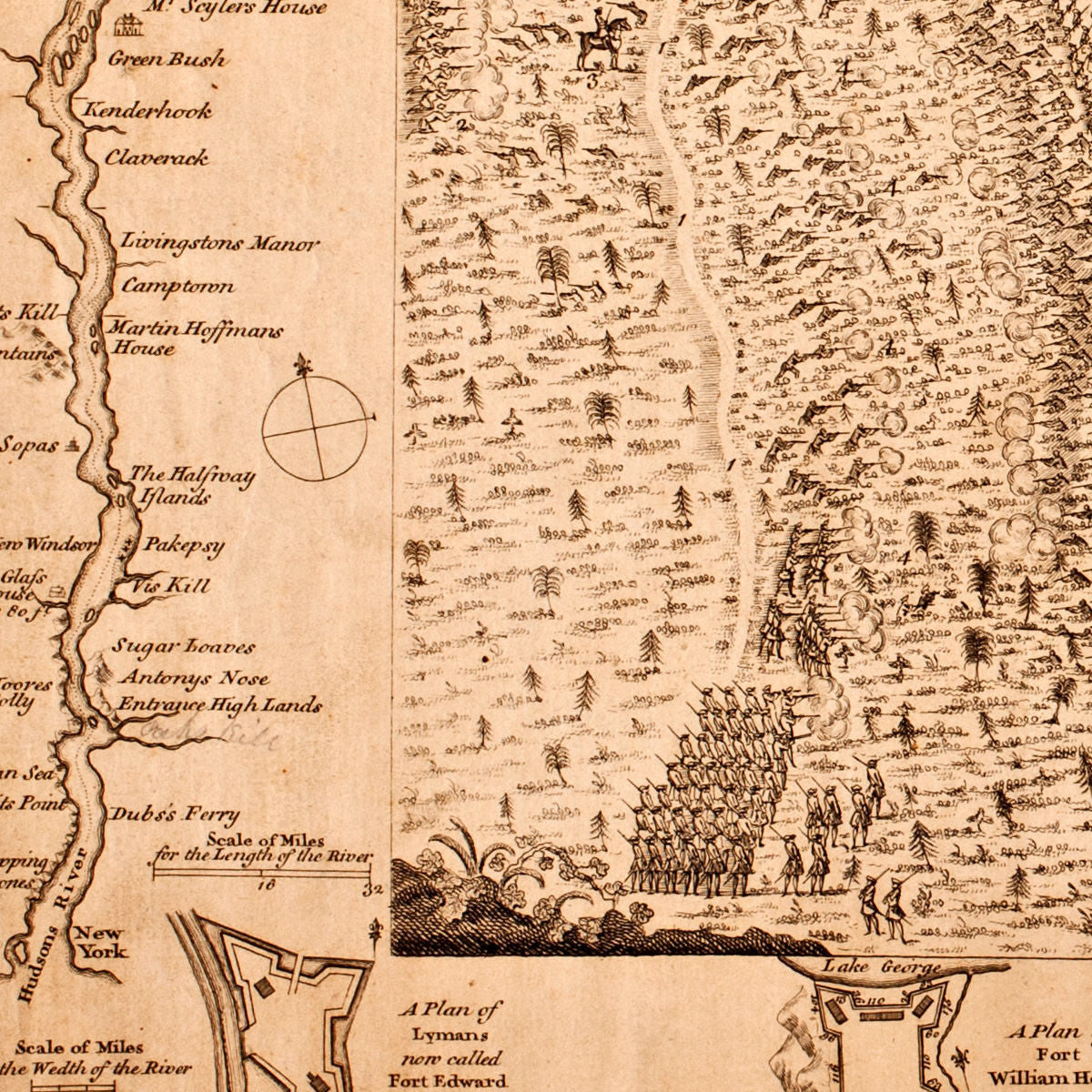
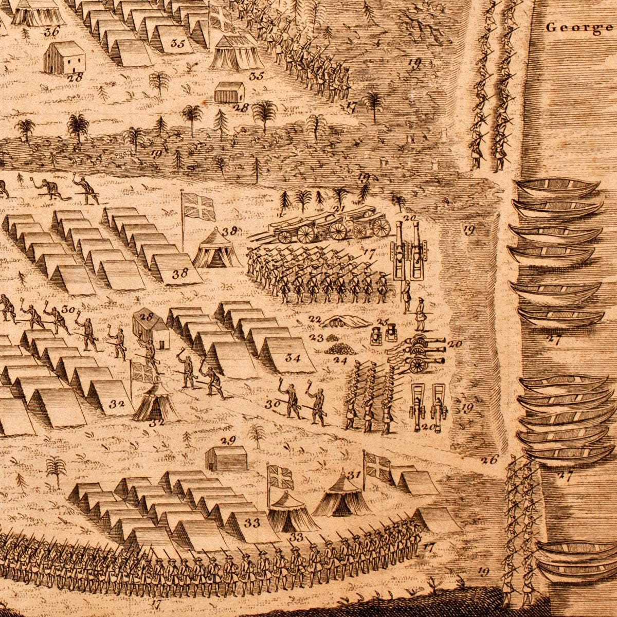
The First American Battle Plan A map of the 1755 Battle of Lake George in New York, fought between the French and Native American (Iroquois) forces under the command of General Ludwig August von Dieskau, and the British and provincial troops under Sir William Johnson. The highly detailed pictorial view and map, depicting the “First Engagement” and the “Second Engagement”, was first drawn and published by Samuel Blodget in Boston, barely three months after the battle, and later re-engraved and published by Thomas Jefferys in 1756 in London. Blodget had viewed the conflict personally, while serving as a sutler in General Johnson’s colonial force. (A color edition of the same map is available here.)
Title: A Prospective View of the Battle fought near Lake George, on the 8th of Sepr. 1755, between 2000 English with 250 Mohawks, under the command of Genl. Johnson: & 2500 French & Indians under the command of Genl. Dieaskau in which the English were victorious captivating the French Genl. with a Number of his Men killing 700 & putting the rest to flight.
• Battle of Lake George, New York, 1755, pictorial battle map, French & Indian War (II)
• Fine Art Premium Giclée (Gouttelette) Print (100% cotton 340 gsm fine art paper)
• Made in USA