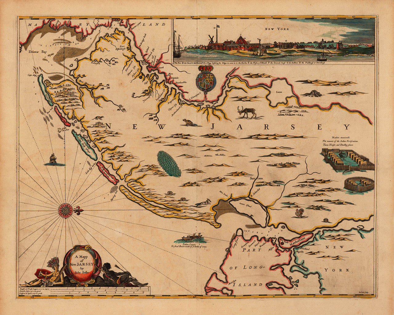

The First Map in English to Use the Name New Jersey
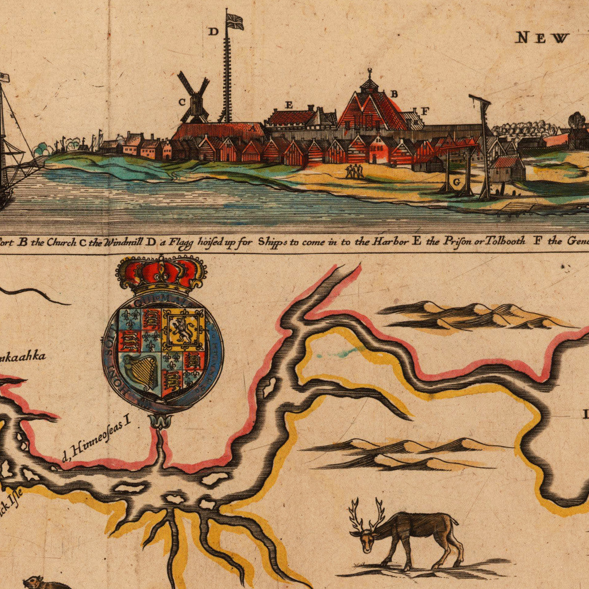
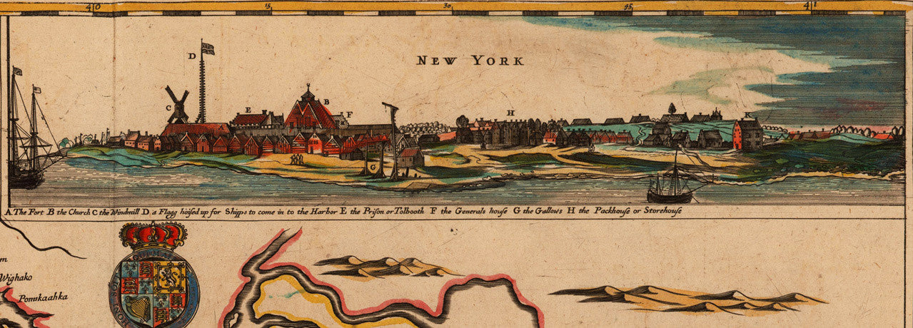
A Mapp of New Jarsey by John Seller is the first English map of the colony of New Jersey and the first one to use that name. John Seller, the map’s publisher, changed the spelling in later editions from “New Jarsey” to “New Jersey”. The original plate was probably engraved for Seller by Wenceslaus Hollar around 1660, and later adapted, (before 1675), by James Clerk for Seller’s publication Atlas Maritimus. The map shows Native American settlements and fortifications throughout the region, and detailed depictions of New York Harbor, Staten (States) Island, Coney (Conny) Island, Manhattan (Manhattans), and part of Long Island. It also features a picturesque view of New York with a key to important buildings and locations. The coastal areas show banks, shoals and soundings. The dry land portions are decorated with illustrations of North American animals — deer, beavers, foxes, rabbits, turkeys, etc. The ocean side contains ships, canoes, and windroses. The bottom left corner features a title cartouche, flanked by a Native American and an African warrior on each side.
• A Mapp of New Jarsey by John Seller, earliest map in English of New Jersey, ca. 1675
• Fine Art Premium Giclée (Gouttelette) Print (100% cotton 340 gsm fine art paper)
• Made in USA