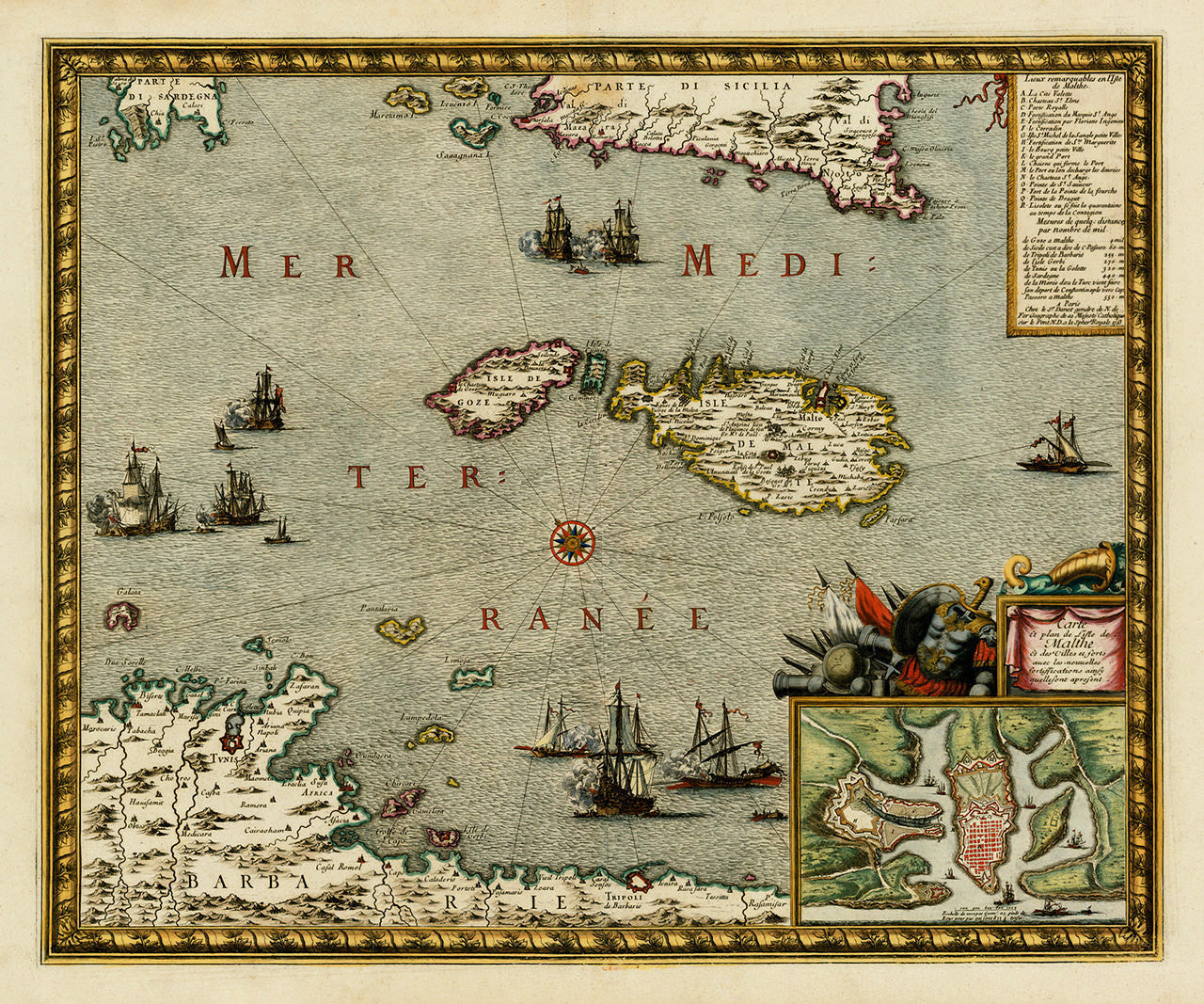

An early-eighteenth-century map of of Malta in an almost perspective view, looking at the Maltese archipelago from the coast of Tripoli up north towards the southern part of Sicily. A martial-themed cartouche encases a plan of the harbor and fortifications of Valletta, and the main map title: “Carte et plan de L’isle de Malthe et des Villes et forts avec le nouvelles fortiffcations ainsy quelle sont apresent”. The map is based on a late-1600s map by Sebastien de Beaulieu, and also on a 1680 version by de Wit. It was published in 1723 by Guillaume Danet, the successor of the de Fer firm in Paris. The map features several vignettes with naval battles throughout the layout.
• Old map of Malta, Carte et Plan de l’Isle de Malthe, 1723, Beaulieu / Danet
• Fine Art Premium Giclée (Gouttelette) Print (100% cotton 340 gsm fine art paper)
• Made in USA