 "Pin It")
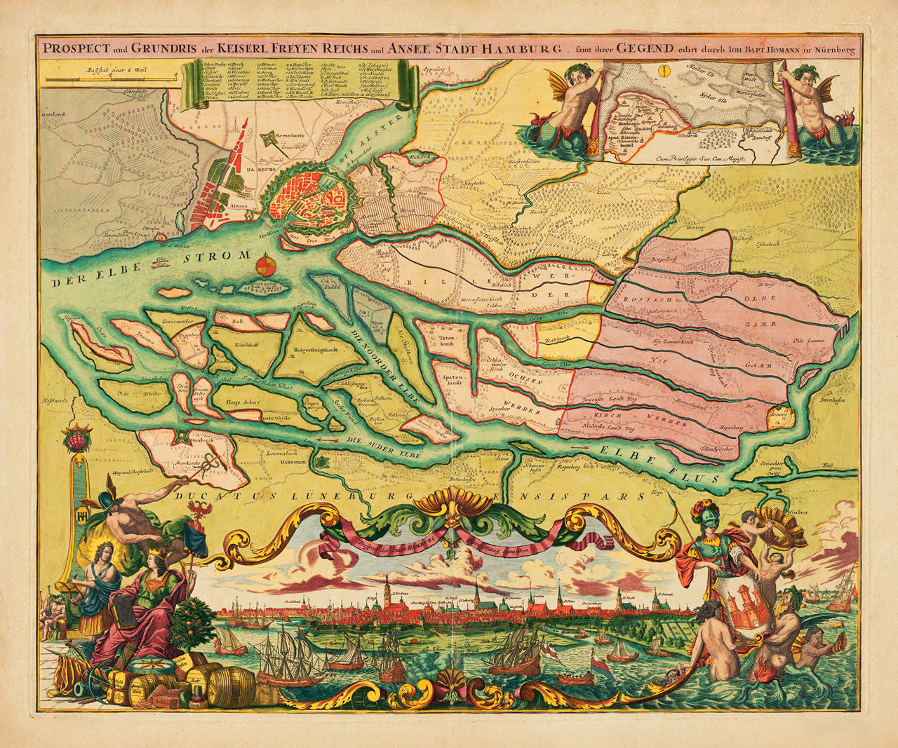
An ornate and richly colored map of Hamburg, Germany, created and issued by Johann Baptist Homann in 1720. The map contains a ‘ground plan’ — a city plan and grid, with a detailed map of the surrounding countryside, with vegetation and drainage, as far south as Lüneburg; and a ‘prospect’ — a panoramic view of the city, upstream from the Elbe. The view is enveloped by intricately drawn cartouches and illustrations in vibrant colors. The upper part of the layout contains a smaller inset map, and an alphanumeric key to locations. (A different-color version of the map, in a much larger size, is available here.)
Map title: Prospect und Grundris der Keiserl. Freyen Reichs und Ansee Stadt Hamburg, [Freie und Hansestadt Hamburg] samt ihrer Gegend edirt durch Ioh. Bapt. Homann in Nürnberg (Prospect and Ground Plan of the Free Imperial and Hanseatic City of Hamburg, including surrounding area, edited by Johann Baptist Homann in Nuremberg
Secondary title: Prospect der Stadt Hamburg gegen Mittag anzusehen (Prospect of the City of Hamburg seen around noon)
• 1720 map of Hamburg and surrounding area, with a prospect, Johann Baptist Homann (II)
• Fine Art Premium Giclée (Gouttelette) Print (100% cotton 340 gsm fine art paper)
• Made in USA