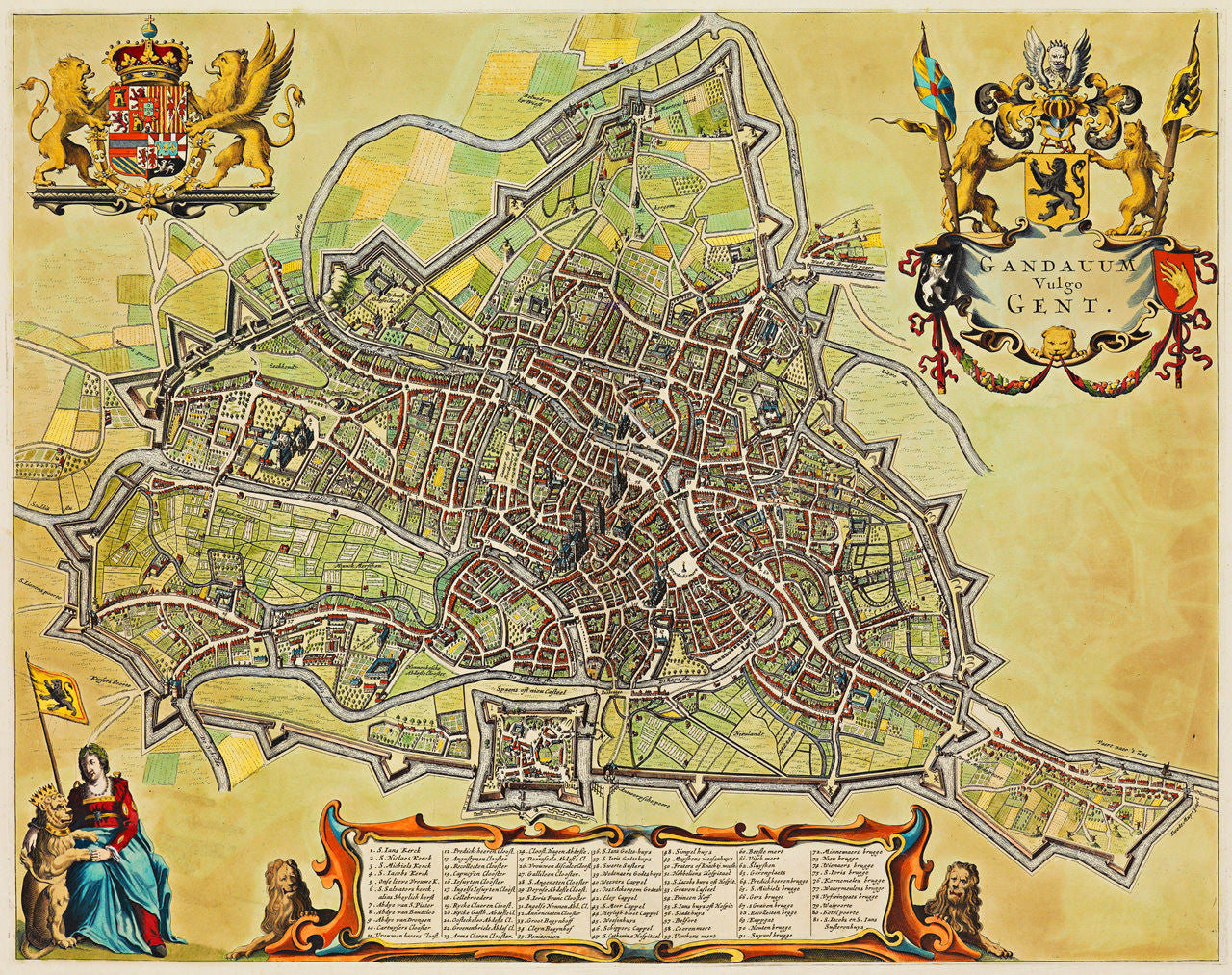

A striking 17th-century city plan of Ghent, Belgium (then Spanish Netherlands), originally published by Antonius Sanderus in his 1641–44 Flandria Illustrata. Sanderus was a Flemish cleric, historian and cartographer, who incidentally, was ordained as a priest in Ghent. In 1649 Joan Blaeu published the same map in his Stedeboeck (Stedenboek) Novum Ac Magnum Theatrum Urbium Belgicae, using Sanderus’ plates. In 1672 Blaeu’s Gravenstraat printshop in Amsterdam was destroyed by fire and some surviving printing plates and equipment were sold at an auction. Frederik de Wit acquired some of Blaeu’s plates and later used them in his own spectacular Atlas De Wit (Theatrum Ichnographicum Omnium Urbium et Præcipuorum Oppidorum Belgicarum XVII Provinciarum Peraccurate Delineatarum). Interestingly enough, De Wit had done some engraving work for Sanderus in Gouda in the 1640s, for his Flandria Illustrata.
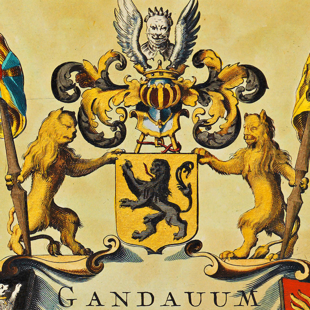
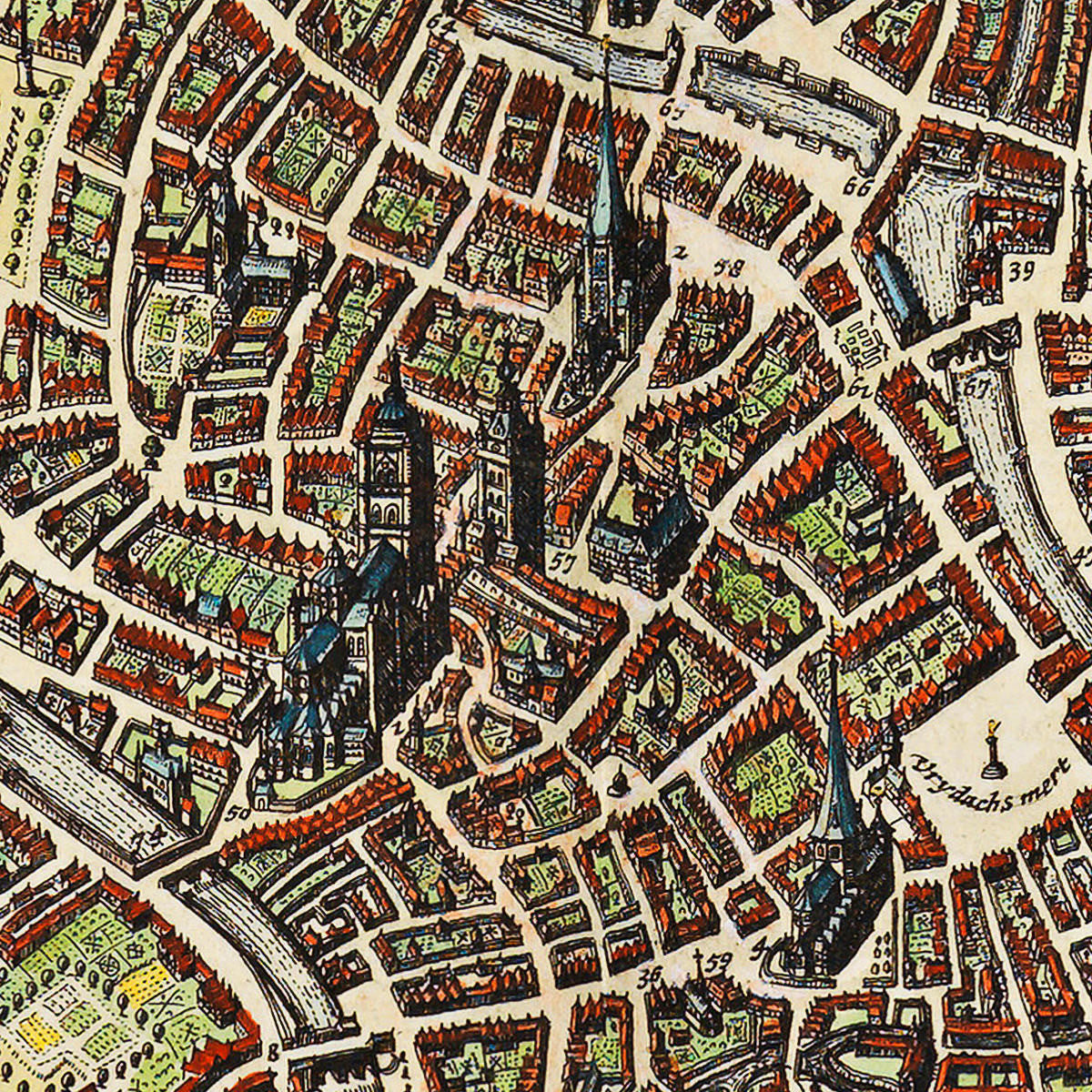
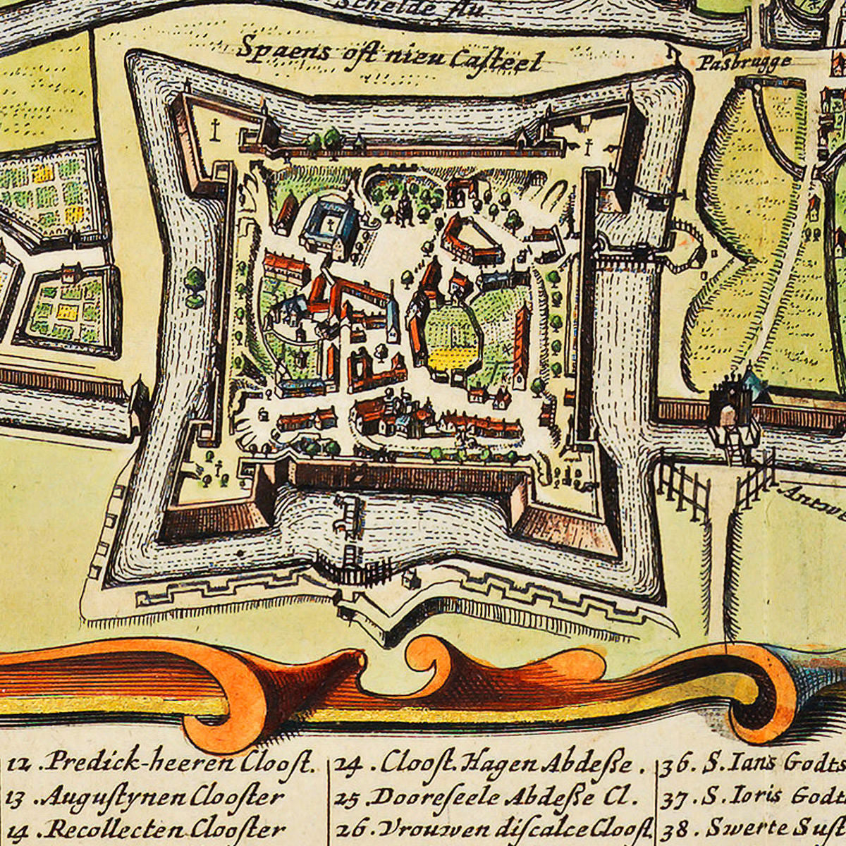
De Wit’s Gandavum Vulgo Gent is very detailed. The bottom part of the map contains a cartouche with a key to 81 landmarks in the city — churches, abbeys, bridges, important public buildings, etc. The top left corner of the layout features the Royal Arms of Habsburg Spain, as Southern Netherlands was part of the Spanish Empire at the time. The top right area is reserved for the coat of arms of the Counts of Flanders (Vlaanderen). The bottom left corner is dedicated for the defenders and symbols of Ghent, the Virgin and a Lion, flying the banner of Flanders.
• 17th-century map of Ghent, Belgium, (1641, 1649), 1698, F. De Wit, Atlas de Wit• Map title: Gandauum Vulgo Gent (Gandavvm/Gandavum Vulgo Gent)
• Fine Art Premium Giclée (Gouttelette) Print (100% cotton 340 gsm fine art paper)
• Made in USA