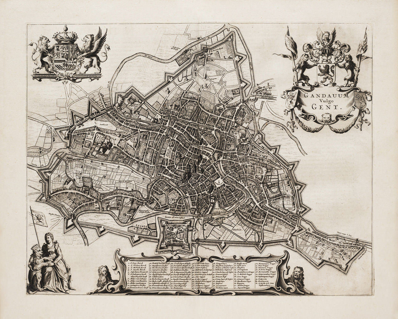
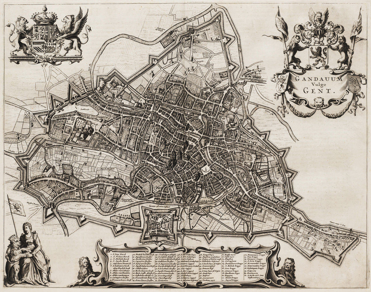

An attractive and detailed 17th-century city plan of Ghent, Belgium (then Spanish Netherlands), created and originally published by Antonius Sanderus in 1641. Sanderus was a Flemish cleric and historian, who was ordained as a priest in Ghent. In 1649 Joan Blaeu published the same map in his Town book Novum ac Magnum Theatrum Urbium Belgicae, using Sanderus’ plates. The current version of the map was published in 1657 by Johannes Janssonius, who was Blaeu’s business competitor and neighbor in Amsterdam. The Ghent map was a part of Janssonius’ impressive atlas Stedenboeken van de Wereld. (The same map was reissued in 1698 by Frederik de Wit, using Blaeu's plate.)
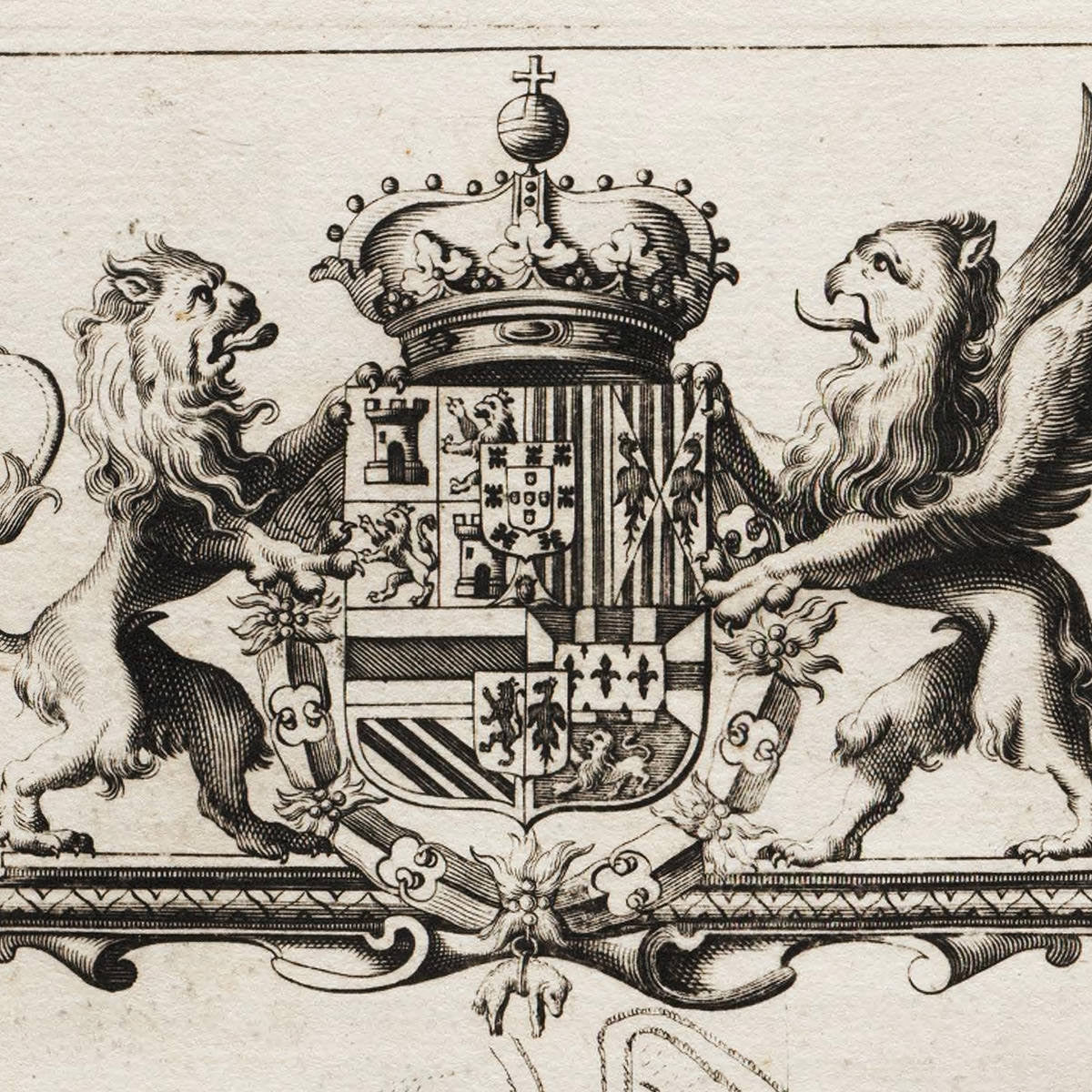
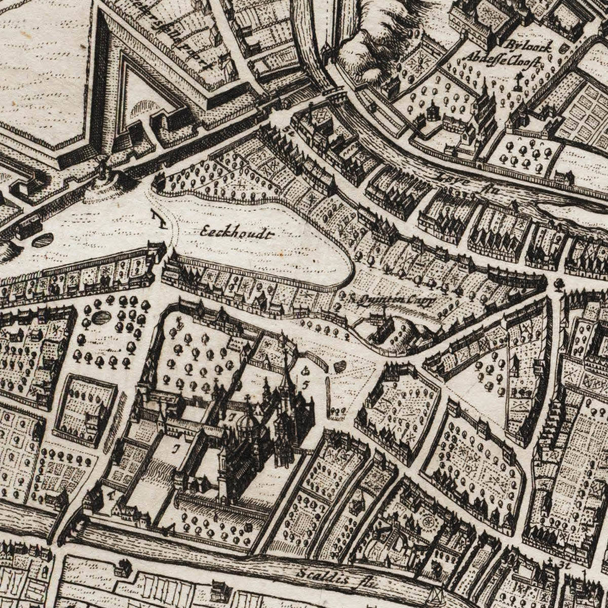
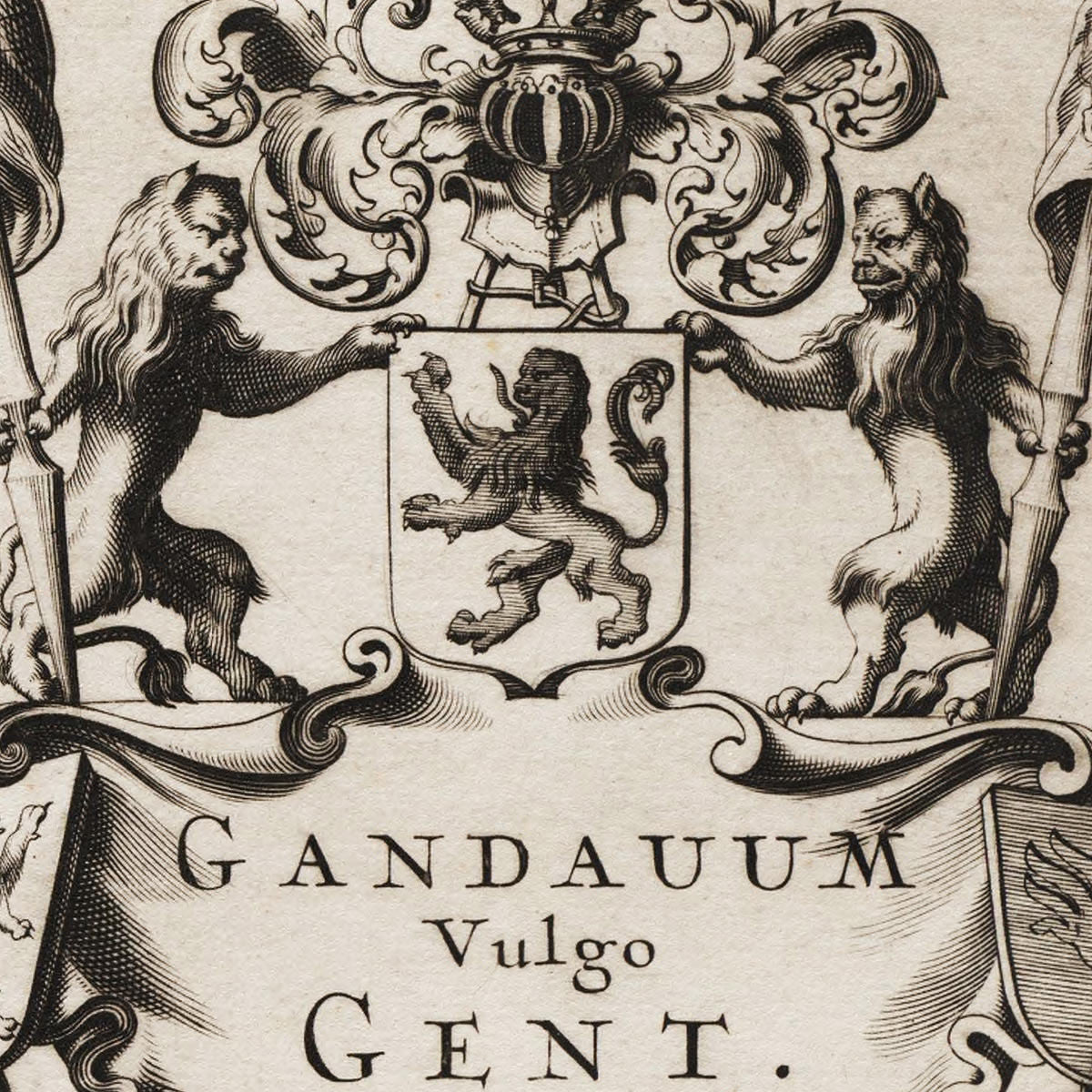
The bottom part of the map contains a cartouche with a key to 81 landmarks in the city — churches, abbeys, bridges, important public buildings, etc. The top left corner of the layout features the Royal Arms of Habsburg Spain, as Southern Netherlands was part of the Spanish Empire at the time. The top right area is reserved for the coat of arms of the Counts of Flanders (Vlaanderen). The bottom left corner is dedicated for the defenders and symbols of Ghent, the Virgin and a Lion, flying the banner of Flanders.
• 17th-century map of Ghent, Belgium, (1641, 1649) 1657, Johannes Janssonius
• Map title: Gandauum Vulgo Gent (Gandavvm/Gandavum Vulgo Gent)
• Fine Art Premium Giclée (Gouttelette) Print (100% cotton 340 gsm fine art paper)
• Made in USA