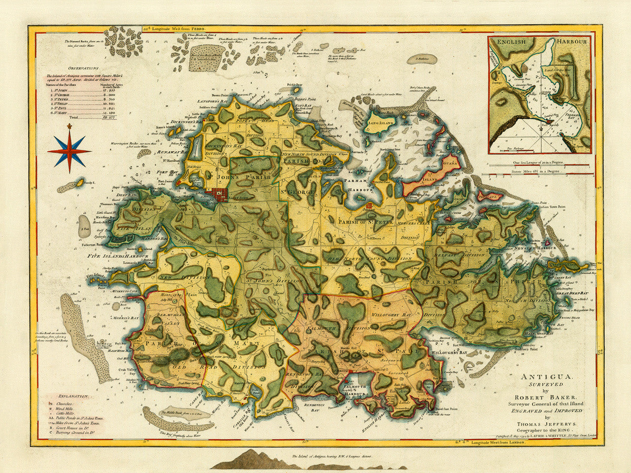

A late-eighteenth-century map of the island of Antigua, showing its six parishes and featuring a plan of the town of Saint John (today’s capital St. John’s), and an inset chart of English Harbour. The map could have been used as a nautical chart as well, as it contains banks, soundings and navigational markings in the waters surrounding the island. The map was surveyed by Robert Baker and engraved before 1771 by Thomas Jefferys for his compilation The West-India Atlas (alternative title, The West Indian Atlas). In 1775 the atlas was published posthumously by Sayer & Bennett under Jefferys’ name. The present copy is from the 1794 edition of the atlas, updated and published by Laurie & Whittle. Map title: Antigua, Surveyed by Robert Baker, Surveyor General of that Ifland: Engraved and Improved by Thomas Jefferys, Geographer to the King. (For a different edition of this map, please see Antigua 1779.)
• 1794 (1775) map of Antigua, West-India Atlas, R. Baker, T. Jefferys, Sayer & Bennett, Laurie & Whittle
• Fine Art Premium Giclée (Gouttelette) Print (100% cotton 340 gsm fine art paper)
• Made in USA