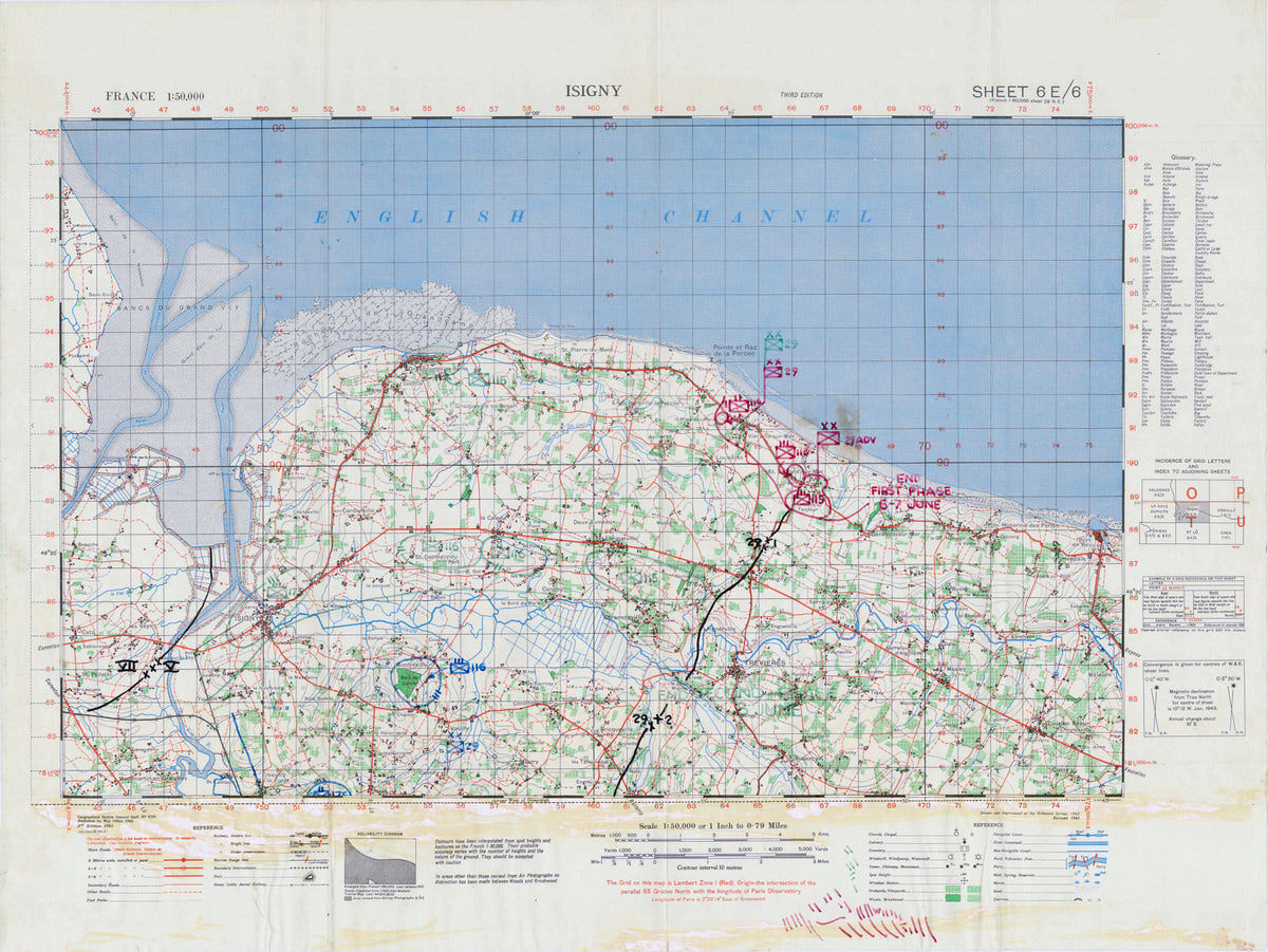
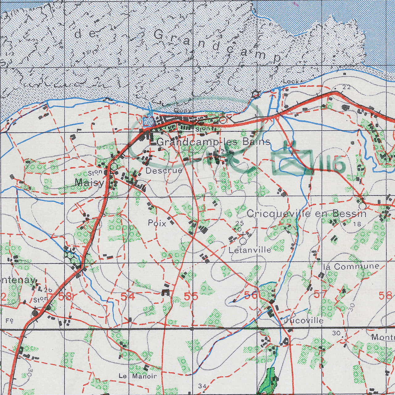
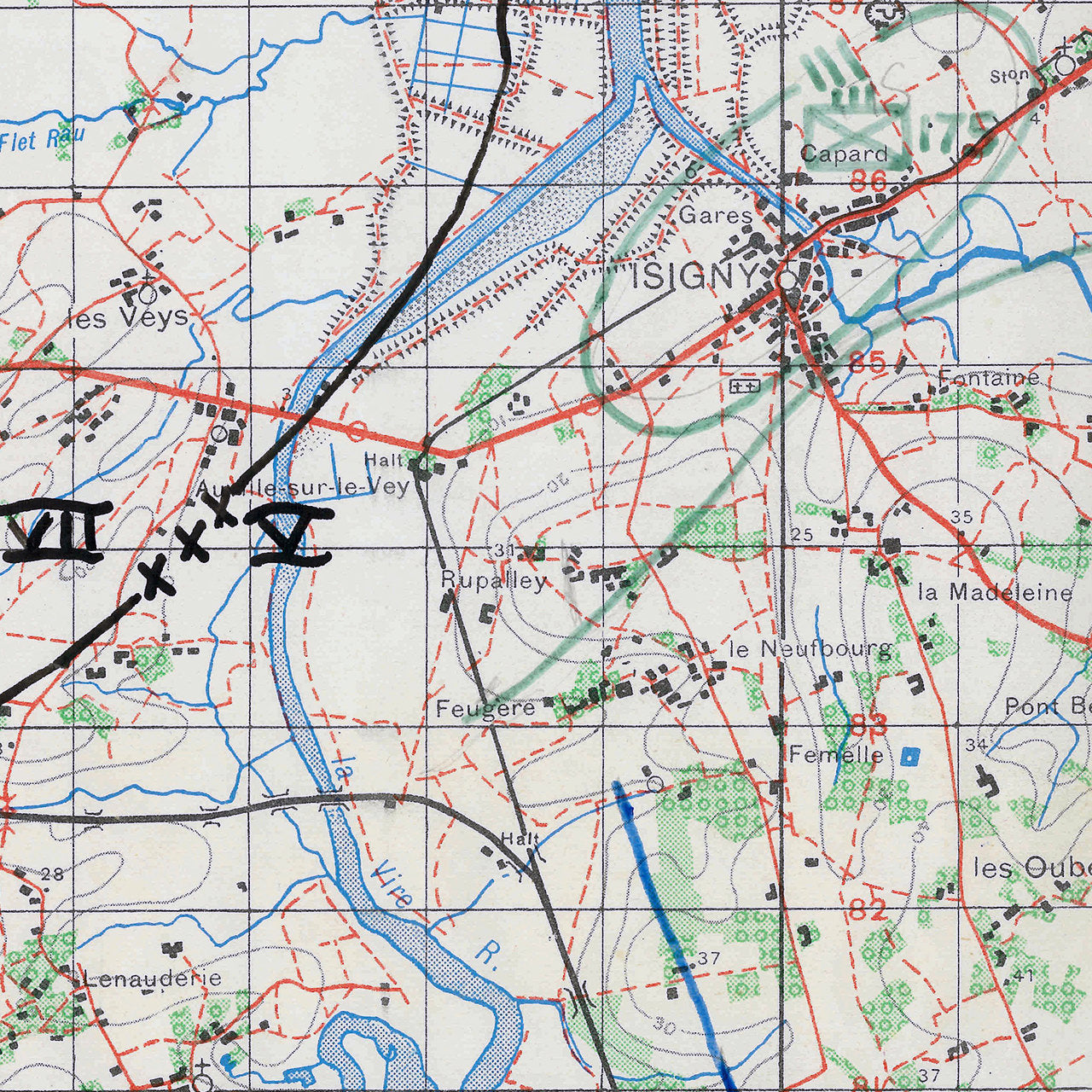
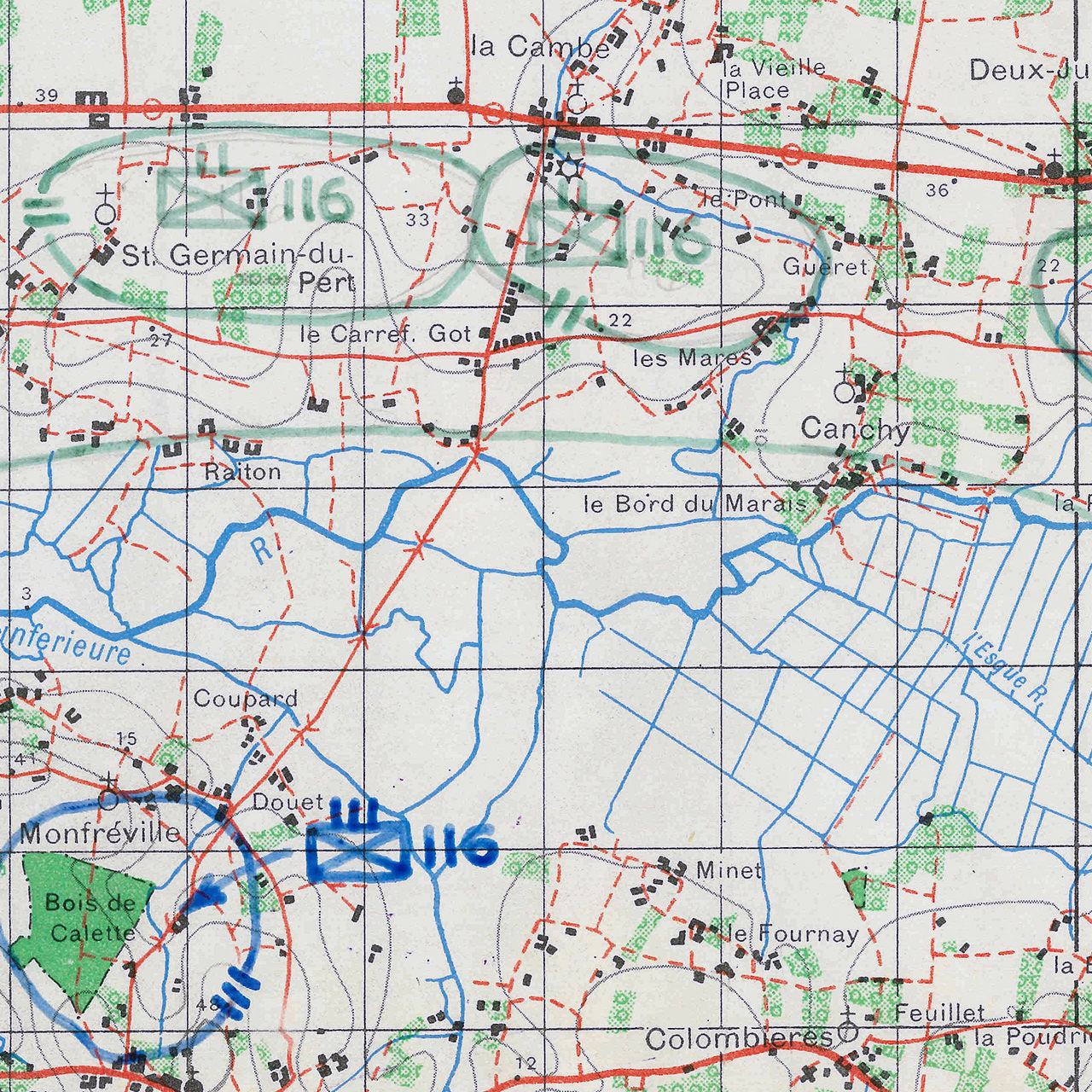
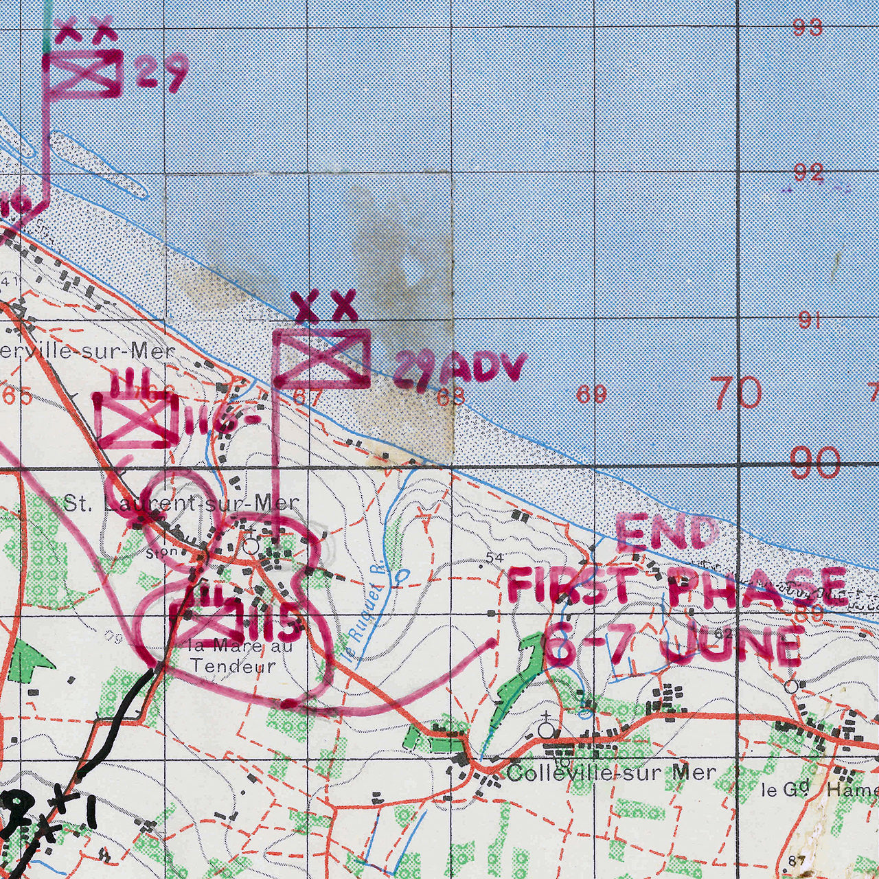

In the early hours of the 6th of June 1944, Allied soldiers landed on the coast of Normandy in Operation Overlord and began the liberation of Europe. This map records the locations of one of the American divisions, which landed that day, the 29th Infantry Division. The division headquarters probably used the map, as it depicts the locations of its subordinate units. It tracks the locations of the 115th, 116th, and 175th Regiments, as well as the Division HQ through the early fighting in Normandy. Division and Corps boundaries are also marked on the map. The map was used as part of a larger situation map. It still has traces of the glue used to attach it to adjoining map sheets. You can just imagine staff officers and enlisted using this map to make sense of the reports coming in from the front line.
-
Hand drafted US operational graphics in red, blue, black, and green marker
-
Premium Giclée Print (Ultra-Premium Presentation Enhanced Matte Paper) of original
-
Isigny, France Map Sheet, 1:50,000 scale Sheet 6/6E
-
Produced by the Geographical Section, General Staff
-
Published by the War Office 1942. 3rd Edition 1943
-
Made in USA