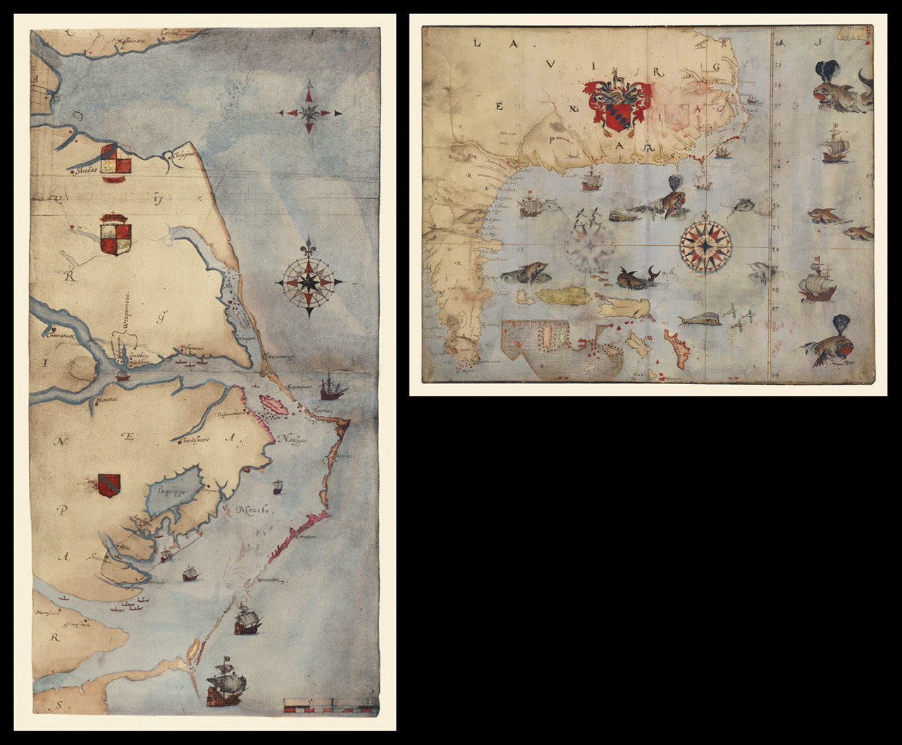
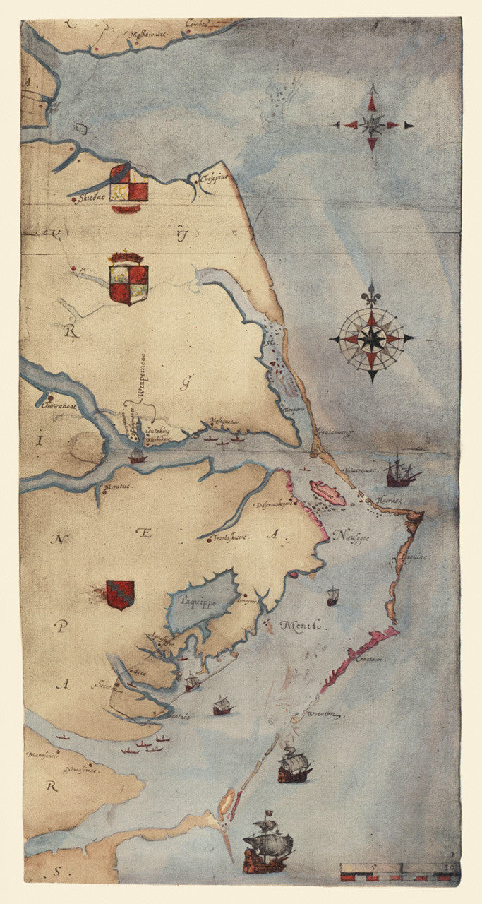
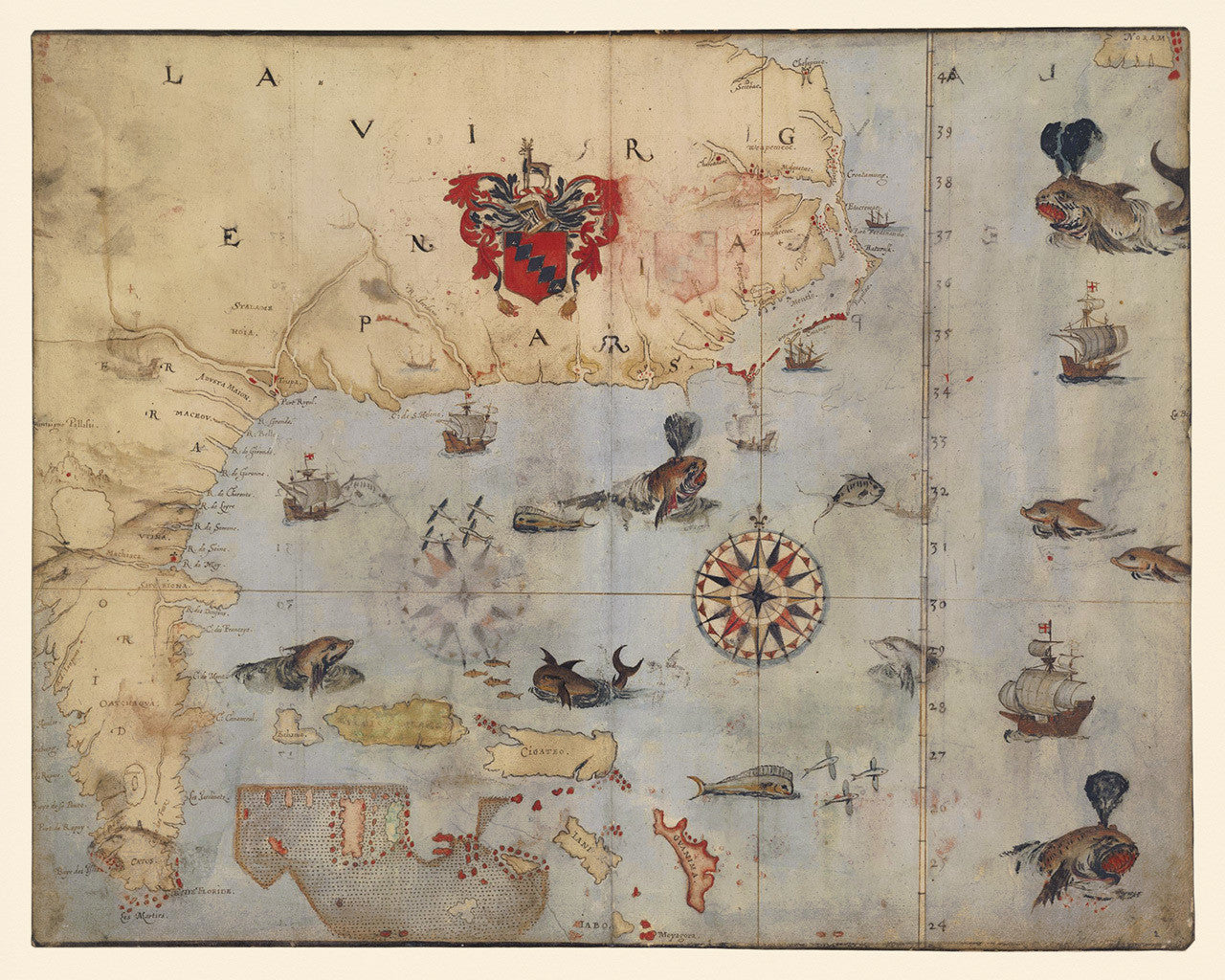
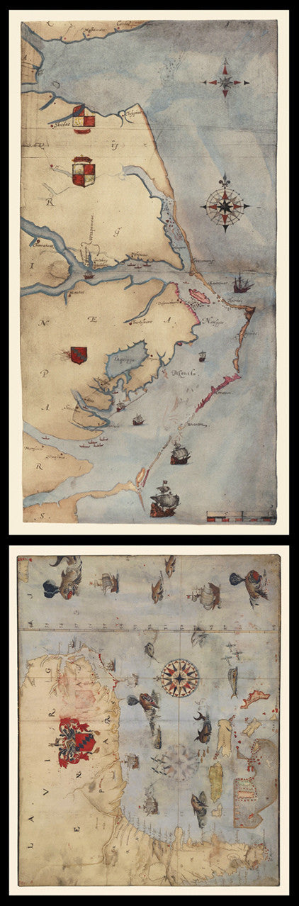

Virginia — the First English Colony Anywhere in the World
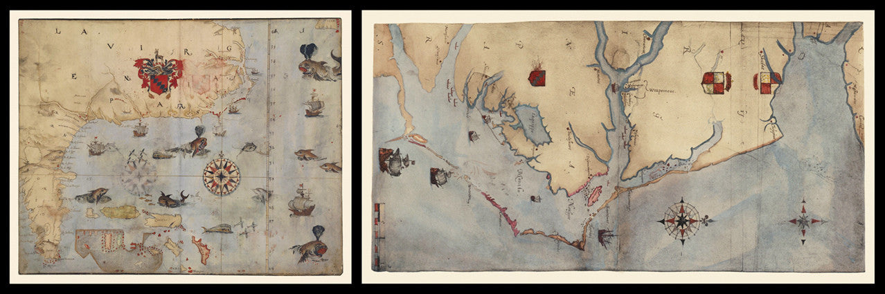
“La Virginea Pars” is the first and one of the most important attempts by the English crown at mapping colonial North America. This striking manuscript map is a beautiful watercolor testimony to the earliest efforts by the English to colonize America. The map is remarkably accurate and includes names and locations of Native American villages visited by the colonists. John White, the creator of La Virginea Pars, was a member of Sir Walter Raleigh’s expedition to America in 1585. White was later appointed governor of the Roanoke Colony. He was also the grandfather of Virginia Dare — the first English child born in the New World. The shown set includes two separate parts: the first map covers the area from Chesapeake Bay to Cape Lookout (NC); the second one extends from Chesapeake Bay to the Florida Keys.
• La Virginea Pars, antique manuscript map set of the earliest Virginia Colony and Florida, 1585, John White
• Fine Art Premium Giclée (Gouttelette) Print (100% cotton 340 gsm textured fine art paper)
• Size of map 1: 16” x 30”
• Size of map 2: 16” x 20”
• Made in USA