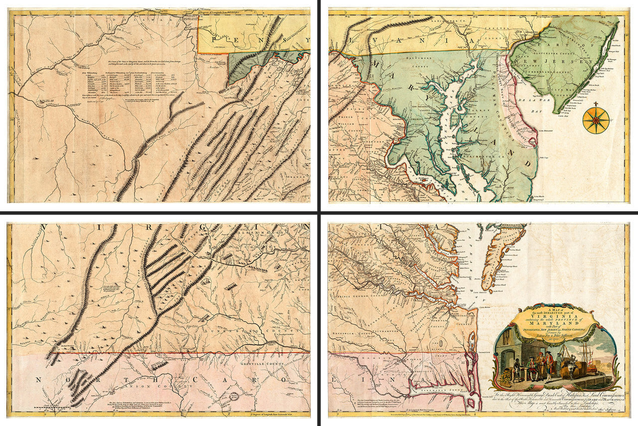
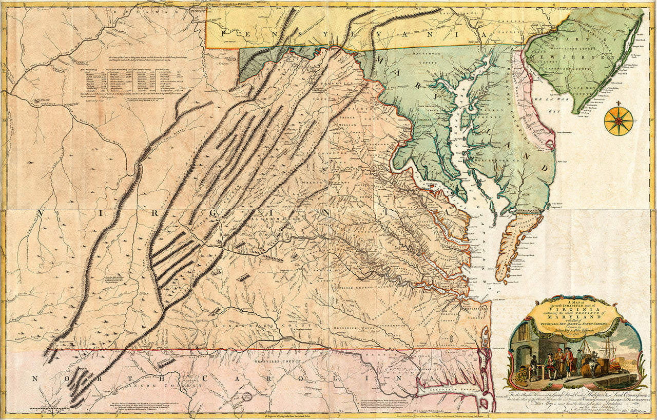

The First Map of Virginia by Virginians
Full map title: A Map of the most Inhabited part of Virginia, containing the whole province of Maryland with Part of Pensilvania, New Jersey and North Carolina, Drawn by Joshua Fry and Peter Jefferson in 1751. Commonly known as “The Fry-Jefferson Map”, as it was surveyed and drawn by Joshua Fry and Peter Jefferson, father of President Thomas Jefferson, this map is widely considered as the most important map of Virginia produced in the 18th century. Both the British and French used the map in the French and Indian War (Seven Years’ War), and in the American Revolution. Although Fry and Jefferson completed the manuscript of their map in 1751, it was first engraved and published in London by Thomas Jefferys in 1753. Artist and engraver Francis Hayman, a popular historical painter and a founding member of the Royal Academy, and Charles Grignion, were commissioned to design the cartouche. The later states of the map of 1754 and 1755 corrected certain errors of the first edition by using data collected by Fry, Christopher Gist, and young George Washington.
• Large-scale set of the famous Fry-Jefferson Map of Virginia in four (4) sheets• Suitable for individual framing, or as one large-scale wall map (approx. 70” x 45” / 178 x 115 cm)
• 4 Sheets of 36” x 24” (with ample margin for framing)
• Premium Giclée Print (Ultra Premium Presentation Enhanced Matte Paper)
• Made in USA