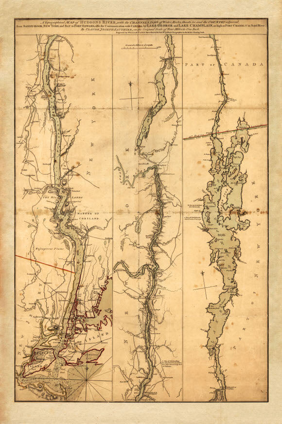
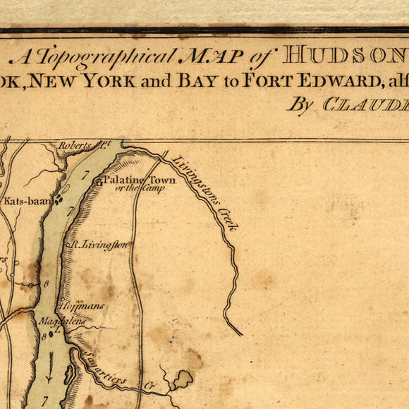
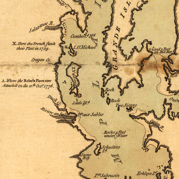
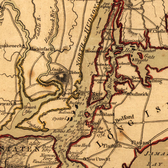

Revolutionary War era map shows the major waterways from the Canadian border to New York City, New York. During the Colonial Era these waterways were the superhighways of the time and used by the French, British and Americans as a route of invasion. The map contains soundings of the waterways, forts, settlements and significant hills.
• American Revolutionary War map of the Lake Champlain-Lake George-Hudson River Corridor from Canada to New York City, New York in 1776 by Claude Joseph Sauthier
• Title: A Topographical Map of Hudsons River, with the Channels, Depth of Water, Rocks, Shoals, etc
• Fine Art Premium Giclée (Gouttelette) Print (100% cotton 340 gsm fine art paper)
• Made in USA